GET THIS 5.87 ACRE PIECE OF LAND IN VALENCIA, NEW MEXICO & CREATE YOUR OWN OFF-GRID PARADISE!

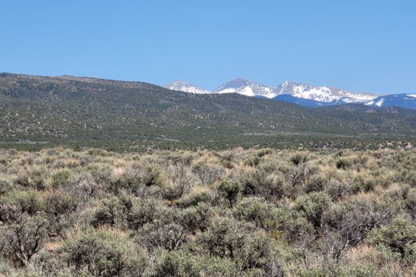
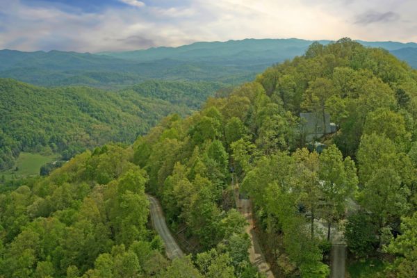
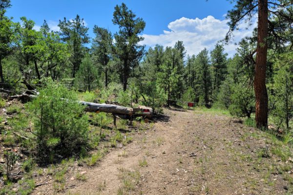
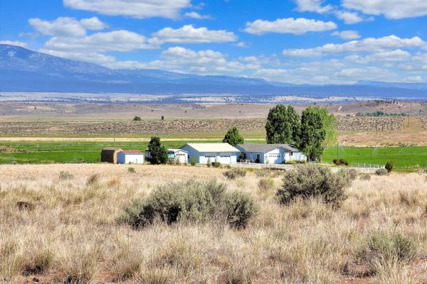
Create your own off-grid paradise on this 5.87 acre piece of land in Valencia County, New Mexico! This property is the best of both worlds. Get a little sunshine and enjoy the finest beauty in a gorgeous mountain community while enjoying nature, social settings and breathtaking views anywhere.
You’ll also live right along the historic Rio Grande. Don’t miss this off-grid paradise. Join the movement today.

What are you waiting for? Call us today for this offer before someone take it from you!

Prop ID: 1-015-019-070-285-000180

Acreage Size: 5.87 acres

Taxes Due: $27.59

Yearly Taxes: $26.52

Zone Type: RR-2

Mobile Homes: NO mobile, manufactured or modular homes allowed. ALL homes must be built on site.

RV: “RV’s and other temporary dwelling are not permitted as per the Unit 3 of Tierra Grande Protective Covenants.

Once a residence is completed, RV’s can be parked on the property as long as they are licensed and operable.”

Sewer: A private septic system would have to be installed.

Water: You can put in a private well or cistern system

Electricity: Socorro Electric Cooperative is the only power company that serves the area but there is no power lines nearby.

Terrain: Property is gently rolling.

Road Access: Property can be accessed via W Mora Dr.

Flood Zone: Not in a flood zone area.

HOA Past Due: Property is within Tierra Grande. Association Dues are $50/year.

Abbreviated Legal Description: SUBD: TIERRA GRANDE LOT: 18 BLOCK: 12 UNIT: 3 5.87 AC

Complete Legal Desc: All of Lots 18 in Block 12 of Tierra Grande Unit No.3, according to the plat thereof recorded in the Office of the Clerk of Valencia County, New Mexico, on January 2, 1973, including any gas, oil or mineral rights now owned by Grantor.

GPS Coordinates:
Center: 34.537195, -106.648295
NW: 34.537987, -106.649010
NE: 34.537602, -106.647071
SW: 34.536438, -106.649255
SE: 34.536381, -106.647729

Continue reading

0.52 ACRE LOT LOCATED IN WARREN, NORTH CAROLINA! A PLACE WHERE YOU CAN BUILD YOUR SECOND HOME!

Tired of having to deal with the stressful life and busy days being in the city? Looking for a place to build a home far from the toxicity urban life offers? Then, this is just perfect for you. Grab this piece of land and start living in peaceful serenity.

This property offers the best of both worlds – close to nature, with calm surroundings, but also close to town! Build that weekend getaway for the family to kick back and relax.

What are you waiting for? Call us today for this offer!

Prop ID: 13D449

Acreage Size: 1

Taxes Due: $0

Yearly Taxes: $594.42

Tax Status: paid to date

Zone Type: Residential

Time to build: 10 months after start for exterior then extension must be approved per POA and 1 year to complete construction

Mobile Homes: No trailer or mobile per POA. For Modular, must meet requirements of Roof Pitch min of 4/12, Interior ceiling height 7’6″, Wood or Brick siding, Floor system to be of wood and not supported primarily by steel beams,

RV: No per POA

Camping: No per POA

Sewer : Septic

Water: Community water

Electricity: Power is available through Halifax per POA

Terrain: Rolling

Road Access: Beavertail Dr

Flood Zone: No

HOA Past Due: $250/yr due July 1st every year – $285.00 past due. (250+35 late fee)

POA Summary: Single family, accessory outbuilding must match exterior of home, 950 sq ft min for one story, 1600 sq ft for 2 story-800 sq ft min on the first floor, one half story 1350 sq ft min-850 sq ft on the first floor, Setbacks: 30F 10S, building plans must be approved, native stone or cleaned old brick for exterior and must be of new material, cement block foundations or basements must be finished with either brick stone or paraged or stuccoed in such a manner as to conceal all mortar joints in the cement blocks, utility lines should be underground, must follow easement guidelines listed in saved restrictions,

Abbreviated Legal Description: LOT 110 BUCK SPRING WEST

Complete Legal Desc: BEING shown and designated as LOT NUMBER ONE HUDRED TEN (110) on “final Plat (Revised) of Buck Springs Plantation West Section” by Bobbitt Surveying, P.A., under date of March 22, 1988 said plat being recorded in Map Book 21, Page 45, Warren County Public Registry, which property is also shown and designated on survey of plat entitled “lot 110, Buck Spring Plantation, West Section, Surveyed For Gray Family Trust, River Township, Warren County, North Carolina,” dated March 27, 2007, prepared by Jasper Eley Land Surveying, which plat is recorded in said Registry in Plat Cabinet 1, Slide 257A Plat 02.

GPS Coordinates:

Center: 36.4873, -78.0031

NW: 36.4874, -78.0035

NE: 36.4874, -78.0027

SW: 36.4872, -78.0035

SE: 36.4871, -78.0027

Continue reading

1 ACRE LOT IN WARREN COUNTY, NORTH CAROLINA/PERFECT FOR YOUR NEW DREAM HOME!

If you are looking for a quiet place close to fun and adventure, this beautiful lot with great mountain views is perfect for you and also is a great investment in your future. You may want to build your second home here, a home where you can relax and get away from all the hurly-burly you can get from living in the city.

This is nestled a few minutes to surrounding mountain peaks where you can have lifetime experience in hiking and great mountain views. Brand new mobile homes are allowed either singlewide or doublewide mobile home on that lot with a minimum of 1000 square feet per POA. Restrictions however apply.

To check and know more about the property location, check below. You may also call us for more information and details of the property!

Property Details:

Prop ID: 14B 45

Acreage Size: 1

Taxes Due: $0

Yearly Taxes: $128.25

Tax Status: current

Zone Type: Residential Lakeside

Time to build once construction starts: 150 days after start of construction and if not complete will need extension approved by POA

Mobile Homes: Brand new only (used not allowed) singlewide or doublewide mobile home on that lot with a minimum of 1000 square feet per POA. Restrictions say only allowed on lots S of the thoroughfare

RV: No per POA

Camping No: per POA

Sewer : Septic

Water: Can either dig a well or have county water come to your lot in our neighborhood per POA

Electricity: Power is available through Halifax per POA

Terrain: Rolling

Road Access: S Holiday Dr

Flood Zone: No

HOA Dues: $75.00/year. Paid for this year.

Lake Gaston Summary: Single family residence, 600 sq ft min, 2 story max, Setback of 30F and 15S, it is recommended to only remove trees necessary for building-need auth if 10″ diameter and larger to tear down

Abbreviated Legal Description: Ext Lot 119 LGE

Complete Legal Desc: LOT NUMBER EXTENSION 119 of Lake Gaston Estates, Inc. as shown on plat of Extension Section 1 of Lake Gaston Estates, which plat is recorded in the office of the Register of Deeds of Warren County, North Carolina, in Plat Book 10, Page 63. This is the identical property conveyed to Donald Roberge and wife, Terri L Roberge, by deed recorded in Book 850, Page 813

This Conveyance is made subject al all those certain restrictions as set forth in a Declaration of Restrictions dated February 16, 1967, and recorded in said Registry in Book 227, Page 670

GPS Coordinates:

Center: 36.4836, -78.0169

NW: 36.4835, -78.0167

NE: 36.4839, -78.0159

SW: 36.4833, -78.0166

SE: 36.4836, -78.0158

Continue reading

Own 4.38 Acres in Costilla County San Luis North Estates

***Seller Financing available–No Credit / Employment Checks–MANUFACTURED HOMES ALLOWED!***


This 4.38-acre parcel in San Luis North Estates subdivision is only minutes away from San Luis via Onate Road on the west. Just imagine living in a place where you can smell the fresh air in the morning and enjoy the scenery of the vast Colorado mountain ranges. This is a great fit for anyone who wants to have a quiet and peaceful place to live in or escape to. Just clear nights skies for starry views as far as the eyes can see.

This could be your hideaway spot! This is a fantastic opportunity to own this year-round accessible property Costilla County. This area is surrounded by vast open spaces with wildlife and elk and vistas of the wide-open spaces.

Are you looking for mountain views and somewhere to escape the hustle and bustle of city life? This is it! Make this your homestead or getaway location. Imagine your own spot to get away and enjoy the great outdoors from your property in Costilla County Colorado.

San Luis North Estates subdivision provides both the solitude of the area and the convenience of being near the towns of San Luis and Fort Garland. Costilla County is in the San Luis Valley of southern Colorado. The San Luis Valley is about 150 miles long and 75 miles wide, surrounded by the Sangre de Cristo Mountains on the East with several peaks above 14,000 feet and the San Juan Mountains on the West.

There are an average of 285 sunny days a year in Fort Garland. This is a perfect location to enjoy fresh air, sunny days and bright star-filled nights. Looking for outdoor sporting activities? The area provides numerous fishing, hunting, mountain biking and hiking opportunities!

There are many historical, cultural and recreational activities in the area. Explore Monte Vista & Alamosa Wildlife Refuges, San Luis Lake State Park, Great Sand Dunes National Park & Preserve, Penitente Canyon, Thunder Mountain Speedway, Cumbres & Toltec Scenic Railroad, Colorado Gator Farm, Del Norte, Monte Vista, and more.

Now is your chance to have the off the grid property you’ve always dreamed about. Spend your weekends hiking, fishing, hunting and just relaxing while you breathe in the fresh mountain air. Enjoy exploring Southern Colorado and the peace and natural beauty of the area. Become a Costilla County land owner now. Call today!

If buying on terms, the minimum down payment for this property is $1560 with monthly payments starting at $207/mo. Ask us how we can customize your payment plan to work for you! As owners of the property, we can really get creative. Pricing is subject to change without warning.

GREAT SAND DUNES NATIONAL PARK:

Nearby is the Great Sand Dunes National Park and Preserve. The Park features hours of fun where you can:

*Hike, birdwatch and explore the Park’s numerous trailheads

*Sand sled and Sandboard on the dunes

*4WD through Medano Pass

*Stargaze at night


Learn more about this Great Sand Dunes National Park at:

https://www.nps.gov/grsa/planyourvisit/index.htm

https://www.nps.gov/grsa/learn/news/upload/visitor-guide-great-sand-dunes2019-webversion2.pdf


APPROXIMATE DISTANCES FROM FORT GARLAND, CO:

San Luis, CO = 16 miles (16 minutes)

Alamosa, CO = 25 miles (25 minutes)

Pueblo, CO = 98 miles (1.5 hours)

Colorado Springs, CO = 140 miles (2 hours)

Santa Fe, NM = 150 miles (2.5 hours)

Albuquerque, NM = 212 miles (3.75 hours)

DETAILS:

Prop ID
707-04-530
Size of Lot (or LOT AREA):
190,964 sq. ft.
Acreage Size:
4.3839 acres
Property Address:
N/A, Onate Rd, San Luis, CO 81152
Tax Assessment Year:
2020
Yearly Taxes:
$130.90
Zone Type:
Estate – Residential
Mobile Homes:
Site built home 600sqft min, manufactured homes are okay.
RV:
Long-Term RV Camping Permits are valid for 60 Days and a new application must be filed before the expiration date of the permit. $200 fee – septic & water required). Long-term camping SHALL NOT EXCEED 180 DAYS per RV, Person, or Parcel in any 12-month period. RV’s must be inspected by the Planning and Zoning office to ensure all plumbing and electrical is in working order prior to application approval. Sites will be inspected prior to approval. ONLY ONE (1) RV SHALL BE PERMITTED PER PARCEL. 14 days of camping within a 3-month period. $250 fee – good for 90 days at a time while building, renew for up to 18 months.
Sewer:
Septic can be installed. Composting toilets are only allowed if they are connected directly to an approved septic system.
Water:
Can drill a well.
Electricity:
No power lines nearby.
Terrain:
Property is gently rolling.
Road Access:
Property can be accessed via Onate Rd on the West.
Flood Zone:
Not in a floodplain area.
HOA Past Due:
No HOA/POA information found for the property online.
Abbreviated Legal Description:
S.L.N.E. FILING 4 BLK 1 LOT 1
Complete Legal Description:
San Luis North Estates Filing 4 Block 1 Lot 1
GPS Coordinates:
Center:
37.243976, -105.406660
NW:
37.244380, -105.407720
NE:
37.244370, -105.405645
SW:
37.243580, -105.407725
SE:
37.243578, -105.405649


Continue reading

Awe-Inspiring 0.49 Acre Lot in Warren, NC for $11,999

Wind down and take in your very own majestic mountain range views, build your dream home to overlook the wonderful town. Come get away and see these beautiful fresh air mountains and be with nature. Get a little sunshine and enjoy the finest beauty in a gorgeous mountain community while enjoying nature, and social settings. In a place that’s offering breathtaking views, you can enjoy high country sunsets from acres of open space! If you are looking for a place where you can completely relax and seclude yourself, and be able to meditate, come escape the hustle and bustle of city life and enjoy these quiet nights and cool country days.

It is indeed an inviting place to stay, offering calmness and peace from its serenity. A perfect place to enjoy exciting activities with friends and loved ones. This property is a great escape away from the bigger crazy city life.

So, Look No Further for your own spot to get away, this property is not only something that you can enjoy with friends and family, but is also a great investment in your future. Property is a gift that keeps on giving.

What are you waiting for? Call us today for this offer!

Prop ID: I4B 82

Acreage Size: 0.49

Taxes Due: $0

Yearly Taxes: 128.25

Zone Type: Residential

Mobile Homes: allowed on lots S of the thoroughfare only

RV: No

Camping: No

Sewer: Septic

Water: can either dig a well or have county water come to your lot in our neighborhood per POA

Electricity: Power is available through Halifax per POA

Road Access: Boatman Court

Flood Zone: No

Abbreviated Legal Description: Lake Gaston Estates Extension Lot 148

Complete Legal Desc: Lot No. 148 as shown on a plat entitled “Map 1 – East Section, Lake Gaston Estates Extension”, surveyed and mapped by D. C. Shearin, Registered Engineer, June 10 1970, which plat is recorded in the office of the Register of Deeds of Warren County, North Carolina, in Plat Book 10, Page 63. This is a part of the lands described in that certain deed dated November 8, 1967, from Peoples Bank and Trust Company, Trustee under will of Claude Maxwell Haithcook, to Lake Gaston Estates, Inc., which is recorded in said Registry in Book 230, Page 114.
BUT this conveyance is made subject to those certain restrictions which are set forth in a declaration of restrictions dated February 16, 1967, recorded in said Registry in Book 227, page 670.
Reference to said plat, deed and restrictions is hereby specifically made for other and further description, and the notes, calls, bounds and distance shown on said map are hereby made a part hereof as fully as if set forth herein.

GPS Coordinates:

Center: 36.4818, -78.0147

NW: 36.4819, 78.0151, then S to 36.4818, -78.0151 then to SW point

NE: 36.4819, -78.0144

SW: 36.4817, -78.0150

SE: 36.4815, -78.0144

Continue reading

Imagine Waking Up to These Views!

Come and build your home in this land where the lifestyle for your family and friends is like a dream come true. This country setting is located just outside the city limits. The magic unfolds as you enter to luxurious mountain living. The serenity, and breath taking views are all in access for you. Work from home while enjoying nature, sunsets, sledding on the green space in the snow, fishing down at the pond or cooking dinner for family and friends on your back deck. Let me introduce you to one of the best communities for a life worth living.

Don’t miss the chance of owning this lot. Call us for more information and options!

Prop ID: 7507925929

Acreage Size: 0.32 acres

Taxes Due: $0.00

Yearly Taxes: $20.49

Tax Status: Current

Zone Type: There is no zoning as in commercial or residential outside the city limits of Franklin or Highlands. County Ordinances however still apply.

Mobile Homes: Manufactured homes should have an age cap in order to prevent dilapidated mobile homes from being permitted and creating a minimum housing issue. Any structure built under the NC Building Codes and permitted by Macon County Planning Permitting and Development would be allowed. Proved lot is or can be approved for septic system and well by Macon Environmental Health.

RV: You can stay in an RV with active building permit. Permits are good for 6 months. Once you have an inspection permit will be good for a year from last inspection date.

Sewer: Septic can be installed.

Water: Can drill a well for water.

Electricity: There are power lines along Big Ridge Road.

Road Access: Property can be accessed via Big Ridge Road.

Flood Zone: Not in a flood zone area.

Abbreviated Legal Description: LOT 26 BIG RIDGE DEV

Complete Legal Desc: “ALL THAT CERTAIN TRACT OF PARCEL OF LAND SITUATE AND LYING AND BEING IN MILLSHOAL TOWNSHIP, MACON COUNTY, STATE OF NORTH CAROLINA, AND MORE PARTICULARLY DESCRIBED AS FOLLOWS:

BEING LOTS NOS. 26 OF THE BIG RIDGE DEVELOPMENT PROPERTY, AS SHOWN BY A SURVEY OR PLAT THEREOF MADE BY J. FRANK SHOPE IN JUNE 1965, A COPY OF WHICH SAIDPLAT IS RECORDED IN THE OFFICE OF THE REGISTER OF DEEDS FOR MACON COUNTY, NORTH CAROLINA IN PLAT BOOK NO. 2, PAGE 67, TO WHICH SAID PLAT REFERENCE IS HEREBY MADE FOR A MORE PARTICULAR DESCRIPTION OF THE LANDS HEREBY CONVEYED.

BEING THE SAME PROPERTY CONVEYED TO N.R.L.L. EAST, LLC, A FLORIDA LIMITED LIABILITY, FROM NONA MARTIN, BY DEED RECORDED 8/15/2006 IN DOCUMENT NUMBER O-30-1502, IN THE OFFICIAL RECORDS OF MACON COUNTY, NORTH CAROLINA.

THE ABOVE LEGAL LOT IS PROPERTY BEING SOLD AS A VACANE LOT AND AS SUCH HAS NOT BEEN ASSIGNED A PROPER STREET NUMBER, SUCH STREET NUMBER SHALL BE DULY ASSIGNED IN THE FUTURE SHOULD ANY HOUSING OCCUR ON SAID LOT.”

GPS Coordinates:
Center: 35.247176, -83.323710
North: 35.247394, -83.323671
East: 35.247265, -83.323484
South: 35.246923, -83.323598
West: 35.247142, -83.323987

Continue reading

2.46AC Tranquil Lot in Fremont County CO – A place to build your second home!

Want to escape from hurly-burly of city life? This is just the right place for you with a great view and scenery you can enjoy everyday. It is perfect as a great investment in your future.

Spectacular mountain views are all yours to enjoy from the sun-soaked meadows, or you can relax in the shade of the tree-line on a hot day as you relish the peace and privacy on offer. There’s plenty of room for animals, or you can use this lot as the ultimate camping retreat as you prepare to build the dream home you have always wanted.

This property has character and one can only truly appreciate all it has to offer when you put on your hiking boots and go exploring! Come out and take a hike, and look for some ancient treasures.

What are you waiting for? Call us today for this offer!

PROPERTY DETAILS:

Parcel Number: 98804246

Size:2.46 acres

Property Address: J Path, Cotopaxi, CO 81223

Zoning: AE

Power: Would be solar or off grid

Water: Well.

Access: J Path

Mobile homes: Manufactured homes allowed if 1975 or newer. No mobile or trailer homes.

Taxes: $120.88

Legal Description: SUBD: FLORIDA-COLO ACRES SW4SE4NE4NE4 SEC 15-20-73 FLA-COLO ACRES TR-47

Complete Legal Description:  Ranch 63, Section 15, A.K.A. SW 1/4 SE 1/4 NE 1/4 NE 1/4 Section 15, Township 20 South, Range 73 West of the 6th P.M., Fremont County, State of Colorado

GPS COORDINATES:

Center: 38.3179, -105.5206

NW: 38.3183, -105.5211

NE: 38.3183, -105.5200

SW: 38.3174, -105.5211

SE: 38.3174, -105.5200

Continue reading

9.49-acre Amazing Paradise in Hampshire County, WV – Live and Relax Here – Below Market Value!

Some place are meant to be, and yes, this 9.49-acre is a must-invest oasis  that you deserve in Hampshire County, West Virginia.  Sitting 3 minutes outside of Kirby, easily accessible both via Briar Lick and Katybug Ln which guarantees a generous open space, quick and easy road access. If you want more of the country feels and scenic trails, a good 13-minute drive up the mountains will take you to the breathtaking Short Mountain Wildlife. 

This lot’s pristine location gives you that much-sought privacy that you won’t get anywhere in hustling and bustling city streets! This parcel offers unique outings, beautiful nature and a chance to disconnect and relax as you explore this amazing paradise. Slow down, step back in time, and enjoy simpler pleasures as you reconnect with family, friends, and nature.

Call us today for this offer! 

Parcel Number: 9-20-58

Size: 9.49 acres

Property Address: Katybug Lane, Rio, WV 26755

Zoning: No zoning for Hampshire county per planning dept. No setback for county, just need to follow if any for electric, etc or any subdivision info. Home must meet 2015 International Residential Code requirements

Power: There looks to be overhead lines at SE corner of lot and Also corner at Briar Lick and Katybug intersection towards center/NW area of lot. Per electric co, would use briar lick access. Call to set up meter and get pricing eval/site eval

Septic: Septic.No records per county on this lot. Installer must be certified by state. Permit approval/received required before building permits will be issued. Soil/perc test and site eval required

Water: Well

Access: Katybug Lane (dirt on North side) and Briar Lick Rd Paved on S side. Private road for Katybug. Need easement. Briar Lick public and state maintaned. Need right of way for driveway from Brier Lick

RV: yes

Mobile homes: yes

Taxes: $202.78

Legal Description: 9.493 AC TRACT 10 BRIER LICK ESTATES

GPS Coordinates

Center:39.1869, -78.7443

NW Corner: 39.1889, -78.7461, then S to 39.1866, -78.7446, Then curves over to SE point

SE Corner: 39.1861, -78.7410

NE Corner: 39.1894, -78.7457, Then S to 39.1888, -78.7450, Then S to 39.1882, -78.7446, Then curves S/SE to about 39.1867, -7422, then to SE point

Continue reading

Two 4.87-Acre Lots with Perfect Solitude In Alturas, CA – Seller’s Financing Guaranteed – Below Market Value!

Two 4.87 acre lots ($12,500 each) tucked in the vast flatlands of Modoc County, California, calls out to you to invest to its tranquil solitude. Snuggled along Westside Rd, just 8 minutes south of Alturas. Bask in the beauty of the naturally-wondrous landscape while still getting to enjoy the convenience of the big city. Boast itself as being very unlike San Francisco, Los Angeles and crystal views of mountains and four distinct seasons 

Free from the California of smog, congestion and crowded amusement parks. Crisp, clean air, breathtaking scenery, and enough activity to satisfy all ages and levels of physical health appeals especially to outdoorsmen. One of the “must-see” attractions in the region is the The Modoc Volcanic Scenic Byway. Meandering past stunning Tule Lake National Wildlife Refuge, Lava Beds National Monument,, Shasta-Trinity, and Modoc National Forests, you’ll drive through a volcanic area unrivaled for its volcanic features.

Isn’t it exciting? Call us today! 

Property Details:

APN: 022-450-056-000 & 022-450-058-000

Size:  212,137 sq. ft. each lot

Address: N/A, near Westside Rd, Alturas, CA 96101

Annual Taxes: $276.36 & $50.36

Zoning: Residential Low Density(RL) 

Mobile Homes  Mobile Homes/Manufactured Homes are allowed on the property. Mobile Homes are allowed. If you are looking at a Used Mobile Home it has to be 10 years newer from the day you apply for the building permit.

RV allowed 30 days out of the year. You cannot live in an RV. You can apply for an Administrative Use Permit if you have an active building permit to stay in the RV until the primary residence has been constructed. This AUP is only good for as long as the building permit is active. 

Power: There is a power post in the SW corner of the lot.

Sewer: Septic can be installed.

Water: Can drill a well for water.

Terrain: Property is gently rolling.

Access: Property can be accessed via Westside Rd.

HOA Dues: No HOA/POA information found for the property online.

Legal Description: In the State of California, County of Modoc, the W1/2 of W1/2 of Parcel 1 of Wildlife Estates. Notes: Order covers other property. -and-  In the State of California, County of Modoc, the W1/2 of E1/2 of Parcel 1 of Wildlife Estates. Notes: Order covers other property.

GPS Coordinates 022-450-058-000:

Center: 41.415452, -120.561081

NW Corner: 41.416456, -120.561599

NE Corner: 41.416440, -120.560556

SW Corner: 41.414576, -120.561613

SE Corner: 41.414576, -120.560578

GPS Coordinates 022-450-056-000:

Center41.415488, -120.563133

NW Corner: 41.416468, -120.563645

NE Corner: 41.416456,  -120.562611

SW Corner: 41.414567, -120.563666

SE Corner: 41.414575, -120.562637

Continue reading

IDEAL 7.25 ACRE LOT WITH POWER AT PROPERTY COTOPAXI, COLORADO!

Want to escape from hurly-burly of city life? This is just the right place for you with a great view and scenery you can enjoy everyday. It is perfect as a great investment in your future.

This property is located and is sitting in between mountain peaks. A place where you can enjoy and also get away from all the stress city life brings. It’s topography is definitely put into good use as it is home to a number of attractions that showcase the wonderful scenery. You can go for a 2 week camping to alleviate stress once in a calendar year and be able to start anew after unwinding. 

What are you waiting for? Call us today for this offer! 

Property Details:

Parcel Number: 99504018

Size: 7.25 acres

Zoning: Agricultural Rural

Property Address: 550 INDIAN WELLS RD COTOPAXI, CO 81223

ZONING: AR (Per GIS) Agricultural Rural.

Power: Power at property. 

Septic: Handled by Building Dept per Environmental Health Site. Need an address to get a permit which goes through zoning. Need soil/perc test. No records kept for previous tests unless existing septic.

Water: Can drill a well for water.

Access: Indian Wells Road

RV: Not right now but they are trying to get it approved. This could take several months to a year

Mobile homes: Manufactured ok if doublewide. No trailer or mobile per POA

Taxes: $274.56

Legal Description: SUBD: GLEN-VISTA F6 LOT 22 BLK 1 GLEN VISTA FIL #6 REF FROM 770-18-413

GPS Coordinates:

Center: 38.3724999831156,-105.488418972527


Continue reading

© 2026 Liberty Land Sales. All Rights Reserved