Three Beautiful Lots With Roanoke River Views | 2.04 ac in Hardy, VA

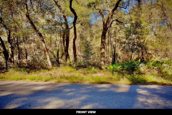
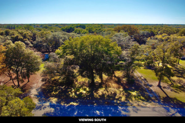
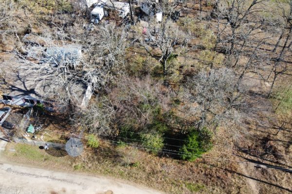
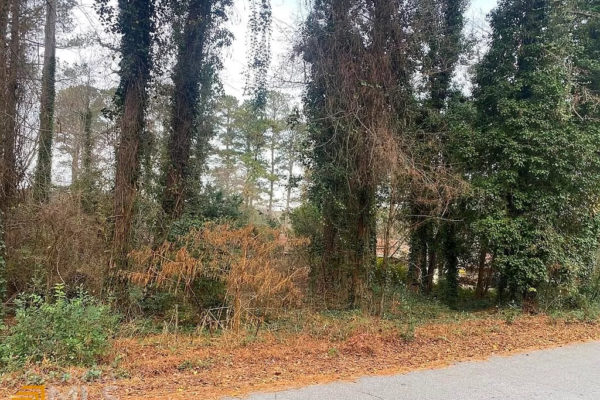
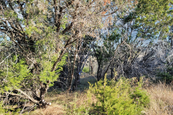
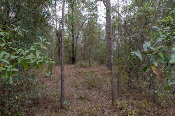
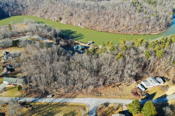
Ready to build your dream home in a peaceful community with beautiful view of the Roanoke River? This beautiful property can do it all! Nestled in the breath-taking Franklin County, this property is 2.04 acres (three adjoining lots) and is situated on a quiet, state-maintained road. These lots are perfect for any residential building needs. Bay Roc Marina and a public boat ramp are conveniently located right around the corner. If you’re not ready to build just yet, these lots are an excellent investment as they are priced well below tax assessment! For our commuters out there, Roanoke is just minutes away!

If you’re ready to make this land yours, let us know and we will help you start your next chapter!

Parcel Size: 0.68 Acres; 0.68 Acres; 0.68 Acres
APN: 0010103300; 0010103400; 0010103500
State: Virginia
County: Franklin
Legal Description: LAKESHORE TERRACE LOT 117; LAKESHORE TERRACE LOT 116; LAKESHORE TERRACE LOT 115
Power: Next to Property

Water: Public Water
Sewer: Septic System Needed
Roads: Paved

Continue reading

Land For Sale In Florida, 0.7 Acres In Levy County, FL

Situated on a large 0.7 Acre lot in the country, yet just minutes away from town, this is your chance to own a unique property. The coziness of the country living with all the amenities of town so close by. Wake up to the sounds of wild turkeys and song birds in the treetops.

Sometimes, the best things in life are closer than they appear. That’s certainly true of this country setting, just moments from town. And at an affordable price, you can realize the dream of owning your own unique property.

Natural springs and public parks close by. Easy access to Gainesville (43.1 miles) and Cedar Key…

The City of Trenton, Florida is a small town with an abundant supply of small-town values. This Old Florida town is located on the southern shores of the Suwannee River and exists by agricultural trade, featuring retail shops that are unique to the area. If a night out on the town is what you’ve got in mind, then head into Gainesville for live music venues and restaurants that offer a variety of options to satisfy your palette and pique your curiosity.

Details

Land Size: 0.7

APN:  3410140762505000

Legal Description: 34-10-14 FANNIN SPRINGS ANNEX BLK 7 LOT 80 OR BOOK 1218 PAGE 610

Property Taxes: $ 107.55

Title: Warranty Deed

HOA: $0.00

Zoning & Restriction Information

Zoning: F/RR Forestry/Rural Residential District

What Can Be Built on the Property: Single-family residences, Mobile homes – Please see the details attached

Time limit to build? Building permits are active for 180 days and renew for an additional 180 days with each passing inspection

Are mobile homes allowed? Yes

Mobile home restrictions if any: Have to be zone 2 and 3 and have to pass the inspection.

Are RV’s allowed? Yes

RV restrictions if any: Not more than 14 days a month.

Are Tiny Homes Allowed:

Is camping allowed? Yes

Camping restrictions if any: Not more than 14 days a month.

 Utilities & Internet Information:

Water: Would have to drill a well

Sewer & Septic: Would have to install a septic

Electric: Would have to contact Central Florida Electric Cooperative (352-493-2511) or Florida Municipal Agency (352-472-3203)

Gas: Would have to contact Amerigas Propane Exchange (+1 888-428-9779) or Gatorgas LP Inc (352-542-8420)

Waste: Would have to contact Waste Pro USA – Fanning Springs (352-463-6200) or Junk Removal (833-869-2783)

Municipal and County Officials

Levy County County Planning & Zoning Department: 352-486-5405 (Website)

Levy County County Assesor Office: 352-486-5222 (Website)

Levy County County Treasurer’s Office: 352-486-5172 (Website)

Levy County County Recorder or Circuit Clerk Office: 352-486-5266 (Website)

What’s Nearby

Things to Do

5 Minutes – Fanning Springs State Park – 2.9 Miles (Learn More) (Driving Directions)

17 Minutes – Manatee Springs State Park – 12.5 Miles (Learn More) (Driving Directions)

29 Minutes – Lower Suwannee National Wildlife Refuge – 23.4 Miles (Learn More) (Driving Directions)

39 Minutes – Kirby Family Farm – 33.5 Miles (Learn More) (Driving Directions)

42 Minutes – Cedar Lakes Woods and Gardens – 32.6 Miles (Learn More) (Driving Directions)

41 Minutes – Two Tails Ranch – 32.5 Mies (Learn More) (Driving Directions)

43 Minutes – Cedar Key Fishing Pier – 36.2 Miles (Learn More) (Driving Directions)

Nearby Cities

Closest Small Town: 7 Minutes – Fanning Springs, Florida – 4.1 Miles – (Driving Directions)

Closest Major City: 1 Hour 57 Minutes – Tallahassee, Florida – 113 Miles – (Driving Directions)

Address & Coordinates

You can view the land anytime provided that it’s available

The actual address as it appears on tax record is: – , Trenton, FL32693 (Google Map)

How To Buy This Land? Very Simple 4 Step Process Below

Step 1: Contact us to get a Purchase Agreement

Step 2: Once all parties have signed. A $1,000 deposit required with escrow and closing agent. You’ll need to come up with rest of the funds at the time of closing.

Step 3: Await title company to come back clean/clear. Usually takes 10-15 days to process title.

Step 4: Once all is complete, you’re land owner!

Continue reading

Land For Sale In Florida, 0.7 Acres In Levy County, FL

Situated on a large 0.7 Acre lot in the country, yet just minutes away from town, this is your chance to own a unique property. The coziness of the country living with all the amenities of town so close by. Wake up to the sounds of wild turkeys and song birds in the treetops.

Sometimes, the best things in life are closer than they appear. That’s certainly true of this country setting, just moments from town. And at an affordable price, you can realize the dream of owning your own unique property.

Natural springs and public parks close by. Easy access to Gainesville (43.1 miles) and Cedar Key…

The City of Trenton, Florida is a small town with an abundant supply of small-town values. This Old Florida town is located on the southern shores of the Suwannee River and exists by agricultural trade, featuring retail shops that are unique to the area. If a night out on the town is what you’ve got in mind, then head into Gainesville for live music venues and restaurants that offer a variety of options to satisfy your palette and pique your curiosity.

Details

Land Size: 0.7

APN:  3410140762004100

Legal Description: 34-10-14 FANNIN SPRINGS ANNEX BLK 3 LOT 42 OR BOOK 1218 PAGES 608 & 609 OR BOOK 1215 PAGE 82

Property Taxes: $ 107.55

Title: Warranty Deed

HOA: $0.00

Zoning & Restriction Information

Zoning: F/RR Forestry/Rural Residential District

What Can Be Built on the Property: Single-family residences, Mobile homes – Please see the details attached

Time limit to build? Building permits are active for 180 days and renew for an additional 180 days with each passing inspection

Are mobile homes allowed? Yes

Mobile home restrictions if any: Have to be zone 2 and 3 and have to pass the inspection.

Are RV’s allowed? Yes

RV restrictions if any: Not more than 14 days a month.

Are Tiny Homes Allowed:

Is camping allowed? Yes

Camping restrictions if any: Not more than 14 days a month.

 Utilities & Internet Information:

Water: Would have to drill a well

Sewer & Septic: Would have to install a septic

Electric: Would have to contact Central Florida Electric Cooperative (352-493-2511) or Florida Municipal Agency (352-472-3203)

Gas: Would have to contact Amerigas Propane Exchange (+1 888-428-9779) or Gatorgas LP Inc (352-542-8420)

Waste: Would have to contact Waste Pro USA – Fanning Springs (352-463-6200) or Junk Removal (833-869-2783)

Municipal and County Officials

Levy County County Planning & Zoning Department: 352-486-5405 (Website)

Levy County County Assesor Office: 352-486-5222 (Website)

Levy County County Treasurer’s Office: 352-486-5172 (Website)

Levy County County Recorder or Circuit Clerk Office: 352-486-5266 (Website)

What’s Nearby

Things to Do

5 Minutes – Fanning Springs State Park – 2.7 Miles (Learn More) (Driving Directions)

16 Minutes – Manatee Springs State Park – 12.5 Miles (Learn More) (Driving Directions)

29 Minutes – Lower Suwannee National Wildlife Refuge – 23.7 Miles (Learn More) (Driving Directions)

40 Minutes – Kirby Family Farm – 35.4 Miles (Learn More) (Driving Directions)

42 Minutes – Cedar Lakes Woods and Gardens – 34.5 Miles (Learn More) (Driving Directions)

42 Minutes – Two Tails Ranch – 34.4 Mies (Learn More) (Driving Directions)

44 Minutes – Cedar Key Fishing Pier – 36.5 Miles (Learn More) (Driving Directions)

Nearby Cities

Closest Small Town: 8 Minutes – Fanning Springs, Florida – 4.4 Miles – (Driving Directions)

Closest Major City: 1 Hour 57 Minutes – Tallahassee, Florida – 112 Miles – (Driving Directions)

Address & Coordinates

You can view the land anytime provided that it’s available

The actual address as it appears on tax record is: – , Trenton, FL32693 (Google Map)

How To Buy This Land? Very Simple 4 Step Process Below

Step 1: Contact us to get a Purchase Agreement

Step 2: Once all parties have signed. A $1,000 deposit required with escrow and closing agent. You’ll need to come up with rest of the funds at the time of closing.

Step 3: Await title company to come back clean/clear. Usually takes 10-15 days to process title.

Step 4: Once all is complete, you’re land owner!

Continue reading

0.09 Acres in Mabank, TX

Check out this 0.9 acres in the Cherokee Shores subdivision in Mabank, TX. Located just minutes from Cedar Creek Reservoir where water activities are plentiful. This would make a great spot for a vacation lake retreat to bring the family for years to come.

Ready to check it out? Contact us today!
Prop ID:
R000038278
Size of Lot (or LOT AREA):
3,993 Sq. Ft.
Acreage Size:
0.09 ac
Tax Assessment Year:
2020
Yearly Taxes:
$31.43
Zone Type:
Residential
Mobile Homes:
Must be 10 years or newer. Need permit through POA. Must be underskirted.
RV:
Not for residency
Sewer:
Sewer connection
Water:
Public water connection
Electricity:
Overhead lines at the street
Terrain:
Level
Road Access:
Property can be accessed via Coahoma St
Flood Zone:
No
HOA Information:
Cherokee Shores – 600sq ft min. All buildings and structures shall be completely underpinned and under skirted with no piers or pilings exposed to view, 2 story max, household pets only..
Abbreviated Legal Description:

Complete Legal Description:

Lot LT 823, AB 132 G CHOVANNO SUR, CHEROKEE SHORES, SEC E LT 823, D/24

Lt NO.(s), 823, in Section E, Cherokee Shores Subdivision, as shown by the plat thereof recorded in Volume D, Page 24, Plat Records, Henderson County, Texas.

GPS Coordinates:
Center:
32.2609, -96.0832
NW:
32.2609, -96.0834
NE:
32.2609, -96.0830
SW:
32.2608, -96.0834
SE:
32.2608, -96.0830


Continue reading

0.67 ac in Conyers, GA

Very Well-Maintained Community With Access To Lake Capri For Boating And Fishing. An Excellent Opportunity To Build Your New Dream Home In An Already Established Neighborhood. Lake Capri Is Conviniently Located In Conyers And In Close Proximity To Shopping And Restaurants. Close To I-20 And Downtown Commuting. This One Is Also On The Water.
Ready to check it out? Contact us today!


Prop ID:
019-0-05-0001
Size of Lot (or LOT AREA):
29,185 Sq. Ft.
Acreage Size:
0.67 ac
Tax Assessment Year:
2021
Yearly Taxes:
$365.61
Zone Type:
R-1 Single Family
Mobile Homes:
Currently camping or mobile homes are not allowed.
RV:
RV’s are allowed as a temporary dwelling only in emergency situations (house caught fire, tree fell on it, etc.)
Sewer:
Septic should be installed.
Water:
Connection to Rockdale County water is available. Water map attached on G-Drive
Electricity:
There are power lines along Lake Capri Dr and Capistrano Way.
Terrain:
Property is gently sloping to the West.
Road Access:
Property can be accessed via Lake Capri Dr and Capistrano Way.
Flood Zone:
Western portion of the lot touches the floodzone area as it borders Lake Capri.
HOA Information:
No HOA/POA information found for the property online.
Abbreviated Legal Description:
LAKE CAPRI DR-L
GPS Coordinates:
Center:
33.713828, -84.055327
NW:
33.714152, -84.055598
NE:
33.713784, -84.054797
SW:
33.713757, -84.055792
SE:
33.713579, -84.054884

Continue reading

0.243 ac in Bertram, TX

This property is located on a U-shaped road, in the Horseshoe Bay area of Burnet County, TX. Just minutes from Lake Lyndon B. Johnson, a reservoir off of the Colorado River there are plenty of water sports, fishing and boating and overall fun to be had. The property is buildable with a few restrictions, noted in the details below. This would be a great home away from home or a year-round homestead in beautiful Central Texas. 
Ready to check it out? Contact us today!
Prop ID:
22313
Size of Lot (or LOT AREA):
10,585 Sq. Ft.
Acreage Size:
0.243 ac
Tax Assessment Year:
2021
Yearly Taxes:
$88.76
Zone Type:
R-1 Single Family – You are permitted to build one single family home on the lot. You will have to do some feasibility work or hire an architect to determine how buildable the lot is.
There are Zoning restrictions that the City enforces as well as private restrictions that the POA enforces. Front yard setback is 25 feet, Rear yard setback is 15 feet, Side yard setback is a minimum of 5 feet with a combined total of 15 feet. Minimum size of the home is 1200 square feet. Must provide a garage of at least 200 square feet and no more that 50% of the lot can be used for building and structures. 
Mobile Homes:
Allowed
RV:
Only allowed use of the property is for one single family home. Temporary uses such as camping or use for an RV is NOT permitted.
Sewer:
You will need to contact our utility department for this information before applying for a permit and building.
Water:
You will need to contact our utility department for this information before applying for a permit and building.
Electricity:
Pedernales Electric Coop (PEC) is the electric provider. Nearest power post is about 200 feet.
Terrain:
Property is gently rolling.
Road Access:
Property can be accessed via Ponderosa Bend to Ponderosa Circle.
Flood Zone:
There are no identified floodplains on this parcel.
HOA Information:
Property is within HORSESHOE BAY WEST. The annual fees for this property are $305.07. 
Abbreviated Legal Description:
S5221 HORSESHOE BAY SOUTH LOT K9034, PLAT K9
Complete Legal Description:
BEING Lot K9034, in HORSESHOE BAY SOUTH, a subdivision in Burnet County, Texas, according to Plat No K9 1 recorded in Plat Cabinet 1, Slide 121-D, Burnet County Plat Records.
GPS Coordinates:
Center:
30.535414, -98.333156
NW:
30.535373, -98.333374
NE:
30.535635, -98.333099
SW:
30.535270, -98.333314
SE:
30.535333, -98.332914

Continue reading

5.19 ac in Blanca, CO

A wonderful opportunity awaits here in Blanca, CO. This small community is filled with history and named for its close proximity to Blanca Peak, a beautiful mountain range just within an hours drive. This property is located south of the town, outside of the town limits and is ready for your imagination to create a home away from home or a year round homestead. There’s potential for living the simpler life here away from the big city lights on just over 5 acres of untouched land in beautiful southern Colorado.
Ready to check it out? Contact us today!

Please note, these are nearby photos. Our photographer is working to get to the area.

Prop ID:
70313030
Size of Lot (or LOT AREA):
225,882 Sq. Ft.
Acreage Size:
5.19 ac
Tax Assessment Year:
2020
Yearly Taxes:
$88.54
Zone Type:
Residential 
Mobile Homes:
1976 or newer per county
RV:
Must be connected to septic for residency per county
Sewer:
Septic can be installed
Water:
Well would be required
Electricity:
Solar or off grid
Terrain:
Property is level
Road Access:
10th St.
Flood Zone:
There are no identified floodplains on this parcel
HOA Information:
None found
Abbreviated Legal Description:
S.L.V.R. UNIT H BLK 9 LOT 12
Complete Legal Description:
S.L.V.R. UNIT H BLOCK 9 LOT 12
GPS Coordinates:
Center:
37.3184, -105.5112
NW:
37.3193, -105.5118
NE:
37.3193, -105.5107
SW:
37.3175, -105.5118
SE:
37.3175, -105.5107

Continue reading

6.43 ac in Silver Springs, NV

In the rural community of Silver Springs, this buildable lot is available and ready for development. With views all around and plenty to do, this property would be great for living the simpler life. Silver Springs Beach is just a 6 minute drive, located on Lake Lahontan and the mountainous view is always available. Adjacent to the Union Pacific Railroad, the oldest operating Class I railroad in the U.S., a piece of history is right nearby! Silver Springs Airport is also nearby, it is a full-service airport with LPV navigation approach, AV fuel, Jet A fuel, AWOS 2, hangars, 6000’ x 75’ lighted runway, with full length taxiway, and large tarmac. 
Ready to check it out? Contact us today!

Please note, these are nearby photos. Our photographer is working to get to the area.

Prop ID:
017-084-11
Size of Lot (or LOT AREA):
280,091
Acreage Size:
6.43 ac
Tax Assessment Year:
2020
Yearly Taxes:
$120.94
Zone Type:
RR-3 (Third Rural Residential – 5 acre minimum)
Mobile Homes:
Manufactured Home can be placed anywhere in Lyon County as long as there are no CC&Rs or Deed Restrictions in place that might prohibit them.
RV:
RVs are only allowed as a temporary residence on a parcel that has been issued a Building Permit for a primary residence. As long as the Building Permit is kept current with regular inspections showing progress on the construction, the RV can be used as a residence but will have to be disconnected from the septic prior to the primary home receiving a Certificate of Occupancy.
Sewer:
Septic can be installed.
Water:
Well would be required.
Electricity:
NV Energy is the local electrical service provider in this area.
Terrain:
Property is gently rolling.
Road Access:
Access is from Fir Avenue to the north of the subject parcel, then south onto Railroad Street. Access is off of Spooner St.
Fir Ave. to Railroad St. to Spooner St.
Flood Zone:
There are no identified floodplains on this parcel.
HOA Information:
None found.
Abbreviated Legal Description:
Lot 126 MOUNTAIN VIEW 2
Complete Legal Description:
Lot 126 as shown on the Official Map of MOUNTAIN VIEW SUBDIVISION, NO. 2, recorded in the Official Records of Lyon County, Nevada, on 6/5/1951, as Document No. 59046, and as shown on the Amended Map of MOUNTAIN VIEW SUBDIVISION NO. 2, recorded in the Official Records of Lyon County, Nevada on November 8, 1954, as Document No. 66540.
GPS Coordinates:
Center:
39.362969, -119.220545
NW:
39.363429, -119.221939
NE:
39.363433, -119.219044
SW:
39.362528, -119.222152
SE:
39.362514, -119.219040

Continue reading

0.3 ac in Idaho Springs, Colorado

This property is covered in mature trees and is bursting with potential for a home away from home or year-round residence in the heart of the mountains of Colorado! Mt. Flora, Mt. Eva and James Peak are all within an hour and this is just to name a few! Denver is also just 1 hour away. The property is buildable and accessible, however, it is noted that 4WD is recommended. The subdivision allows new construction homes only, with single story minimum of 600 sq. ft. and 2-story minimum of 450 sq. ft.; a cabin would fit in perfectly! Can you imagine the views and the fun you could have here? Ready to make Northern Central Colorado home? Contact us today!

Please note, these are nearby photos. Our photographer is working to get to the area.

Prop ID:
1837-034-04-051
Size of Lot (or LOT AREA):
14,505 Sq. Ft.
Acreage Size:
0.33 ac
Tax Assessment Year:
2020
Yearly Taxes:
$277.78
Zone Type:
RESIDENTIAL
Mobile Homes:
Not allowed per POA
RV:
Not allowed per POA
Sewer:
Septic can be installed.
Water:
Well would be required.
Electricity:
Overhead lines on Upper Forest Rd, (next Road over to East of lot)
Terrain:
Property is level.
Road Access:
Green Crt
Flood Zone:
There are no identified floodplains on this parcel.
HOA Information:
Saint Mary’s Subdivision. Dues are voluntary. $50.00 if you want to join. This includes access for fishing.
Abbreviated Legal Description:
SUBDIVISION: SAINT MARYS SUBDIVISION LOT: 266 U2 427/669 LETS 539/680 539/683
Complete Legal Description:
Lot 266, St. Mary’s Subdivision – Unit 2, County of Clear Creek, State of Colorado. also known as street and number TBD Green Ct., Idaho Springs, CO 80452
GPS Coordinates:
Center:
39.8140, -105.6510
NW:
39.8142, -105.6512
NE:
39.8141, -105.6508
SW:
39.8139, -105.6513
SE:
39.8138, -105.6509

Continue reading

1.25 acres in Morriston, FL

Check out this wooded 1.25 ac in Levy County, Florida. The property is centrally situated to many conveniences. With direct road access, this parcel is sure to fit the needs of anyone looking to make Central West Florida their year-round home or vacation oasis. A short 1 hour drive to the large city of Ocala, FL and only 45 minutes to the beautiful gulf coast city of Cedar Key! A wonderful opportunity awaits here on SE 23rd St. Take a look today before it’s gone!

Prop ID 09515-002-00
Acreage Size 1.25
Property Address N/A, near SE 23rd Pl, Morriston, FL 32668
Tax Assessment Year 2020
Yearly Taxes $148.26
Zoning ARR/Agricultural Rural Residential
Mobile Homes Yes. It should be Minimum of 500SqFt and 12ft wide
RV You can stay in an RV once active building permit is issued, so long as project is active, until completion.
Sewer Sewer
Water Well
Electricity Unknown provider but power is in the area
Terrain Relatively flat
Road Access Property can be accessed via SE 23rd Pl.
Flood Zone No
HOA Information None
Abbreviated Legal Description 06-14-18 REPLAT WILLISTON HIGHLANDS UNIT 5 BLK 34 LOT 3 OR BOOK 212 PAGE 493
Complete Legal Description Lot 3 Block 34 Unit 5 Williston Highlands Subdivision Plat Book 4 Page 5 according to the map or plat shown above on file in the office of the Clerk of the Circuit Court, Public Records of Levy County, Florida.
GPS Coordinates:
Center: 29.299247, -82.539991
NW: 29.299722, -82.540235
NE: 29.299698, -82.539715
SW: 29.298817, -82.540286
SE: 29.298793, -82.539768


Continue reading

© 2026 Liberty Land Sales. All Rights Reserved