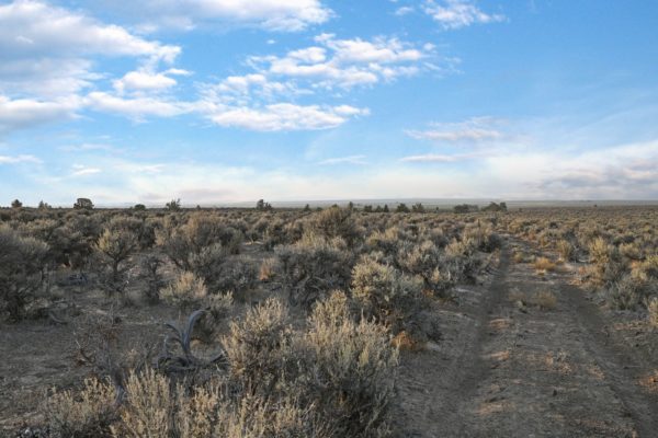
Amazing 20-acre Parcel in Lake County Outback Minutes from Christmas Valley, Oregon

***Seller Financing available–No Credit / Employment Checks–MANUFACTURED HOMES ALLOWED!***


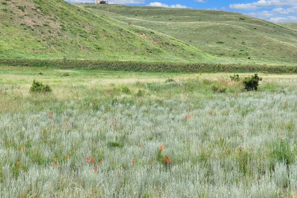
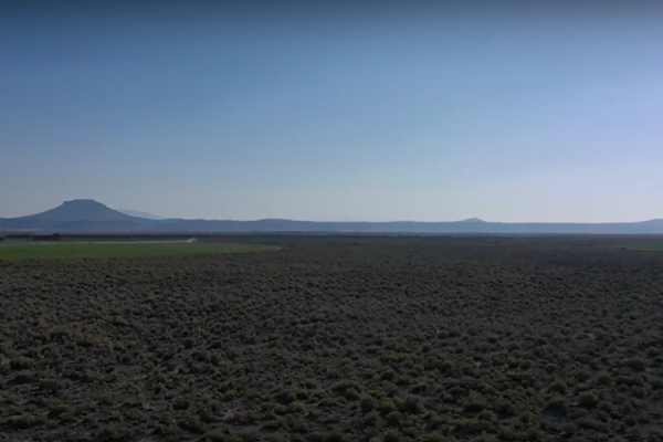
Here is your opportunity to own 20 acres in the Lake County, Oregon outback country just minutes from Christmas Valley with power only 0.60 miles from the property.. Escape large city life and enjoy wide-open spaces with fresh air, vast panoramic vistas and beautiful sunrises and sunsets.

This property is only a few minutes from Christmas Valley, where you can shop for your necessities and enjoy conveniences of Christmas Valley living. This parcel provides access to almost endless hunting, fishing, and OHV opportunities. Build your home here with a Conditional Use Permit (CUP), and have all that Oregon’s High Desert has to offer right at your fingertips.

Links to the Type II CUP can be found here:

https://www.lakecountyor.org/government/land_use_planning.php
https://www.lakecountyor.org/government/docs/Lake_County_Zoning_Ordinance__Entire_Document_.pdf

NEARBY IN CHRISTMAS VALLEY:

  • Sagewood Grocery – Grocery
  • Santa Supply Co – Hardware
  • Willows Antiques
  • North Lake Point S – Tire Shop
  • Fastbreak Convenience Store – CV Chevron
  • Klamath Basin Equipment – KBE Auto Parts & Farm Equipment Supply
  • gifts-n-more – Restaurant and Gifts
  • ThisElf – General Store
  • Coffee Corner Cafe
  • Dragonfly Landing – Health and Beauty Shop
  • Handde Pump & Electric – Garden Center
  • Lakeside Restaurant, Motel & RV Park
  • Christmas Valley Golf Course – 9-hole Public Course
  • Christmas Valley Library – Public Library

Are you a fan of golf? Christmas Valley Golf Course is nearby! Swimming and fishing? Baert Lake in Christmas Valley is open from spring through fall for fishing, swimming and boating. Ice Skating is available in the winter season!

A few miles away is the Summer Lake Wildlife Area, a refuge and breeding area of waterfowl, geese and swans and other water birds. Outdoor activities such as camping, picnicking, wildlife viewing and hunting are available. Stop by and relax at Summer Lake Hot Springs. Nearby Fossil Lake is the #2 spot in all of North America for plant and animal fossils!

Nearby attractions:

  • Sand Dunes
  • Summer Lake Wildlife Area
  • Fossil Lake

Regional cities (Approx. Travel Time from Christmas Valley):

  • Bend, OR = 2.5 hours
  • Portland, OR = 5-6 hours
  • Boise, ID = 5-6 hours

DETAILS:

Prop ID:
2792
Size of Lot (or LOT AREA):
871,200 sq ft
Acreage Size:
20.00 acres
Property Address:
N/A, near Silver Lake, OR 97638
Tax Assessment Year:
2020
Yearly Taxes:
$71.88
Zone Type:
A-2 Agriculture Use, with the A – Agriculture Comp. Plan Des. This would need the Type II Conditional Use Permit before they could be developed.
Mobile Homes:
Mobile homes are not allowed without land use. It would require a Type II CUP and then Building and Septic permits to get power and an address.
RV:
Camping and RV’s are allowed for short periods of time, but not more than 7 out of 30 days for a guest of the owners. You cannot live on the property in an RV, and camping is only supposed to be for short periods like a weekend here or there.
Sewer
Septic can be installed.
Water:
It is not in the Christmas Valley Water District. Property is outside of the Christmas Valley Domestic Water District boundary. You can drill a well for water.
Electricity:
Nearest power post is about 0.60 miles away from the lot.
Terrain:
Property is relatively flat.
Road Access:
Property can be accessed via a dirt road on the Southern portion of the lot.
Flood Zone:
No flood zone data available.
HOA Past Due:
No HOA/POA information found for the property online.
Abbreviated Legal Description”
SECTION 10 TOWNSHIP 27S RANGE 16E QUARTER PRCL 1100 MAPTAX LOT: 27S16E100110000
Complete Legal Description:
The West half of the SE ¼ of the NW ¼ of Section 10 T27S R16E of Willamette Meridian in Lake County, Oregon. Subject to a 30-foot right-of-way along all boundaries for public highway use, and a poleline right-of-way for utilities.
GPS Coordinates:
Center:
43.244709, -120.813212
NW:
43.246559, -120.814548
NE:
43.246567, -120.812043
SW:
43.242947, -120.814516

Continue reading

Own 10 Acres Just Minutes from Christmas Valley, Oregon

***No Credit / Employment Checks–MANUFACTURED HOMES ALLOWED!***


Here is your opportunity to own 10 acres in the Oregon backcountry just minutes from Christmas Valley. Escape large city life and enjoy wide-open spaces with fresh air, vast panoramic vistas and beautiful sunrises and sunsets.

The property is located on Fermac Road only a few minutes from Christmas Valley, where you can shop for your necessities and enjoy conveniences of Christmas Valley living. This parcel provides access to almost endless hunting, fishing, and OHV opportunities. Build your home here with a Conditional Use Permit (CUP), and have all that Oregon’s High Desert has to offer right at your fingertips.

Links to the Type II CUP can be found here:

https://www.lakecountyor.org/government/land_use_planning.php
https://www.lakecountyor.org/government/docs/Lake_County_Zoning_Ordinance__Entire_Document_.pdf

NEARBY IN CHRISTMAS VALLEY:

  • Sagewood Grocery – Grocery
  • Santa Supply Co – Hardware
  • Willows Antiques
  • North Lake Point S – Tire Shop
  • Fastbreak Convenience Store – CV Chevron
  • Klamath Basin Equipment – KBE Auto Parts & Farm Equipment Supply
  • gifts-n-more – Restaurant and Gifts
  • ThisElf – General Store
  • Coffee Corner Cafe
  • Dragonfly Landing – Health and Beauty Shop
  • Handde Pump & Electric – Garden Center
  • Lakeside Restaurant, Motel & RV Park
  • Christmas Valley Golf Course – 9-hole Public Course
  • Christmas Valley Library – Public Library

Are you a fan of golf? Christmas Valley Golf Course is nearby! Swimming and fishing? Baert Lake in Christmas Valley is open from spring through fall for fishing, swimming and boating. Ice Skating is available in the winter season!

A few miles away is the Summer Lake Wildlife Area, a refuge and breeding area of waterfowl, geese and swans and other water birds. Outdoor activities such as camping, picnicking, wildlife viewing and hunting are available. Stop by and relax at Summer Lake Hot Springs.

Nearby Fossil Lake is the #2 spot in all of North America for plant and animal fossils!

Nearby attractions:

  • Sand Dunes
  • Summer Lake Wildlife Area
  • Fossil Lake

Regional cities (Approx. Travel Time from Christmas Valley):

  • Bend, OR = 2.5 hours
  • Portland, OR = 5-6 hours
  • Boise, ID = 5-6 hours
DETAILS:
Prop ID:
6758
Size of Lot (or LOT AREA):
435,600 sq ft
Acreage Size:
10 acres
Property Address:
N/A, near Fermac Rd, Christmas Valley, OR 97641
Tax Assessment Year:
2020
Yearly Taxes:
$3.19
Zone Type:
A-2 Agriculture Use, with the A – Agriculture Comp. Plan Des. This would need the Type II Conditional Use Permit before they could be developed.
Mobile Homes
Mobile homes are not allowed without land use. It would require a Type II CUP and then Building and Septic permits to get power and an address.
RV:
Camping and RV’s are allowed for short periods of time, but not more than 7 out of 30 days for a guest of the owners. You cannot live on the property in an RV, and camping is only supposed to be for short periods like a weekend here or there.
Sewer:
Septic can be installed.
Water:
It is not in the Christmas Valley Water District. Property is outside of the Christmas Valley Domestic Water District boundary. You can drill a well for water.
Electricity:
No power lines nearby.
Terrain:
Property is gently sloped
Road Access:
Property can be accessed via Fermac Rd.
Flood Zone:
No flood zone data available.
HOA Past Due:
No HOA/POA information found for the property online.
Abbreviated Legal Description:
SECTION 0 TOWNSHIP 27S RANGE 18E QUARTER PRCL 4401 MAPTAX LOT: 27S18E000440100
Complete Legal Description:
TS27S, R18EWM Sec. 19: E1/2 W1/2 SW1/4 SE1/4
GPS Coordinates:
Center:
43.210319, -120.629569
NW:
43.212195, -120.630200
NE:
43.212178, -120.628951
SW:
43.208522, -120.630191
SE:
43.208528, -120.628934

Continue reading

Wonderful .92 Acre Lot in Rarity Meadows near Niota, TN

Take a relaxing drive on the country roads of southeastern Tennessee to reach this picturesque piece of land. Situated in the rural area of Niota, TN, in McMinn County, in-between Chattanooga and Knoxville off of I-75. This lot is located in Phase 2 of Rarity Meadows in the Sweetwater Valley. The adjacent .80 acre corner lot is also available. Each lot has an assessed value of $18,000 and our last lot on this street sold in a week. Don’t miss out. Call us today!

Property Details:

Property ID: 010O-A-128.00

Acreage Size: .92 AC

Assessed Value: $18,000

Property Address: 

Yearly Taxes: $ 70.00

Zone Type: There is no zoning in the unincorporated portion of McMinn County.

Mobile Homes: Not allowed.

RV: Camping is meant to be recreational and temporary, not permanent. Temporary living in a travel trailer is permitted while building a home. There is no specific length of time for this.

Sewer: Septic can be installed.

Water: Area is served by Watts Bar Utility District.

Electricity: Nearby area is served by Sweetwater Utility District.

Terrain Type: Gently rolling

Road Access: County Road 316

HOA: N/A

Abbreviated Legal Description: RARITY MEADOWS TSV PHASE 2 PB H PG 28 LOT 161 ROSSER SURV 8/14/06

GPS Coordinates:

Center: 35.5902, -84.5747
NW: 35.5904, -84.5751
N: 35.5907, -84.5749
SW: 35.5898, -84.5745
SE: 35.5901, -84.5742


Continue reading

Spectacular .80 Acre Corner Lot in Niota, TN

Take a relaxing drive on the country roads of southeastern Tennessee to reach this picturesque piece of land. Situated in the rural area of Niota, TN, in McMinn County, in-between Chattanooga and Knoxville off of I-75. This corner lot is located in Phase 2 of Rarity Meadows in the Sweetwater Valley. The adjacent .92 acre lot is also available. Each lot has an assessed value of $18,000 and our last lot on this street sold in a week. Don’t miss out. Call us today!

Property Details:

Property ID: 010O-A-129.00

Acreage Size: .80 AC

Assessed Value: $18,000

Property Address: 

Yearly Taxes: $ 70.00

Zone Type: There is no zoning in the unincorporated portion of McMinn County.

Mobile Homes: Not allowed.

RV: Camping is meant to be recreational and temporary, not permanent. Temporary living in a travel trailer is permitted while building a home. There is no specific length of time for this.

Sewer: Septic can be installed.

Water: Area is served by Watts Bar Utility District.

Electricity: Nearby area is served by Sweetwater Utility District.

Terrain Type: Gently rolling

Road Access: County Road 316

HOA: N/A

Abbreviated Legal Description: RARITY MEADOWS TSV PHASE 2 PB H PG 28 LOT 160 ROSSER SURV 8/14/06

GPS Coordinates:

Center: 35.5900, -84.5750
NW: 35.5900, -84.5754
NE: 35.5904, -84.5751
S: This is curved. No “point” 35.5897, -84.5748
SE: 35.5898, -84.5745

Continue reading

Spectacular 1 acre in Niota, TN

Take a relaxing drive on the country roads of southeastern Tennessee to reach this picturesque piece of land. Situated in the rural area of Niota, TN, in McMinn County, in-between Chattanooga and Knoxville off of I-75. This lot is located in Phase 2 of Rarity Meadows in the Sweetwater Valley. Mobile Homes allowed! Call us today!

Property Details:

Property ID: 010O-A-126.00

Acreage Size: 1.00 AC

Property Address: 

Yearly Taxes: $ 70.00

Zone Type: There is no zoning in the unincorporated portion of McMinn County.

Mobile Homes: Mobile home is allowed. Any more than two and it will be considered a mobile home park and will require Planning Commission approval.

RV: Camping is meant to be recreational and temporary, not permanent. Temporary living in a travel trailer is permitted while building a home. There is no specific length of time for this.

Sewer: Septic can be installed.

Water: Area is served by Watts Bar Utility District.

Electricity: Nearby area is served by Sweetwater Utility District.

Terrain Type: Gently rolling

Road Access: County Road 316

HOA: N/A

Complete Legal Description: Being known and designated as Lot 163, Phase Two, Rarity Meadows In the Sweetwater Valley, as shown on plat of record in Plat Cabinet H, Slide 28 to which specific reference is made for more particular description.

This property is subject to all easements, restrictions, and covenants of record, including but not limited to Declaration of Covenants, Conditions and restrictions of record in Deed Book 15Y, Page 443 and supplemental declaration of conditions, Covenants and Restrictions of record in Deed Book 17-P, Page 24, in the Office of the McMinn County Register of Deeds.

Subject to all notations, conditions, limitations as set out or shown on recorded Plat.

GPS Coordinates:

35.5902105145757,-84.5734786738256;

35.591100807662,-84.5736858290346;

35.5910173797651,-84.5739405674024;

35.5908983452762,-84.5743040173439;

35.5902825781322,-84.5739589961221

Continue reading

Wooded lot in Henderson County, TX – A place like no other!

This beautiful wooded land offers you privacy, with a sufficient space to build your primary or vacation home away from the hustle and bustle of the city. This lot is close to shopping, a movie theater, family fun park, and medical facilities. 

Cedar Creek Reservoir is only a few minutes away where you can enjoy fun-filled water activities!  Here, you get the best of both worlds! Recreational living with proximity to the DFW metroplex! The property is nestled in a quiet street of Geronimo Trail, where there are few neighbors. This property is the right investment for you; Come, bring your family here and start enjoying life! 

Call us today to learn more about this gorgeous lot! 

Property Details:

 Property ID: R000036767

Acreage Size: 0.12 AC

Property Address: 163 GERONIMO TRL, Mabank TX 75156

Yearly Taxes: $ 31.43

Zone Type: No zoning in Henderson County

Mobile Homes: Yes 

RV: Not allowed for residency

Sewer: Sewer

Water: Public

Electricity: Overhead lines across street

Terrain Type: level

Road Access: Geronimo Trl

HOA: $177.61/year 

Complete Legal Description: Lots 74, Sectin D, Cherokee Shores Subdivision, Henderson County, Texas, as shown by the Plat Recorded in Volume C, Page 394 Recorded in the Plat Records of Henderson County, Texas

GPS Coordinates:

Center: 32.2595, -96.0840

NW: 32.2595, -96.0842

NE: 32.2595, -96.0839

SW: 32.2594, -96.0842

SE: 32.2594, -96.0839

Continue reading

Stunning 0.11 AC Lot in Mabank TX – Mobile Homes Allowed!

Own this stunning 0.11-acre gem of a property that sits alongside the still waters of Cedar Creek Lake in Henderson County, TX! Tucked in the tree lines of Waurika St, this lot enjoys the excellent road frontage and already installed utilities nearby! 

Your new property enjoys the cozy shade provided by trees and its close proximity to the downtown area. Mabank’s residents enjoy its small-town vibes and the friendly community. It also houses a myriad of delicious eats and shopping opportunities.

Call us now!

Property Details:

 Property ID: R000038422

Acreage Size: 0.11 AC

Property Address: 197 Sunray St, Mabank TX 75156

Yearly Taxes: $ 31.43

Zone Type: No zoning in Henderson County

Mobile Homes: Yes 

RV: Not allowed for residency

Sewer: Sewer

Water: Public

Electricity: Overhead lines across street

Terrain Type: level

Road Access: Sunray St

HOA: $177.61 is the yearly fees 

Complete Legal Description: Lot No.(s) 980, in Section E, Cherokee Shores Subdivision, as shown by the plat thereof recorded in Volume D, Page 24, Plat Records, Henderson County, Texas.

GPS Coordinates:

Center: 32.2570, -96.0789

NW: 32.2571, -96.0971

NE: 32.2570, -96.0787

SW: 32.2569, -96.0791

SE: 32.2569, -96.0788


Continue reading

Stunning 5-Acre Gem in the Majestic San Luis Valley! Now Up for Grabs!

Out in the verdant landscape of Alamosa County, Colorado, is a cozy 5-acre gem that surrounds itself with nothing but peace and quiet. Nestled along 16th St outside US-160, this lot offers a generous space and a convenient road access to reach the vibrant downtown and its conveniences.

Known as the “Gateway to Great Sand Dunes National Park”, Alamosa is Rooted in the heart of the Majestic San Luis Valley, Alamosa Colorado offers everything needed to enjoy the quintessential Colorado experience! Alamosa’s close proximity to a multitude of sights and attractions makes it an ideal spot for travelers and weekend warriors alike. With overflowing natural wonders, outdoor activities, culture, and authentic eats, this is definitely the best place to take that long and well-deserved timeout!

Call us today!

Details:

Property ID: 527730102005

Acreage Size: 5 AC

Property Address: 16th St, Mosca, CO 81146

Yearly Taxes: 69.4

Zone Type: Rural (RU)

Mobile Homes: Yes (Should be Permanently fixed. If it is double wide, it may not be older than 1976 and if its single wide, it may not be older than 2003)

RV: Yes (Need to have a permit, build septic system and have a well. Not more than 180 days per year)

Sewer: Would have to install Septic.

Water: Would have to drill a well.

Electricity: Would have to contact Energy Resource Center/ Weatherization & Energy Efficency for the San Luis Valley(+17195879492) or Xcel Energy(+18008954999)

Terrain Type: Desert

Road Access: Can be accessed through 16th Street

HOA: County does not have any information about this and nothing found online. Would need to contact a title company or the owner to confirm.

Legal Description: SAN LUIS VALLEY RANCHES INC LOT 5 BLK 2 UNIT 11 5.0AC TD REC #376026 02-26-2020

GPS Coordinates:

Center: 37.504431, -105.584179

NW: 37.505461, -105.584812

NE: 37.505453, -105.583621

SW: 37.503606, -105.584812

SE: 37.503597, -105.583632

Continue reading

0.1-Acre Gem Hidden Deep in the Verdant Henderson County, TX!

A picturesque environment that definitely fits the bill for your new dream home! A convenient road access, close proximity to downtown area, and easy access to the vibrant communities nearby- comes with excellent road frontage and nearby power lines! Own this 0.1-acre gem in Henderson County, TX and experience the peace of simple living in the countryside!

Nestled along Deer Park Loop in Mabank, this lot enjoys an excellent road access and has power lines already installed nearby. With the downtown area just 15 minutes away, restocking for your daily needs has never been easier! From unique shopping experiences, to fun weekend events, and a small-town lifestyle just minutes from Cedar Creek Lake, Mabank has it all!

Call us today!

Property Details:

Property ID: R000035926

Acreage Size: 0.1 AC

Property Address: 116 Deer Park Loop, Mabank, TX 75156

Yearly Taxes: $31.43

Zone Type: No zoning in Henderson County

Mobile Homes: Yes 

RV: Not allowed for residency

Sewer: Sewer

Water: Public

Electricity: Overhead lines across the street

Terrain Type: level

Road Access: Deer Park Loop

HOA: 177.61/year

Complete Legal Description: Lot 274, Section C, Cherokee Shores Subdivision out of Abstract 32 (C/362), Henderson County, Texas (Document # 2010-00008971 of the Official Public Records, Henderson County, TExas) Tax Account No.2390-0003-2740-300

GPS Coordinates:

Center: 32.254895, -96.097300

NW: 32.255018, -96.097371

NE: 32.255021, -96.097214

SW: 32.254783, -96.097387

SE: 32.254785, -96.097228

Continue reading

Amazing 35.5 Lot in Westcliffe with Great Topography and Awesome Views of the Sangre de Cristos!

Looking for mountain property and a great summer project? This 35 acre parcel has some of the best views of the Sangre De Cristo Mountains and gently rolling terrain with many nice options for building sites.

Prop ID 0.001023617
Size of Lot (or LOT AREA) 1546380
Acreage Size 35.5
Property Address 665 Round Mtn Rd, Westcliffe, CO 81252
Yearly Taxes 376.72
Zone Type Residential Agricultural
Time to build 2 years to have exterior/weather tight and 3 years for completion per county,
Mobile Homes yes per county
RV Yes if hooked up to Septic and have skirting on. Wheels must be taken off per county.
Camping 14 days  
Sewer Septic 
Water Well
Electricity Would be solar or off grid
Terrain Level
Road Access Round Mtn Rd
Flood Zone No
HOA Fees Yearly fees are $100.00
Subdivision Centennial Ranch
Abbreviated Legal Description LOT 15 CENTENNIAL RANCH
GPS Coordinates:
Center: 37.9730, -105.3255
NW: 37.9740, -105.3299
NE: 37.9740, -105.3221 then S to 37.9730, -105.3221 then E to 37.9730, -105.3215
SW: 37.9719, -105.3283
SE: 37.9719, -105.3215

Continue reading

© 2026 Liberty Land Sales. All Rights Reserved