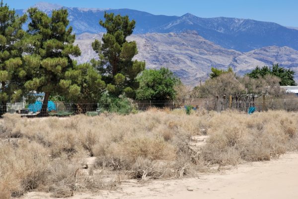
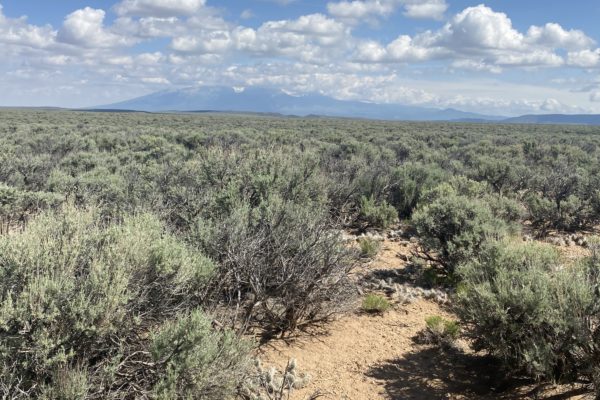
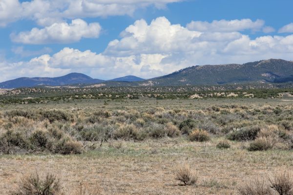
Amazing .232 Acre Lot in Sundance!

Prop ID 516314429005 – (Acct R0003608 for ParcelFact)

Size of Lot (or LOT AREA) 10125

Acreage Size 0.2324

Property Address S West St, Sundance WY 82729

Tax Assessment Year 2020

Taxes Due 0

Yearly Taxes $86.78

Tax Status Current

Current Deed 2014 QCD No 630738. Book 539 Page 131

Assessed Value 12960

Zone Type Within Sundance city limits — High Density Residential

Time to build Permit good for 1 year but can renew after that if not complete

Mobile Homes No

RV No

Camping No

Sewer Sewer

Water Public

Electricity Overhead lines at street

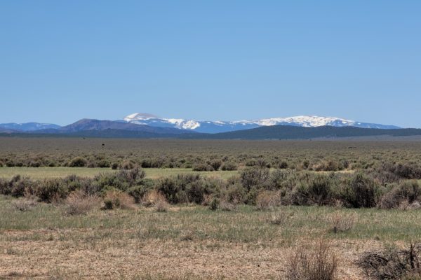
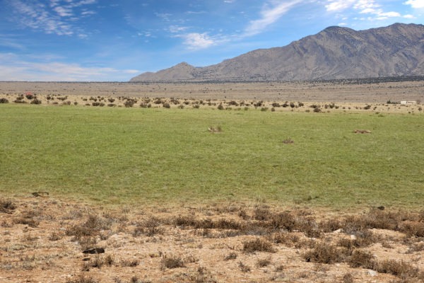
Terrain Slight Slope

Road Access There is an alley going to lot. It is legal access.

Flood Zone No

HOA Dues None

Subdivision Alden Addition

Abbreviated Legal Description ALDEN ADDN BLK 65 LOTS 20 – 22 (N. 75′ OF EACH) TOTAL SQFT: 10,125

Complete Legal Desc: The North 75 feet of Lots 20,21,22 in Block 65 of Alden Addition to the Town of Sundance, Crook County, Wyoming

GPS Coordinates:
Center: 44.4026, -104.3826
NW: 44.4027, -104.3829
NE: 44.4027, -104.3824
SW: 44.4025, -104.3829
SE: 44.4025, -104.3824

Continue reading

Amazing 4.3 Acre Lot with Power Poles On Property

Prop ID 34-4N-23-0000-0001-0020

Size of Lot (or LOT AREA) 187308

Acreage Size 4.3

Property Address Main Dr, Crestview FL 32539

Tax Assessment Year 2020

Taxes Due 0

Yearly Taxes $96.8

Tax Status Current

Zone Type R-1

Time to build 2 years once permit issued. Inspection required every 6 months to keep it valid.

Mobile Homes Yes, they are allowed.

RV No

Camping Extended allowed during building, overnight allowed for private recreational camping

Sewer Septic

Water Well

Electricity Per electric company, lines are at SW corner of lot

Terrain Flat

Road Access Yes

Flood Zone Not in a flood zone

HOA None

Subdivision
Abbreviated Legal Description COM SW COR OF NW1/4 OF SE1/4 N1880.71 FT E327.41 FT FOR POB E330 FT S560 FT W330 FT N560 FT TO POB

GPS Coordinates:
Center: 30.8028, -86.5332
NW: 30.8035, -86.5327
NE: 30.8035, -86.5316
SW: 30.8020, -86.5327
SE: 30.8019, -86.5317

Continue reading

1.6 Acre Lot in Pahrump Near 160


Prop ID: 041-063-22

Size of Lot (or LOT AREA): 69,696 sq. ft.

Acreage Size: 1.6 acres

Property Address: 3500 S Oakridge Ave, Pahrump, NV 89048

Tax Assessment Year: 2020

Taxes Due: $0.00

Yearly Taxes: $157.64

Tax Status: Current

Zone Type: RE-1 (Can put up Single Family Residence and 1 guest dwelling)
Mobile Homes: Manufactured homes and factory-built homes placed within the PRPD in the RE-1, SE and all VR Zoning Districts must:
a. Be permanently affixed to the land and converted to real property through the Assessor’s Office;
b. Be manufactured within the six (6) years immediately preceding the date on which it is affixed to the land;
c. Have exterior siding and roofing which is similar in color, material and appearance to the exterior siding and roofing primarily used on other single-family residential dwellings within one thousand feet (1,000′) of the property line on which the manufactured home or factory-built home will be affixed;
d. Consist of more than one section;
e. Consist of at least nine hundred sixty (960) square feet of living area; and
f. Be installed on an approved permanent foundation with perimeter supporting wall in compliance with Nevada Manufactured Housing Division standards and exterior backfilled to within twelve inches (12″) of the floor elevation.

RV:You are allowed to dry camp on your property in a self contained RV up to 7 days in a calendar year. If there is a connection to water and sewer you are allowed to camp connected to water and sewer up to 120 day each calendar year. You are also allowed to stay in your RV on the property during the construction on your home with permit fees paid and while there is an active building permit.

Sewer: Sewer nearby and can possibly extended to the lot.

Water: Area is served by Great Basin Water Co.

Electricity: There is a power post on the SW portion of the lot served by Valley Electric.

Terrain: Property is almost flat.

Road Access: Property can be accessed via Oakridge Avenue.

Flood Zone: Property is on the floodzone area.

HOA: Past Due No HOA/POA information found for the property online. The county is not aware of any HOA involving this property.

Abbreviated Legal Description: T20S R53E S36 U.2 B.32 L.10 CALVADA VALLEY

Complete Legal Desc: Lot Ten (10) in Block Thirty-Two (32) of CALVADA VALLEY UNIT NO. 2 recorded October 5, 1970 as Document no. 20291 in the Office of the County Recorder of Nye County, Nevada. EXCEPTING THEREFROM all of its right, title and interest in and all of the minerals, including gas, coal, oil and oil shales as disclosed by Deed recorded on January 10, 1961 in Book 43, Page 374 Official Records, Nye County, Nevada.

Continue reading

Truly an Amazing Lot in Christmas Valley, OR! POWER NEARBY!

Looking for small town living? This 0.31 acre double lot in Christmas Valley is the place for you! Enjoy the amenities of town: gas, groceries, dining, even golf! All this with the the Oregon desert in your backyard: hunt, off-road, wildlife watching, enjoy the local geological wonders of the Christmas Valley Sand Dunes, the Lost Forest, Crack in the Ground, and Table Rock!

Property Details:

Prop ID 4340

Size of Lot (or LOT AREA)  13,504 sq. ft.

Acreage Size 0.31 acres

Property Address N/A, near Elm St, Christmas Valley, OR 97641

Yearly Taxes $46.74

Tax Status Current

Zone R-1 Rural Residential. It is buildable, but would need a septic and building permits to be pulled for a dwelling to be able to be established.

Mobile Homes Mobile homes are allowed with building permit and approved septic.

RV Camping and RV’s are allowed for short periods of time, but not more than 7 out of 30 days for a guest of the owners. You cannot live on the property in an RV, and camping is only supposed to be for short periods like a weekend here or there.

Sewer Septic can be installed.

Water Property is within the area served by Christmas Valley Domestic Water District, therefore water would be available when constructing a single-family residence.

Electricity Nearest power post is about 275 feet from the lot.

Terrain Property is flat.

Road Access Property can be accessed via Elm Street.

Flood Zone No floodzone data available.

HOA No HOA/POA found for the property online.

Complete Legal Desc Account No. 271710CA-3600 Reference No. 4340 Land Sale No. 2100 Lot 13 in Block 7 of Christmas Valley Townsite Unit No. 11

GPS Coordinates:

Center: 43.244064, -120.694537

NW: 43.244278, -120.694782

NE: 43.244047, -120.694179

SW: 43.244064, -120.694893

SE: 43.243875, -120.694267

Continue reading

Own 20 acres in the Oregon backcountry near Christmas Valley.

***Seller Financing available–No Credit / Employment Checks–MANUFACTURED HOMES ALLOWED!***


Imagine your own 20 acres in the Oregon backcountry. Escape large city life and enjoy wide-open spaces with fresh air, vast panoramic vistas and beautiful sunrises and sunsets.

The property is approximately 25 minutes northeast of Christmas Valley, where you can shop for your necessities and enjoy conveniences of Christmas Valley living. This parcel provides access to almost endless hunting, fishing, and OHV opportunities. Build your home here with a Conditional Use Permit (CUP), and have all that Oregon’s High Desert has to offer right at your fingertips.

Links to the Type II CUP can be found here:

https://www.lakecountyor.org/government/land_use_planning.php
https://www.lakecountyor.org/government/docs/Lake_County_Zoning_Ordinance__Entire_Document_.pdf

NEARBY IN CHRISTMAS VALLEY:

  • Sagewood Grocery – Grocery
  • Santa Supply Co – Hardware
  • Willows Antiques
  • North Lake Point S – Tire Shop
  • Fastbreak Convenience Store – CV Chevron
  • Klamath Basin Equipment – KBE Auto Parts & Farm Equipment Supply
  • gifts-n-more – Restaurant and Gifts
  • ThisElf – General Store
  • Coffee Corner Cafe
  • Dragonfly Landing – Health and Beauty Shop
  • Handde Pump & Electric – Garden Center
  • Lakeside Restaurant, Motel & RV Park
  • Christmas Valley Golf Course – 9-hole Public Course
  • Christmas Valley Library – Public Library

Are you a fan of golf? Christmas Valley Golf Course is nearby! Swimming and fishing? Baert Lake in Christmas Valley is open from spring through fall for fishing, swimming and boating. Ice Skating is available in the winter season!

A few miles away is the Summer Lake Wildlife Area, a refuge and breeding area of waterfowl, geese and swans and other water birds. Outdoor activities such as camping, picnicking, wildlife viewing and hunting are available. Stop by and relax at Summer Lake Hot Springs.

Nearby Fossil Lake is the #2 spot in all of North America for plant and animal fossils!

Nearby attractions:

  • Sand Dunes
  • Summer Lake Wildlife Area
  • Fossil Lake

Regional cities (Approx. Travel Time from Christmas Valley):

  • Bend, OR = 2.5 hours
  • Portland, OR = 5-6 hours
  • Boise, ID = 5-6 hours
DETAILS:
Prop ID:
708
Size of Lot (or LOT AREA):
871,200 sq. ft.
Acreage Size:
20.00 acres
Property Address:
N/A, Silver Lake, OR 97638
Tax Assessment Year:
2020 (Current)
Yearly Taxes:
$149.44
Zone Type:
A-2 Agriculture Use, and it has the R – Range comprehensive plan designation.
Mobile Homes:
Mobile homes are not allowed without land use. It would require a Type II CUP and then Building and Septic permits to get power and an address.
RV:
Camping and RV’s are allowed for short periods of time, but not more than 7 out of 30 days for a guest of the owners. You cannot live on the property in an RV, and camping is only supposed to be for short periods like a weekend here or there.
Sewer:
Septic can be installed.
Water:
It is not in the Christmas Valley Water District as CV is more than 10 miles to the southwest. Property is outside of the Christmas Valley Domestic Water District boundary. You can drill a well for water.
Electricity:
No power lines nearby.
Terrain:
Property is relatively flat.
Road Access:
Property can be accessed via an unnamed dirt road on the North and Christmas Valley Back Country Bywy on the SE corner of the lot.
Flood Zone:
No flood zone data available.
HOA Past Due:
No HOA/POA information found for the property online.
Abbreviated Legal Description:
SECTION 26 TOWNSHIP 25S RANGE 18E QUARTER PRCL 100 MAPTAX LOT: 25S18E260010000
Complete Legal Description:
T25S, R18EWM Sec.26: E1/2 NE1/4 NE1/4
GPS Coordinates:
Center:
43.383107, -120.517802
NW:
43.384892, -120.519057
NE:
43.384892, -120.516615
SW:
43.381193, -120.519044
SE:
43.381213, -120.516629

Continue reading

Own 4.57 Acres in Costilla County near San Luis in San Luis North Estates!

***Seller Financing available–No Credit / Employment Checks–MANUFACTURED HOMES ALLOWED!***


Imagine your own 4.573 acres in Costilla County near San Luis in San Luis North Estates! This parcel is only minutes away from San Luis via V 5 to the south. Just imagine living in a place where you can smell the fresh air in the morning and enjoy the scenery of the vast Colorado mountain ranges. This is a great fit for anyone who wants to have a quiet and peaceful place to live in or escape to. Just clear nights skies for starry views as far as the eyes can see.

This could be your hideaway spot! This is a fantastic opportunity to own this year-round accessible property Costilla County. This area is surrounded by vast open spaces with wildlife and elk and vistas of the wide-open spaces.

Are you looking for mountain views and somewhere to escape the hustle and bustle of city life? This is it! Make this your homestead or getaway location. Imagine your own spot to get away and enjoy the great outdoors from your property in Costilla County Colorado.

San Luis North Estates subdivision provides both the solitude of the area and the convenience of being near the towns of San Luis and Fort Garland. Costilla County is in the San Luis Valley of southern Colorado. The San Luis Valley is about 150 miles long and 75 miles wide, surrounded by the Sangre de Cristo Mountains on the East with several peaks above 14,000 feet and the San Juan Mountains on the West.

There are an average of 285 sunny days a year in Fort Garland. This is a perfect location to enjoy fresh air, sunny days and bright star-filled nights. Looking for outdoor sporting activities? The area provides numerous fishing, hunting, mountain biking and hiking opportunities!

There are many historical, cultural and recreational activities in the area. Explore Monte Vista & Alamosa Wildlife Refuges, San Luis Lake State Park, Great Sand Dunes National Park & Preserve, Penitente Canyon, Thunder Mountain Speedway, Cumbres & Toltec Scenic Railroad, Colorado Gator Farm, Del Norte, Monte Vista, and more.

Now is your chance to have the off the grid property you’ve always dreamed about. Spend your weekends hiking, fishing, hunting and just relaxing while you breathe in the fresh mountain air. Enjoy exploring Southern Colorado and the peace and natural beauty of the area. Become a Costilla County land owner now. Call today!

If buying on terms, the minimum down payment for this property is $2099 with monthly payments starting at $209/mo. Ask us how we can customize your payment plan to work for you! As owners of the property, we can really get creative. Pricing is subject to change without warning.

GREAT SAND DUNES NATIONAL PARK:

Nearby is the Great Sand Dunes National Park and Preserve. The Park features hours of fun where you can:

*Hike, birdwatch and explore the Park’s numerous trailheads

*Sand sled and Sandboard on the dunes

*4WD through Medano Pass

*Stargaze at night

Learn more about this Great Sand Dunes National Park at:

https://www.nps.gov/grsa/planyourvisit/index.htm

https://www.nps.gov/grsa/learn/news/upload/visitor-guide-great-sand-dunes2019-webversion2.pdf

APPROXIMATE DISTANCES FROM FORT GARLAND, CO:

San Luis, CO = 16 miles (16 minutes)

Alamosa, CO = 25 miles (25 minutes)

Pueblo, CO = 98 miles (1.5 hours)

Colorado Springs, CO = 140 miles (2 hours)

Santa Fe, NM = 150 miles (2.5 hours)

Albuquerque, NM = 212 miles (3.75 hours)

DETAILS:
Property ID:
70701510
Size of Lot (or LOT AREA):
199,200 sq. ft.
Acreage Size:
4.573 acres
Property Address:
V 5, San Luis, CO 81152
Tax Assessment Year:
2020
Yearly Taxes:
$130.90
Zone Type:
Estate – Residential
Mobile Homes:
Site built home 600-sqft min, Manufactured homes are okay.
RV:
Long-Term RV Camping Permits are valid for 60 Days and a new application must be filed before the expiration date of the permit. $200 fee – septic & water required). Long-term camping SHALL NOT EXCEED 180 DAYS per RV, Person, or Parcel in any 12-month period. RV’s must be inspected by the Planning and Zoning office to ensure all plumbing and electrical is in working order prior to application approval. Sites will be inspected prior to approval. ONLY ONE (1) RV SHALL BE PERMITTED PER PARCEL. 14 days of camping within a 3-month period. $250 fee – good for 90 days at a time while building, renew for up to 18 months.
Sewer:
Septic can be installed. Composting toilets are only allowed if they are connected directly to an approved septic system.
Water:
Can drill a well.
Electricity:
No power lines nearby.
Terrain:
Property is gently rolling.
Road Access:
Property can be accessed via V 5 on the Southern portion.
Flood Zone:
No flood data available online.
HOA Past Due:
No HOA/POA information found for the property online.
Abbreviated Legal Description:
S.L.N.E. FILING 1 LOT 248 (226-265)(WD 393-263) (SOA 399-791)(WD 402-541)
Complete Legal Description:
San Luis North Estates Filing 1 Lot 248
GPS Coordinates:
Center:
37.268004, -105.452711
NW:
37.268875, -105.453273
NE:
37.268864, -105.452168
SW:
37.267173, -105.453296
SE:
37.267158, -105.452184

Continue reading

Power Close By! Own 4.8 Acres in Costilla County Top of the World

***Seller Financing available–No Credit / Employment Checks–MANUFACTURED HOMES ALLOWED!***

This 4.8-acre parcel in the popular Top of the World subdivision is only minutes away from San Luis. Just imagine living in a place where you can smell the fresh air in the morning and enjoy the scenery of the vast Colorado mountain ranges. This is a great fit for anyone who wants to have a quiet and peaceful place to live in or escape to. Just clear nights skies for starry views as far as the eyes can see. Yes, these are actual photos of and from the property!

This could be your hideaway spot! This is a fantastic opportunity to own this year-round accessible property Costilla County. This area is surrounded by vast open spaces with wildlife and elk and vistas of the wide-open spaces.

Are you looking for mountain views and somewhere to escape the hustle and bustle of city life? This is it! Make this your homestead or getaway location. Imagine your own spot to get away and enjoy the great outdoors from your property in Costilla County Colorado.

The Top of the World subdivision provides both the solitude of the area and the convenience of being near the towns of San Luis and Fort Garland. Costilla County is in the San Luis Valley of southern Colorado. The San Luis Valley is about 150 miles long and 75 miles wide, surrounded by the Sangre de Cristo Mountains on the East with several peaks above 14,000 feet and the San Juan Mountains on the West.

There are an average of 285 sunny days a year in Fort Garland. This is a perfect location to enjoy fresh air, sunny days and bright star-filled nights. Looking for outdoor sporting activities? The area provides numerous fishing, hunting, mountain biking and hiking opportunities!

There are many historical, cultural and recreational activities in the area. Explore Monte Vista & Alamosa Wildlife Refuges, San Luis Lake State Park, Great Sand Dunes National Park & Preserve, Penitente Canyon, Thunder Mountain Speedway, Cumbres & Toltec Scenic Railroad, Colorado Gator Farm, Del Norte, Monte Vista, and more.

Now is your chance to have the off the grid property you’ve always dreamed about. Spend your weekends hiking, fishing, hunting and just relaxing while you breathe in the fresh mountain air. Enjoy exploring Southern Colorado and the peace and natural beauty of the area. Become a Costilla County land owner now. Call today!

If buying on terms, the minimum down payment for this property is $1560 with monthly payments starting at $207/mo. Ask us how we can customize your payment plan to work for you! As owners of the property, we can really get creative. Pricing is subject to change without warning.

GREAT SAND DUNES NATIONAL PARK:

Nearby is the Great Sand Dunes National Park and Preserve. The Park features hours of fun where you can:

*Hike, birdwatch and explore the Park’s numerous trailheads

*Sand sled and Sandboard on the dunes

*4WD through Medano Pass

*Stargaze at night


Learn more about this Great Sand Dunes National Park at:

https://www.nps.gov/grsa/planyourvisit/index.htm

https://www.nps.gov/grsa/learn/news/upload/visitor-guide-great-sand-dunes2019-webversion2.pdf


APPROXIMATE DISTANCES FROM FORT GARLAND, CO:

San Luis, CO = 16 miles (16 minutes)

Alamosa, CO = 25 miles (25 minutes)

Pueblo, CO = 98 miles (1.5 hours)

Colorado Springs, CO = 140 miles (2 hours)

Santa Fe, NM = 150 miles (2.5 hours)

Albuquerque, NM = 212 miles (3.75 hours)

DETAILS:

Prop ID: 70601440

Size of Lot (or LOT AREA): 209,305 sq. ft.

Size: 4.805 acres

Property Address: N/A, Fort Garland, CO 81133

Tax Assessment Year: 2020

Taxes Due: $0.00

Yearly Taxes: $97.70

Tax Status: Current
Zone Type: Estate – Residential

Mobile Homes: Site built home 600 sq ft min, manufactured homes are okay. Mobile Homes manufactured prior to 1976 are prohibited in unincorporated Costilla County.

RV: Long-Term RV Camping Permits are valid for 60 Days and a new application must be filed before the expiration date of the permit. $200 fee – septic & water required). Long-term camping SHALL NOT EXCEED 180 DAYS per RV, Person, or Parcel in any 12 month period. RV’s must be inspected by the Planning and Zoning office to ensure all plumbing and electrical is in working order prior to application approval. Sites will be inspected prior to approval. ONLY ONE (1) RV SHALL BE PERMITTED PER PARCEL. 14 days of camping within a 3 month period. $250 fee – good for 90 days at a time while building, renew for up to 18 months.

Sewer: Septic can be installed. Composting toilets are only allowed if they are connected directly to an approved septic system.

Water: Can drill a well.

Electricity: Power lines in the area. Buyer to confirm details.

Terrain: Property is gently rolling.

Road Access: Property can be accessed via Arrowhead Rd.

Flood Zone: No

HOA:No HOA/POA

Abbreviated Legal Description

T.O.W. UNIT 3 LOT 2

Complete Legal Desc:

Top of the World Unit 3 Lot 2

GPS Coordinates:

Center:37.329280, -105.394571

NW: 37.330203, -105.395138

NE: 37.330193, -105.394005

SW: 37.328446, -105.395165

SE: 37.328437, -105.394036

Continue reading

AMAZING 4.805 ACRE PROPERTY IN COSTILLA COUNTY COLORADO! $5999 OR $212.57/MONTH

Wake up to this amazing beauty of the mountains everyday! With slope terrain and plenty of trees to enjoy, this land in Costilla County CO is a great to retreat to any time of the year. While nestling in this 4.805 acre property you will still have the convenience of small town amenities just few miles away from your home.

Zoned estate residential, this property allows mobile homes and limited RV living while you plan to build your perfect home, surrounded by wooded beauty.

If you are into hiking, skiing, mountain biking, horseback riding, or just want some solitude, this is sure to be an ideal property for you!

Get in touch to find out how simple and straightforward the process can be. What are you waiting for? Give us a call now!

Prop ID: 70601440
Acreage Size: 4.805 acres
Taxes Due: $0.00
Yearly Taxes: $97.70
Zone Type: Estate – Residential
Mobile Homes: Site built home 600 sq ft min, manufactured homes are okay. Mobile Homes manufactured prior to 1976 are prohibited in unincorporated Costilla County.
RV: Long-Term RV Camping Permits are valid for 60 Days and a new application must be filed before the expiration date of the permit. $200 fee – septic & water required). Long-term camping SHALL NOT EXCEED 180 DAYS per RV, Person, or Parcel in any 12 month period. RV’s must be inspected by the Planning and Zoning office to ensure all plumbing and electrical is in working order prior to application approval. Sites will be inspected prior to approval. ONLY ONE (1) RV SHALL BE PERMITTED PER PARCEL. 14 days of camping within a 3 month period. $250 fee – good for 90 days at a time while building, renew for up to 18 months.
Sewer: Septic can be installed. Composting toilets are only allowed if they are connected directly to an approved septic system.
Water: Can drill a well.
Electricity: No power lines nearby.
Terrain: Property is gently rolling.
Road Access: Property can be accessed via Arrowhead Rd.
Flood Zone: No flood data available.
HOA Past Due: No HOA/POA information found for the property online.
Abbreviated Legal Description: T.O.W. UNIT 3 LOT 2
Complete Legal Desc: Top of the World Unit 3 Lot 2

GPS Coordinates:
Center: 37.329280, -105.394571
NW: 37.330203, -105.395138
NE: 37.330193, -105.394005
SW: 37.328446, -105.395165
SE: 37.328437, -105.394036

Continue reading

Make your dream happen in this perfect 5.98 acre lot in Valencia, New Mexico!

Breathe in fresh air & freedom! Situated in the quiet subdivision of Tierra Grande, you’ll find 5.98 acres of flat land surrounded by stunning views, brilliant blue New Mexico skies by day and vivid starry nights – may just be the perfect spot for your dream home! As an owner of a portion of Tierra Grande you’ll enjoy country living just minutes from town as well as access to acres of open space which provide beautiful trails and canyons for exploring, horseback riding, hiking and backpacking.

THIS IS IT, the perfect piece of land to build your dream home. Grab your cup of coffee, watch the sunrise or kick up your feet with a glass of wine and drink in the magnificent sunsets. Stargaze into a vast dome of lights above and city below. Feel like you’re on the edge of the world yet minutes from town. Authentic local restaurants and friendly businesses. A welcoming community who truly loves its town & people. What are you waiting for? Make your dream happen now!!!

Prop ID: 1-020-018-130-170-000130
Acreage Size 5.98 ares
Taxes Due: $0.00
Yearly Taxes: $43.26
Tax Status: Current
Current Deed: Warranty Deed recorded on 04/07/1984 in Book 269 Page 6808
Assessed Value: $1,595.00
Zone Type: RR-2
Mobile Homes: NO mobile, manufactured or modular homes allowed. However, we allow Kit built homes, metal buildings converted to residences, and we are open to alternative housing styles. ALL homes must be built on site.
RV: “It is allowed WITH AN APPROVED TEMPORARY VARIANCE to live in an RV during construction. Renewable in 6 month increments – up to a maximum of 2 years. There is a $10 a month fee for this variance.

Once a residence is completed, RV’s can be parked on the property as long as they are licensed and operable.”

Sewer: A private septic system would have to be installed.

Water: You can put in a private well or cistern system

Electricity: Socorro Electric Cooperative serves the area. Nearest power post is about 276 feet away from the property.

Terrain: Property is gently rolling.

Road Access: Property can be accessed via Districto Dr and Iluso Cir.

Flood Zone: Not in a floodzone area.

HOA Past Due: Active member of Tierra Grande. Association Dues are $50. Account is paid in full through December 2020.

Abbreviated Legal Description: TIERRA GRANDE Lot: 13 Block: 7 Unit: 21

Complete Legal Desc: All of Lots 13 in Block 7 of Tierra Grande Unit No. 21, according to the plat thereof recorded in the Office of the Clerk of Valencia County, New Mexico on Febuary 23, 1973, including any gas, oil or mineral rights now owned by Grantor.

GPS Coordinates:
Center: 34.507616, -106.547220
NW: 34.507884, -106.548520
NE: 34.508452, -106.546650
SW: 34.506970, -106.548114
SE: 34.507124, -106.546061

Continue reading

5.6 ACRE LOT IN VALENCIA, NEW MEXICO! Perfect to be off grid or make an investment!

Get out of the hustle & bustle and enjoy a pristine country living on your own serene and phenomenal 5.6 acre piece of land. Attractive homes in the neighborhood. Build your dream house here! Or split the land and build several. Whether you are wanting to run a ranch or build a home this is the property you have been looking for. Just take a drive down and you will fall in love with this property. Gorgeous views all around.

And if you want to have mountain views and privacy for days, this lot is perfect for you. Perfect to be off grid or make an investment.

What are you waiting for? Call us today for this offer before it becomes unavailable!

Prop ID: 2-001-037-462-008-000000
Acreage Size: 5.6 acres
Taxes Due: $200.25
Yearly Taxes: $57.12
Tax Status: Paid
Zone Type: OD (Outland District)
Mobile Homes: Mobile homes should have a minimum size of 840 square meters with major hook-ups. You can build anything for residential purposes such as Single Family, Mobile or Manufactured home. There is no restrictions when it comes to building a tiny homes as long as you have good foundation and major hook-ups and it could not be a trailer.
RV: RV’s are allowed as long as you live temporarily in an RV for not more that 45 days in a year. Recreational vehicles (RVs) shall not be used as primary residences in any Rural Residential (RR) District.
Minimum Home Size: Minimum acreage you can build on is 3/4 of 1 acre. The ground floor of the structure of the dwelling shall not be less than 800 square feet.
Sewer: A private septic system would have to be installed and a permit obtained from the Environmental Dept.
Water: Can drill a well for water.
Electricity: No power lines nearby.
Terrain: Property is gently sloped.
Road Access: Property can be accessed via an unnamed road on the SW corner of the lot.
Flood Zone: Property is within the area of the minimal flood hazard.
HOA Past Due: No HOA/POA information found for the property online.
Abbreviated Legal Description: S: 36 T: 7N R: 1W PORTION OF LOTS 57 & 58 5.60 ACRES +/-
Complete Legal Desc: The SW1/4-SW1/4-SW1/4- & SE1/4-SW1/4-SW1/4 designated as Lots 57 & 58 Section 36 Township 7N, Range 1W, N.M.P.M. being 5.6 acres more or less; including all water, oil and gas rights; subject to restrictions and reservations of record and subject to rights of way for road purposes and railroad rights of way.

GPS Coordinates:
Center: 34.782672, -106.902169
NW: 34.782960, -106.904365
NE: 34.783019, -106.899917
SW: 34.782385, -106.904378
SE: 34.782450, -106.899918

Continue reading

© 2026 Liberty Land Sales. All Rights Reserved