Contact Seller
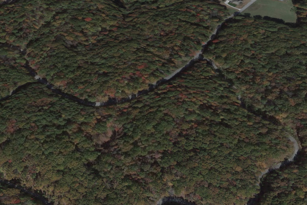
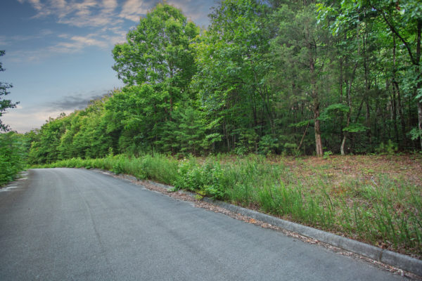
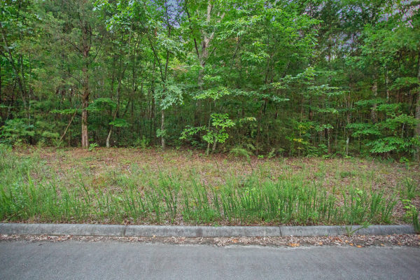
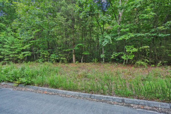
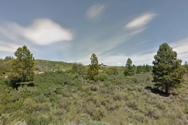
Take a relaxing drive on the country roads of southeastern Tennessee to reach this picturesque piece of land. Situated in the rural area of Niota, TN, in McMinn County, in-between Chattanooga and Knoxville off of I-75. This lot is located in Phase 2 of Rarity Meadows in the Sweetwater Valley. Mobile Homes allowed! Call us today!
Property Details:
Property ID: 010O-A-126.00
Acreage Size: 1.00 AC
Property Address:
Yearly Taxes: $ 70.00
Zone Type: There is no zoning in the unincorporated portion of McMinn County.
Mobile Homes: Mobile home is allowed. Any more than two and it will be considered a mobile home park and will require Planning Commission approval.
RV: Camping is meant to be recreational and temporary, not permanent. Temporary living in a travel trailer is permitted while building a home. There is no specific length of time for this.
Sewer: Septic can be installed.
Water: Area is served by Watts Bar Utility District.
Electricity: Nearby area is served by Sweetwater Utility District.
Terrain Type: Gently rolling
Road Access: County Road 316
HOA: N/A
Complete Legal Description: Being known and designated as Lot 163, Phase Two, Rarity Meadows In the Sweetwater Valley, as shown on plat of record in Plat Cabinet H, Slide 28 to which specific reference is made for more particular description.
This property is subject to all easements, restrictions, and covenants of record, including but not limited to Declaration of Covenants, Conditions and restrictions of record in Deed Book 15Y, Page 443 and supplemental declaration of conditions, Covenants and Restrictions of record in Deed Book 17-P, Page 24, in the Office of the McMinn County Register of Deeds.
Subject to all notations, conditions, limitations as set out or shown on recorded Plat.
GPS Coordinates:
35.5902105145757,-84.5734786738256;
35.591100807662,-84.5736858290346;
35.5910173797651,-84.5739405674024;
35.5908983452762,-84.5743040173439;
35.5902825781322,-84.5739589961221
Property Location
Discounted Cash Pricing
Cash Price: $14,000
Doc & Reservation Fee: $199
Total: $14,199
Deposit Amount: $1,820
Terms Pricing
Terms Price: $18,200
Down Payment: $3,640
Interest Rate: 10%
Monthly Payment: $383
Montly Loan Fee : $20
Total Term months : 48
Property Location
Property Details
Size (Acres)
5.54
Best Attribute
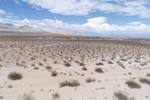
Wide Open Space
APN or Other ID
70235760
Legal Description
LOT 1704, BLOCK 113, SANGRE DE CRISTO RANCHES, UNIT J, COSTILLA COUNTY, COLORADO
Approximate GPS Coordinates
37.364998, -105.342107
Property Size
Rural Land
Zoning
Estate – Residential
General Elevation (in feet)
8554
Power
Would be alternative power source.
HOA/POA
SDCR – Membership is optional for $25/year
Water
Well Can Be Drilled
Sewer
Septic can be installed
Roads
Dirt Road
Terrain
Property on rolling hills
Title Info
Clear Title
Annual Property Taxes (Approx)
$115.64
“We have not visited this property. We have posted all of the information we have available about this property and we encourage our customers to do their own due diligence prior to purchasing.”
Related Properties
Contact Seller
Take a relaxing drive on the country roads of southeastern Tennessee to reach this picturesque piece of land. Situated in the rural area of Niota, TN, in McMinn County, in-between Chattanooga and Knoxville off of I-75. This lot is located in Phase 2 of Rarity Meadows in the Sweetwater Valley. Mobile Homes allowed! Call us today!
Property Details:
Property ID: 010O-A-126.00
Acreage Size: 1.00 AC
Property Address:
Yearly Taxes: $ 70.00
Zone Type: There is no zoning in the unincorporated portion of McMinn County.
Mobile Homes: Mobile home is allowed. Any more than two and it will be considered a mobile home park and will require Planning Commission approval.
RV: Camping is meant to be recreational and temporary, not permanent. Temporary living in a travel trailer is permitted while building a home. There is no specific length of time for this.
Sewer: Septic can be installed.
Water: Area is served by Watts Bar Utility District.
Electricity: Nearby area is served by Sweetwater Utility District.
Terrain Type: Gently rolling
Road Access: County Road 316
HOA: N/A
Complete Legal Description: Being known and designated as Lot 163, Phase Two, Rarity Meadows In the Sweetwater Valley, as shown on plat of record in Plat Cabinet H, Slide 28 to which specific reference is made for more particular description.
This property is subject to all easements, restrictions, and covenants of record, including but not limited to Declaration of Covenants, Conditions and restrictions of record in Deed Book 15Y, Page 443 and supplemental declaration of conditions, Covenants and Restrictions of record in Deed Book 17-P, Page 24, in the Office of the McMinn County Register of Deeds.
Subject to all notations, conditions, limitations as set out or shown on recorded Plat.
GPS Coordinates:
35.5902105145757,-84.5734786738256;
35.591100807662,-84.5736858290346;
35.5910173797651,-84.5739405674024;
35.5908983452762,-84.5743040173439;
35.5902825781322,-84.5739589961221
Property Location
Take a relaxing drive on the country roads of southeastern Tennessee to reach this picturesque piece of land. Situated in the rural area of Niota, TN, in McMinn County, in-between Chattanooga and Knoxville off of I-75. This lot is located in Phase 2 of Rarity Meadows in the Sweetwater Valley. Mobile Homes allowed! Call us today!
Property Details:
Property ID: 010O-A-126.00
Acreage Size: 1.00 AC
Property Address:
Yearly Taxes: $ 70.00
Zone Type: There is no zoning in the unincorporated portion of McMinn County.
Mobile Homes: Mobile home is allowed. Any more than two and it will be considered a mobile home park and will require Planning Commission approval.
RV: Camping is meant to be recreational and temporary, not permanent. Temporary living in a travel trailer is permitted while building a home. There is no specific length of time for this.
Sewer: Septic can be installed.
Water: Area is served by Watts Bar Utility District.
Electricity: Nearby area is served by Sweetwater Utility District.
Terrain Type: Gently rolling
Road Access: County Road 316
HOA: N/A
Complete Legal Description: Being known and designated as Lot 163, Phase Two, Rarity Meadows In the Sweetwater Valley, as shown on plat of record in Plat Cabinet H, Slide 28 to which specific reference is made for more particular description.
This property is subject to all easements, restrictions, and covenants of record, including but not limited to Declaration of Covenants, Conditions and restrictions of record in Deed Book 15Y, Page 443 and supplemental declaration of conditions, Covenants and Restrictions of record in Deed Book 17-P, Page 24, in the Office of the McMinn County Register of Deeds.
Subject to all notations, conditions, limitations as set out or shown on recorded Plat.
GPS Coordinates:
35.5902105145757,-84.5734786738256;
35.591100807662,-84.5736858290346;
35.5910173797651,-84.5739405674024;
35.5908983452762,-84.5743040173439;
35.5902825781322,-84.5739589961221
Property Location
Discounted Cash Pricing
Cash Price: $14,000
Doc & Reservation Fee: $199
Total: $14,199
Deposit Amount: $1,820
Terms Pricing
Terms Price: $18,200
Down Payment: $3,640
Interest Rate: 10%
Monthly Payment: $383
Montly Loan Fee : $20
Total Term months : 48

