Contact Seller
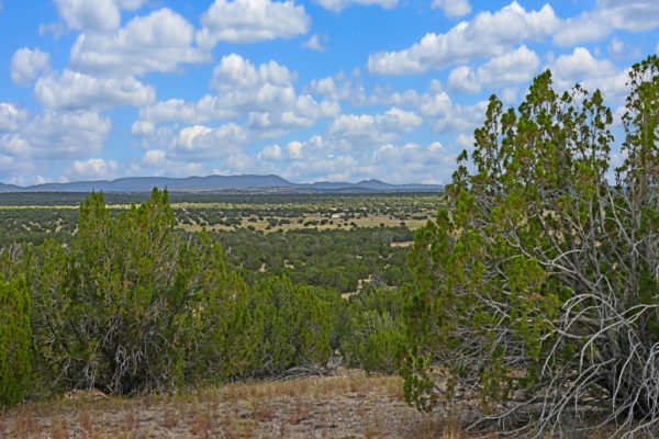
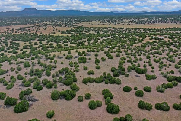
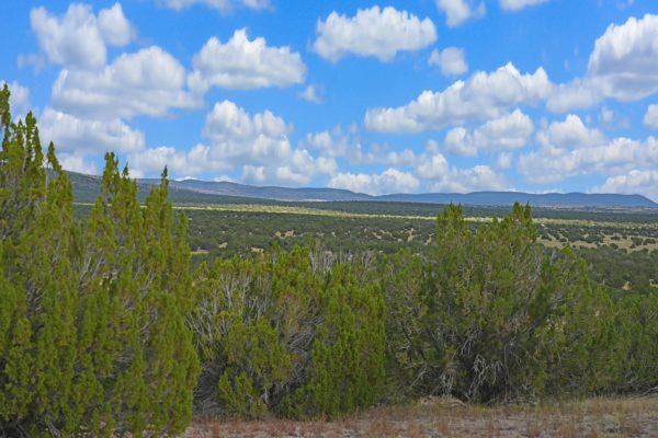
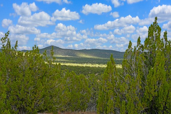
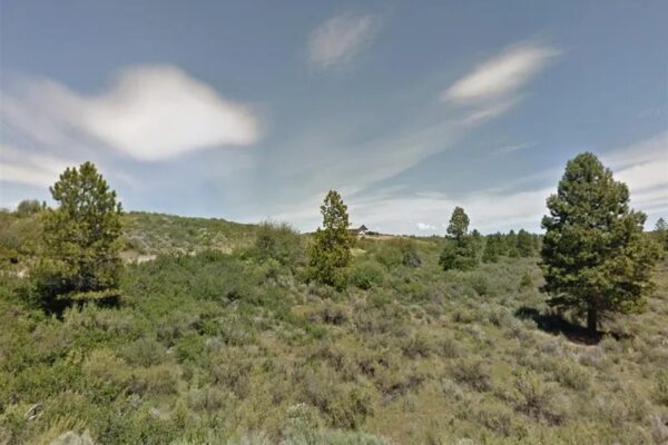
Picture yourself admiring these vast vistas from your porch! This beautiful 37.5 acres is perfect for your vacation home. There is a house nearby! Also, perc test has been approved!
Want to start a ranch? This is a great spot to do it! This property is in an HOA, but cattle and livestock are allowed (though swine are not).
Read on to find out more!
Property APN: 301-05-076
Property Acreage: 37.5
Yearly Taxes: $487.88 (Current)
Zoning: RCU-2A
Mobile Homes: Allowed, with primary residence established, for travel trailer.
RV / Camping: You can camp on the property 10 days at a time, one month between camping trips, three times a year. Can apply for temporary dwelling permit to live in RV while SFR is being built.
Electricity: No power lines nearby. Area should be served by Arizona Public Service.
Sewer: Would be by septic. Approved perf. No composting.
Water: Would be by well.
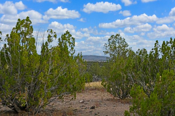
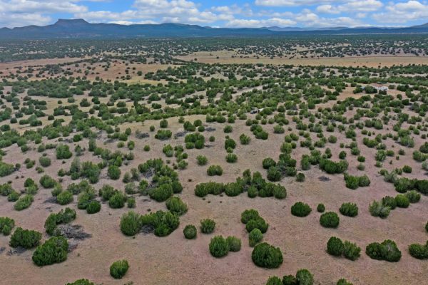
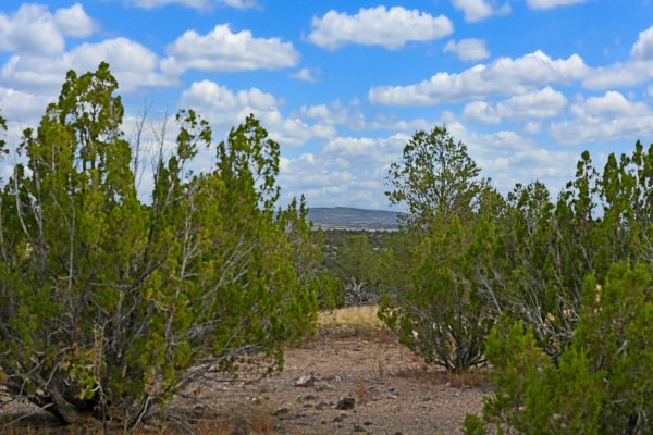
Terrain: Property is rolling.
Access: Nearest access to the property would be by an unnamed dirt road on the West. Lot borders state owned land to the East
HOA: The property is part of Sierra Verde Ranch POA. The annual assessment on this lot is $125.40, however the properties within the POA do vary. The annual assessment is based on lot size (3.30 per acre). Only building restriction is a 50 foot set back requirement.
HOA Restrictions:
*No commercial businesses, medical facilities, churches or sanitary facilities.
*Livestock and horses are allowed, but swine is not.
*Under repair or Inoperable vehicles must be hidden from view.
*Please send us a message for full covenants.
HOA Information: http://www.sierraverderanchpoa.net/default.php
Managed By Hart’s HOA Management Co LLC
Contact is: Caroline Hart
928-607-5023
Flood Zone: The area has not been studied for flood hazards
Legal Description: Lot 756, of Sierra Verde Ranch Unit XV, according to the plat of record in the office of the County Recorder of Yavapai County, Arizona, recoded in Book 48 of Land Surveys, Page 30-35.
GPS Coordinates:
Center: 35.113218, -113.132629
NW:35.115192, -113.135523
NE:35.113236, -113.128711
SW:35.113036, -113.136035
SE:35.111255, -113.128675
Property Location
Discounted Cash Pricing
Cash Price: $32,500
Doc & Reservation Fee: $0
Total: $32,500
Deposit Amount: $4,350
Terms Pricing
Terms Price: $43,500
Down Payment: $2,450
Interest Rate: 2.5%
Monthly Payment: $509
Montly Loan Fee : $20
Total Term months : 84
Property Location
Property Details
Size (Acres)
5.54
Best Attribute
Wide Open Space
APN or Other ID
70235760
Legal Description
LOT 1704, BLOCK 113, SANGRE DE CRISTO RANCHES, UNIT J, COSTILLA COUNTY, COLORADO
Approximate GPS Coordinates
37.364998, -105.342107
Property Size
Rural Land
Zoning
Estate – Residential
General Elevation (in feet)
8554
Power
Would be alternative power source.
HOA/POA
SDCR – Membership is optional for $25/year
Water
Well Can Be Drilled
Sewer
Septic can be installed
Roads
Dirt Road
Terrain
Property on rolling hills
Title Info
Clear Title
Annual Property Taxes (Approx)
$115.64
While we do our own due diligence before we buy any property, buyers are expected to do their own due diligence prior to purchasing. Please visit our Resources tab to find government website links and phone numbers to assist in your research.
Related Properties
Contact Seller
Picture yourself admiring these vast vistas from your porch! This beautiful 37.5 acres is perfect for your vacation home. There is a house nearby! Also, perc test has been approved!
Want to start a ranch? This is a great spot to do it! This property is in an HOA, but cattle and livestock are allowed (though swine are not).
Read on to find out more!
Property APN: 301-05-076
Property Acreage: 37.5
Yearly Taxes: $487.88 (Current)
Zoning: RCU-2A
Mobile Homes: Allowed, with primary residence established, for travel trailer.
RV / Camping: You can camp on the property 10 days at a time, one month between camping trips, three times a year. Can apply for temporary dwelling permit to live in RV while SFR is being built.
Electricity: No power lines nearby. Area should be served by Arizona Public Service.
Sewer: Would be by septic. Approved perf. No composting.
Water: Would be by well.
Terrain: Property is rolling.
Access: Nearest access to the property would be by an unnamed dirt road on the West. Lot borders state owned land to the East
HOA: The property is part of Sierra Verde Ranch POA. The annual assessment on this lot is $125.40, however the properties within the POA do vary. The annual assessment is based on lot size (3.30 per acre). Only building restriction is a 50 foot set back requirement.
HOA Restrictions:
*No commercial businesses, medical facilities, churches or sanitary facilities.
*Livestock and horses are allowed, but swine is not.
*Under repair or Inoperable vehicles must be hidden from view.
*Please send us a message for full covenants.
HOA Information: http://www.sierraverderanchpoa.net/default.php
Managed By Hart’s HOA Management Co LLC
Contact is: Caroline Hart
928-607-5023
Flood Zone: The area has not been studied for flood hazards
Legal Description: Lot 756, of Sierra Verde Ranch Unit XV, according to the plat of record in the office of the County Recorder of Yavapai County, Arizona, recoded in Book 48 of Land Surveys, Page 30-35.
GPS Coordinates:
Center: 35.113218, -113.132629
NW:35.115192, -113.135523
NE:35.113236, -113.128711
SW:35.113036, -113.136035
SE:35.111255, -113.128675
Property Location
Property APN: 301-05-076
Property Acreage: 37.5
Yearly Taxes: $487.88 (Current)
Zoning: RCU-2A
Mobile Homes: Allowed, with primary residence established, for travel trailer.
RV / Camping: You can camp on the property 10 days at a time, one month between camping trips, three times a year. Can apply for temporary dwelling permit to live in RV while SFR is being built.
Electricity: No power lines nearby. Area should be served by Arizona Public Service.
Sewer: Would be by septic. Approved perf. No composting.
Water: Would be by well.
Terrain: Property is rolling.
Access: Nearest access to the property would be by an unnamed dirt road on the West. Lot borders state owned land to the East
HOA: The property is part of Sierra Verde Ranch POA. The annual assessment on this lot is $125.40, however the properties within the POA do vary. The annual assessment is based on lot size (3.30 per acre). Only building restriction is a 50 foot set back requirement.
HOA Restrictions:
*No commercial businesses, medical facilities, churches or sanitary facilities.
*Livestock and horses are allowed, but swine is not.
*Under repair or Inoperable vehicles must be hidden from view.
*Please send us a message for full covenants.
HOA Information: http://www.sierraverderanchpoa.net/default.php
Managed By Hart’s HOA Management Co LLC
Contact is: Caroline Hart
928-607-5023
Flood Zone: The area has not been studied for flood hazards
Legal Description: Lot 756, of Sierra Verde Ranch Unit XV, according to the plat of record in the office of the County Recorder of Yavapai County, Arizona, recoded in Book 48 of Land Surveys, Page 30-35.
GPS Coordinates:
Center: 35.113218, -113.132629
NW:35.115192, -113.135523
NE:35.113236, -113.128711
SW:35.113036, -113.136035
SE:35.111255, -113.128675
Property Location
Discounted Cash Pricing
Cash Price: $32,500
Doc & Reservation Fee: $0
Total: $32,500
Deposit Amount: $4,350
Terms Pricing
Terms Price: $43,500
Down Payment: $2,450
Interest Rate: 2.5%
Monthly Payment: $509
Montly Loan Fee : $20
Total Term months : 84

