Contact Seller
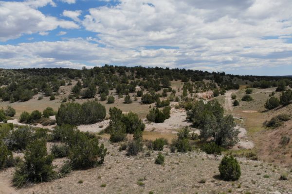
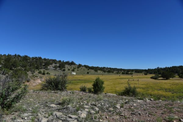
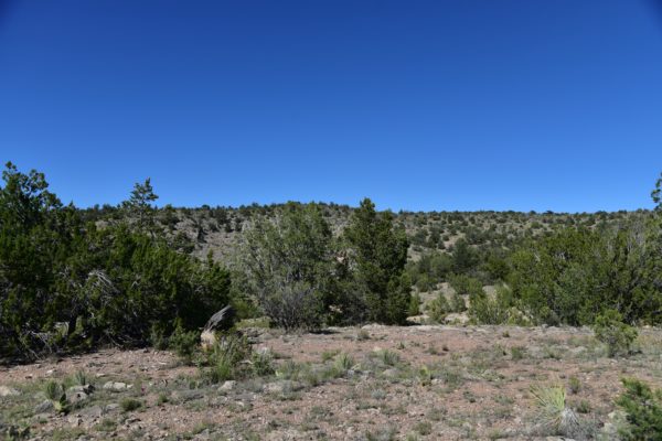
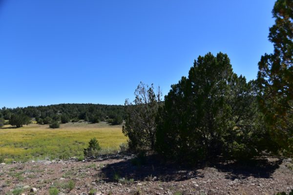
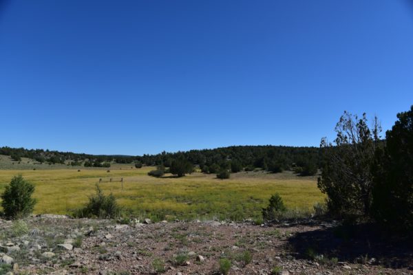
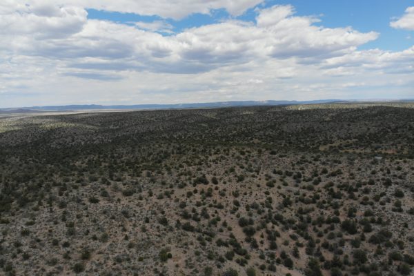
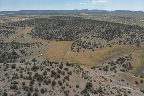
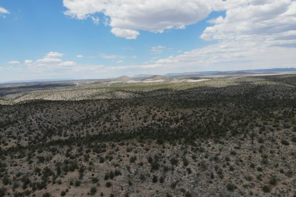
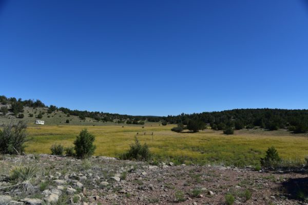
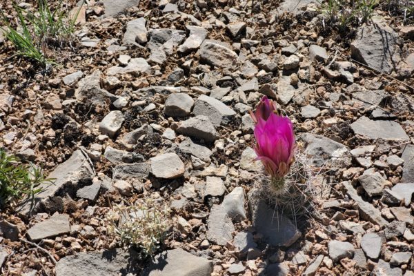
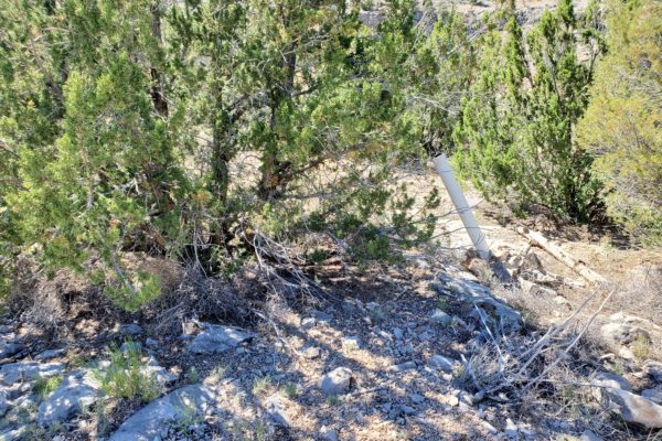
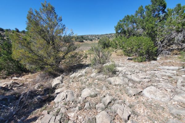
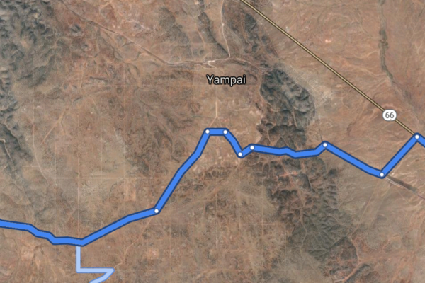
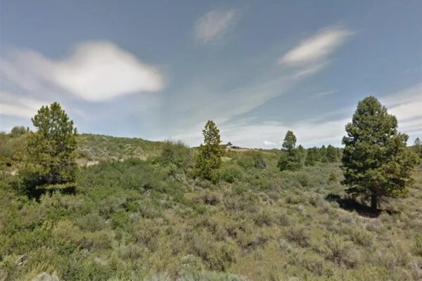
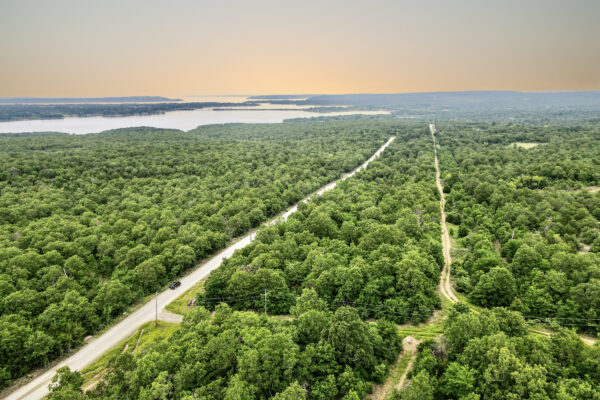
Get ready for your ultimate getaway or second home property! What could be better than a 10 acre lot that borders state land, is accessible by dirt road, but with proximity to historic Route 66 with rolling hills and trees? As you can see from the photos, you can definitely get a camper up here!
This property is just south of route 19 that runs from Kingman to Flagstaff. It is off the beaten path, but still accessible. State land shares a border with this parcel to the west.
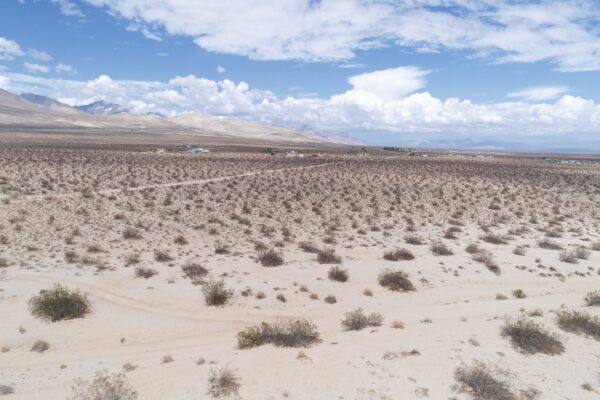
These photos and video were taken May 28, 2020.
- Prop ID: 301-30-052F
- Size: 10 Acres
- Zoning: RCU-2A
- Address: Near Peach Springs, AZ 86434
- Annual Taxes: $140.18 (Current)
- Mobile Homes: Allowed, with primary residence established, for travel trailer.
- RV: You can camp on the property 10 days at a time, one month between camping trips, three times a year. Can apply for temporary dwelling permit to live in RV while SFR is being built.
- Septic: Would need to be installed
- Water: Would need to be hauled or well drilled.
Electricity: Off grid. No power lines nearby. Terrain: Property is rolling. Road Access: Nearest access to the property would be by an unnamed dirt road on the West. There is an easement between the lot west of this property and this property. Also, lot borders state owned land to the North.Flood Zone: The parcel are located in FEMA Zone D, which means that the area has not been study for flood hazards. HOA: None Abbreviated Legal Description: A rectangular portion being the NE4NW4NW4 of said section AKA NE4 of Parcel 645 of Green View Ranches Contains 10.00 acres. Complete Legal Desc: The Northeast Quarter of the Northwest Quarter of the Northwest Quarter of Sec 11 T24N R10W of the Gila and Salt River Base and Meridian, Yavapai County Arizona aka Northeast Quarter of Parcel 645 Green View Ranches. GPS Coordinates: Center: 35.486771, -113.307559 NW: 35.487694, -113.308634 NE: 35.487686, -113.306448 SW: 35.485869, -113.308653 SE: 35.485861, -113.306431
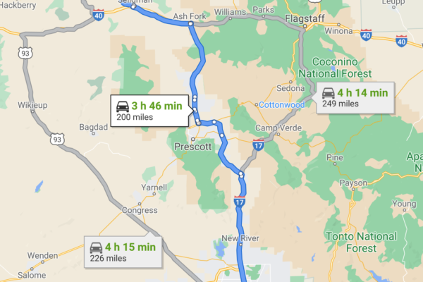
Property Location
Get ready for your ultimate getaway or second home property! What could be better than a 10 acre lot that borders state land, is accessible by dirt road, but with proximity to historic Route 66 with rolling hills and trees? As you can see from the photos, you can definitely get a camper up here!
This property is just south of route 19 that runs from Kingman to Flagstaff. It is off the beaten path, but still accessible. State land shares a border with this parcel to the west.
These photos and video were taken May 28, 2020.
- Prop ID: 301-30-052F
- Size: 10 Acres
- Zoning: RCU-2A
- Address: Near Peach Springs, AZ 86434
- Annual Taxes: $140.18 (Current)
- Mobile Homes: Allowed, with primary residence established, for travel trailer.
- RV: You can camp on the property 10 days at a time, one month between camping trips, three times a year. Can apply for temporary dwelling permit to live in RV while SFR is being built.
- Septic: Would need to be installed
- Water: Would need to be hauled or well drilled.
Electricity: Off grid. No power lines nearby. Terrain: Property is rolling. Road Access: Nearest access to the property would be by an unnamed dirt road on the West. There is an easement between the lot west of this property and this property. Also, lot borders state owned land to the North.Flood Zone: The parcel are located in FEMA Zone D, which means that the area has not been study for flood hazards. HOA: None Abbreviated Legal Description: A rectangular portion being the NE4NW4NW4 of said section AKA NE4 of Parcel 645 of Green View Ranches Contains 10.00 acres. Complete Legal Desc: The Northeast Quarter of the Northwest Quarter of the Northwest Quarter of Sec 11 T24N R10W of the Gila and Salt River Base and Meridian, Yavapai County Arizona aka Northwest Quarter of Parcel 645 Green View Ranches. GPS Coordinates: Center: 35.486719, -113.309678
NW: 35.487696, -113.310912
NE: 35.487696, -113.308638
SW: 35.485883, -113.310913
SE: 35.485882, -113.308648
Property Location
Discounted Cash Pricing
Cash Price: $13,499
Doc & Reservation Fee: $199
Total: $13,698
Deposit Amount: $4,000
Terms Pricing
Terms Price: $15,200
Down Payment: $3,000
Interest Rate: 12%
Monthly Payment: $239
Montly Loan Fee : $20
Total Term months : 72
Property Location
Property Details
Size (Acres)
5.54
Best Attribute
Wide Open Space
APN or Other ID
70235760
Legal Description
LOT 1704, BLOCK 113, SANGRE DE CRISTO RANCHES, UNIT J, COSTILLA COUNTY, COLORADO
Approximate GPS Coordinates
37.364998, -105.342107
Property Size
Rural Land
Zoning
Estate – Residential
General Elevation (in feet)
8554
Power
Would be alternative power source.
HOA/POA
SDCR – Membership is optional for $25/year
Water
Well Can Be Drilled
Sewer
Septic can be installed
Roads
Dirt Road
Terrain
Property on rolling hills
Title Info
Clear Title
Annual Property Taxes (Approx)
$115.64
ALL THE INFORMATION WE HAVE ON THIS PROPERTY IS DISCLOSED WITHIN THE CONTENT OF THIS LISTING PAGE. IN MOST CASES WE HAVE NOT SEEN THE PROPERTY. ANY AND ALL OTHER QUESTIONS REGARDING THIS PROPERTY SHOULD BE DIRECTED TOWARD THE CITY OR COUNTY OF WHICH THE PROPERTY IS LOCATED IN. YOUR DUE DILIGENCE SHOULD BE PERFORMED PRIOR TO BUYING, TO ENSURE THE PROPERTY MEETS YOUR NEEDS AND CRITERIA.
Thank you for considering Liberty Land Sales
Related Properties
Contact Seller
Get ready for your ultimate getaway or second home property! What could be better than a 10 acre lot that borders state land, is accessible by dirt road, but with proximity to historic Route 66 with rolling hills and trees? As you can see from the photos, you can definitely get a camper up here!
This property is just south of route 19 that runs from Kingman to Flagstaff. It is off the beaten path, but still accessible. State land shares a border with this parcel to the west.
These photos and video were taken May 28, 2020.
- Prop ID: 301-30-052F
- Size: 10 Acres
- Zoning: RCU-2A
- Address: Near Peach Springs, AZ 86434
- Annual Taxes: $140.18 (Current)
- Mobile Homes: Allowed, with primary residence established, for travel trailer.
- RV: You can camp on the property 10 days at a time, one month between camping trips, three times a year. Can apply for temporary dwelling permit to live in RV while SFR is being built.
- Septic: Would need to be installed
- Water: Would need to be hauled or well drilled.
Electricity: Off grid. No power lines nearby. Terrain: Property is rolling. Road Access: Nearest access to the property would be by an unnamed dirt road on the West. There is an easement between the lot west of this property and this property. Also, lot borders state owned land to the North.Flood Zone: The parcel are located in FEMA Zone D, which means that the area has not been study for flood hazards. HOA: None Abbreviated Legal Description: A rectangular portion being the NE4NW4NW4 of said section AKA NE4 of Parcel 645 of Green View Ranches Contains 10.00 acres. Complete Legal Desc: The Northeast Quarter of the Northwest Quarter of the Northwest Quarter of Sec 11 T24N R10W of the Gila and Salt River Base and Meridian, Yavapai County Arizona aka Northeast Quarter of Parcel 645 Green View Ranches. GPS Coordinates: Center: 35.486771, -113.307559 NW: 35.487694, -113.308634 NE: 35.487686, -113.306448 SW: 35.485869, -113.308653 SE: 35.485861, -113.306431
Property Location
Get ready for your ultimate getaway or second home property! What could be better than a 10 acre lot that borders state land, is accessible by dirt road, but with proximity to historic Route 66 with rolling hills and trees? As you can see from the photos, you can definitely get a camper up here!
This property is just south of route 19 that runs from Kingman to Flagstaff. It is off the beaten path, but still accessible. State land shares a border with this parcel to the west.
These photos and video were taken May 28, 2020.
- Prop ID: 301-30-052F
- Size: 10 Acres
- Zoning: RCU-2A
- Address: Near Peach Springs, AZ 86434
- Annual Taxes: $140.18 (Current)
- Mobile Homes: Allowed, with primary residence established, for travel trailer.
- RV: You can camp on the property 10 days at a time, one month between camping trips, three times a year. Can apply for temporary dwelling permit to live in RV while SFR is being built.
- Septic: Would need to be installed
- Water: Would need to be hauled or well drilled.
Electricity: Off grid. No power lines nearby. Terrain: Property is rolling. Road Access: Nearest access to the property would be by an unnamed dirt road on the West. There is an easement between the lot west of this property and this property. Also, lot borders state owned land to the North.Flood Zone: The parcel are located in FEMA Zone D, which means that the area has not been study for flood hazards. HOA: None Abbreviated Legal Description: A rectangular portion being the NE4NW4NW4 of said section AKA NE4 of Parcel 645 of Green View Ranches Contains 10.00 acres. Complete Legal Desc: The Northeast Quarter of the Northwest Quarter of the Northwest Quarter of Sec 11 T24N R10W of the Gila and Salt River Base and Meridian, Yavapai County Arizona aka Northwest Quarter of Parcel 645 Green View Ranches. GPS Coordinates: Center: 35.486719, -113.309678
NW: 35.487696, -113.310912
NE: 35.487696, -113.308638
SW: 35.485883, -113.310913
SE: 35.485882, -113.308648
Property Location
Discounted Cash Pricing
Cash Price: $13,499
Doc & Reservation Fee: $199
Total: $13,698
Deposit Amount: $4,000
Terms Pricing
Terms Price: $15,200
Down Payment: $3,000
Interest Rate: 12%
Monthly Payment: $239
Montly Loan Fee : $20
Total Term months : 72

