Contact Seller
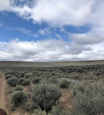
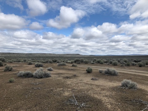
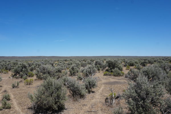
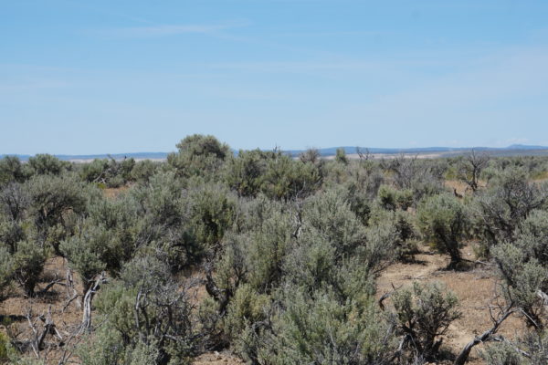
10 acres adjacent to BLM land and wide-open spaces.
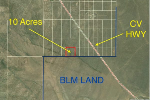
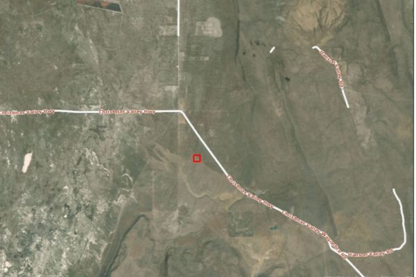
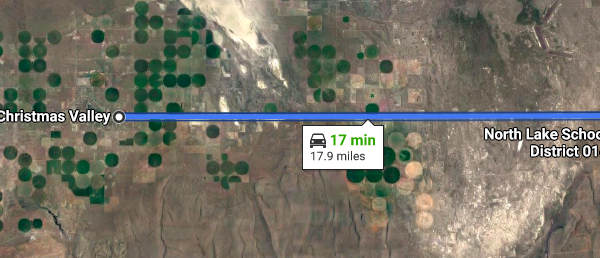
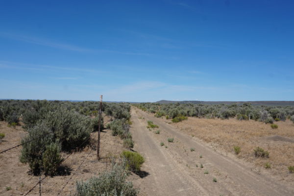
This parcel is near Christmas Valley Highway with access to BLM land adjacent to the property. Lake County provides access to endless hunting, fishing, and OHV opportunities. Build your home with a Conditional Use Permit (CUP), and have all that Oregon’s High Desert has to offer right at your fingertips. This property is only 17 minutes away from CV!
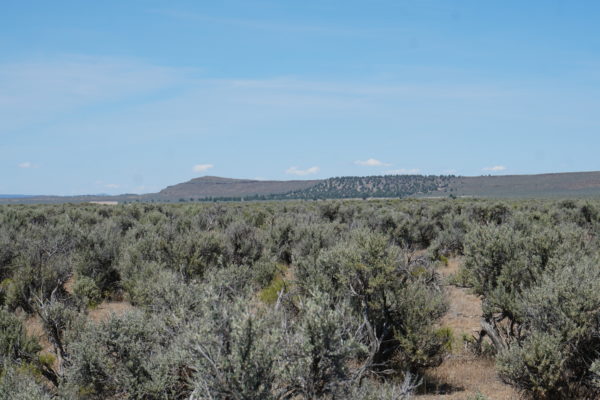
Escape large city life and enjoy wide-open spaces with fresh air, vast panoramic vistas and beautiful sunrises and sunsets.
Picture yourself living and playing on 10 acres in Lake County.
Become a land owner for an affordable monthly payment (or significant cash discount!) and enjoy your country living dreams. With dirt road access to the property, this lot is close to both the outdoor destination Christmas Valley Sand Dunes and the town of Christmas Valley. Christmas Valley offers the amenities of gas, groceries, restaurants, golf and more.
Start your day with vast vistas and sunrises. Spend your day building your off-grid dream or enjoying the outdoors adventure offered by Lake County, Oregon. Camp, hunt, or off-road on or near your own piece of land. Visit local natural wonders like Table Rock or Crack in the Ground, or spend the day riding waves of sand at Christmas Valley Sand Dunes.
Acreage Size: 10 acres
Yearly Taxes: $54.08
Zone Type: The property is zoned A-2 Agriculture Use. A Type II CUP would be required for the property to become buildable, and it would likely be approved.
Mobile Homes: Mobile homes are not allowed without land use.
RV: Camping and RV’s are allowed for short periods of time, but not more than 7 out of 30 days for a guest of the owners. You cannot live on the property in an RV, and camping is only supposed to be for short periods like a weekend here or there.
Minimum Homes Size: 120 sq ft
Sewer: Septic can be installed.
Water: Can drill a well.
Electricity: Would be by alternative source, such as solar or generator.
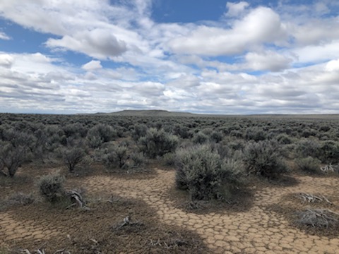
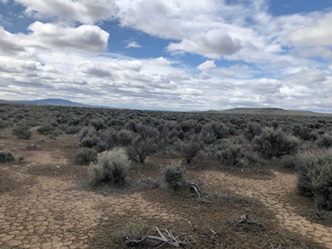
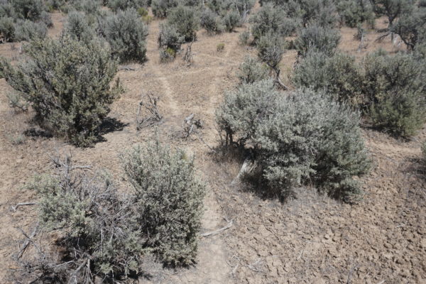
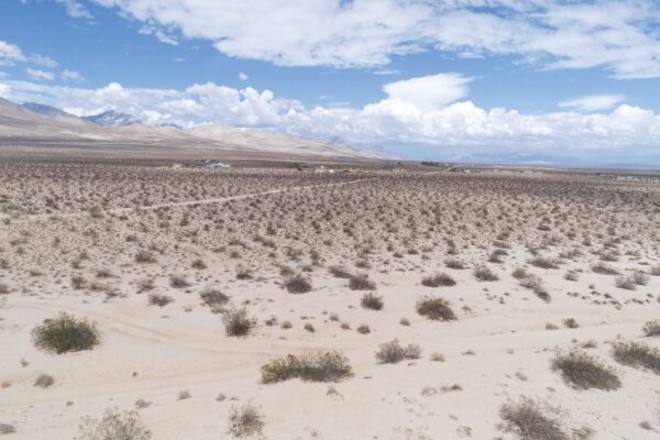
Terrain: Property is almost flat. Property borders BLM land on the Southern portion.
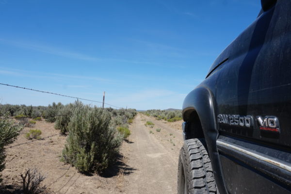
Road Access: Access is from the dirt road on the Southern portion of the property that leads to Christmas Valley HWY.
Flood Zone: No
HOA: No
Legal Description: The East half of the Southwest quarter of the Southeast quarter of the Southwest quarter and the West half of the Southeast quarter of the Southeast quarter of the Southwest quarter of Section 16, Township 27 South, Range 20 East of the Willamette Meridian.
GPS Coordinates:
Center:43.223968, -120.328444
NW:43.224929, -120.329689
NE:43.224935, -120.327201
SW:43.223087, -120.329703
SE:43.223096, -120.327208
Property Location
Property Location
Discounted Cash Pricing
Cash Price: $6,999
Doc & Reservation Fee: $99
Total: $7,098
Deposit Amount: $799
Terms Pricing
Terms Price: $9,099
Down Payment: $1,999
Interest Rate: 12%
Monthly Payment: $187
Montly Loan Fee : $20
Total Term months : 48
Property Location
Property Details
Size (Acres)
5.54
Best Attribute
Wide Open Space
APN or Other ID
70235760
Legal Description
LOT 1704, BLOCK 113, SANGRE DE CRISTO RANCHES, UNIT J, COSTILLA COUNTY, COLORADO
Approximate GPS Coordinates
37.364998, -105.342107
Property Size
Rural Land
Zoning
Estate – Residential
General Elevation (in feet)
8554
Power
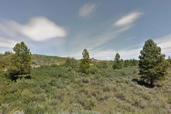
Would be alternative power source.
HOA/POA
SDCR – Membership is optional for $25/year
Water
Well Can Be Drilled
Sewer
Septic can be installed
Roads
Dirt Road
Terrain
Property on rolling hills
Title Info
Clear Title
Annual Property Taxes (Approx)
$115.64
ALL THE INFORMATION WE HAVE ON THIS PROPERTY IS DISCLOSED WITHIN THE CONTENT OF THIS LISTING PAGE. IN MOST CASES WE HAVE NOT SEEN THE PROPERTY. ANY AND ALL OTHER QUESTIONS REGARDING THIS PROPERTY SHOULD BE DIRECTED TOWARD THE CITY OR COUNTY OF WHICH THE PROPERTY IS LOCATED IN. YOUR DUE DILIGENCE SHOULD BE PERFORMED PRIOR TO BUYING, TO ENSURE THE PROPERTY MEETS YOUR NEEDS AND CRITERIA.
Thank you for considering Liberty Land Sales
Related Properties
Contact Seller
10 acres adjacent to BLM land and wide-open spaces.
This parcel is near Christmas Valley Highway with access to BLM land adjacent to the property. Lake County provides access to endless hunting, fishing, and OHV opportunities. Build your home with a Conditional Use Permit (CUP), and have all that Oregon’s High Desert has to offer right at your fingertips. This property is only 17 minutes away from CV!
Escape large city life and enjoy wide-open spaces with fresh air, vast panoramic vistas and beautiful sunrises and sunsets.
Picture yourself living and playing on 10 acres in Lake County.
Become a land owner for an affordable monthly payment (or significant cash discount!) and enjoy your country living dreams. With dirt road access to the property, this lot is close to both the outdoor destination Christmas Valley Sand Dunes and the town of Christmas Valley. Christmas Valley offers the amenities of gas, groceries, restaurants, golf and more.
Start your day with vast vistas and sunrises. Spend your day building your off-grid dream or enjoying the outdoors adventure offered by Lake County, Oregon. Camp, hunt, or off-road on or near your own piece of land. Visit local natural wonders like Table Rock or Crack in the Ground, or spend the day riding waves of sand at Christmas Valley Sand Dunes.
Acreage Size: 10 acres
Yearly Taxes: $54.08
Zone Type: The property is zoned A-2 Agriculture Use. A Type II CUP would be required for the property to become buildable, and it would likely be approved.
Mobile Homes: Mobile homes are not allowed without land use.
RV: Camping and RV’s are allowed for short periods of time, but not more than 7 out of 30 days for a guest of the owners. You cannot live on the property in an RV, and camping is only supposed to be for short periods like a weekend here or there.
Minimum Homes Size: 120 sq ft
Sewer: Septic can be installed.
Water: Can drill a well.
Electricity: Would be by alternative source, such as solar or generator.
Terrain: Property is almost flat. Property borders BLM land on the Southern portion.
Road Access: Access is from the dirt road on the Southern portion of the property that leads to Christmas Valley HWY.
Flood Zone: No
HOA: No
Legal Description: The East half of the Southwest quarter of the Southeast quarter of the Southwest quarter and the West half of the Southeast quarter of the Southeast quarter of the Southwest quarter of Section 16, Township 27 South, Range 20 East of the Willamette Meridian.
GPS Coordinates:
Center:43.223968, -120.328444
NW:43.224929, -120.329689
NE:43.224935, -120.327201
SW:43.223087, -120.329703
SE:43.223096, -120.327208
Property Location
Property Location
Discounted Cash Pricing
Cash Price: $6,999
Doc & Reservation Fee: $99
Total: $7,098
Deposit Amount: $799
Terms Pricing
Terms Price: $9,099
Down Payment: $1,999
Interest Rate: 12%
Monthly Payment: $187
Montly Loan Fee : $20
Total Term months : 48

