Contact Seller
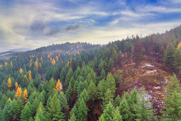
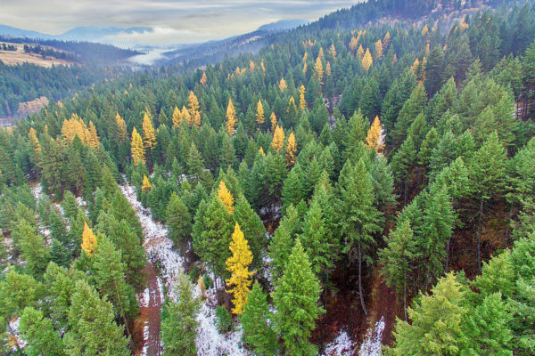
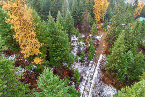
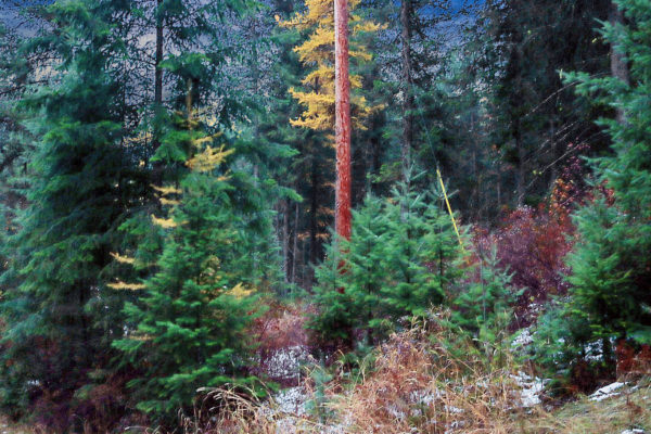
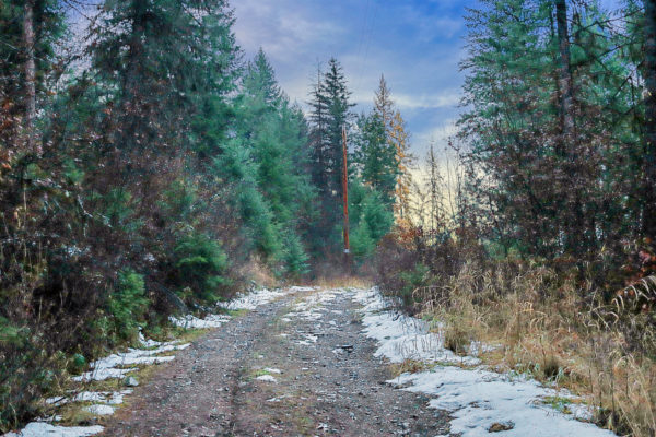
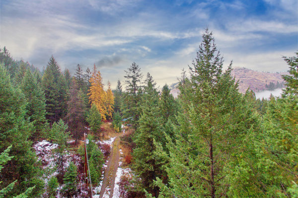
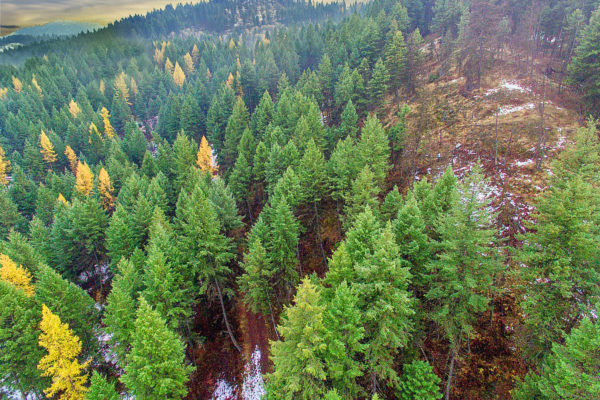
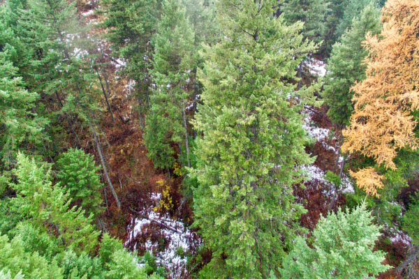
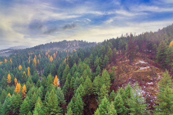
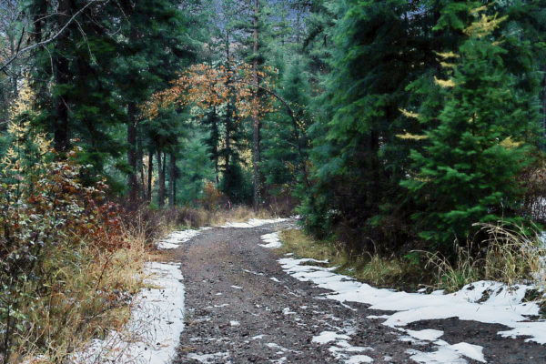
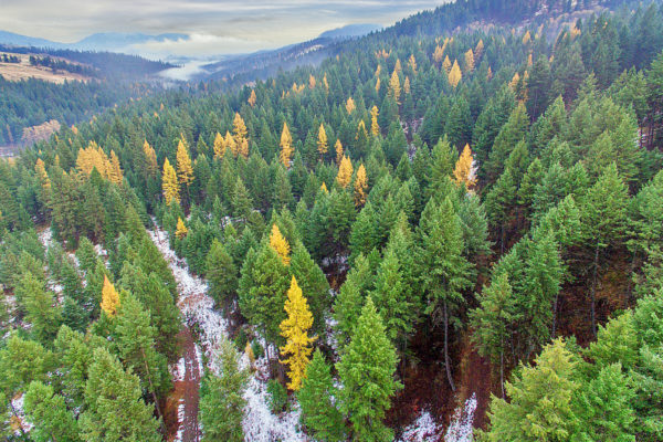
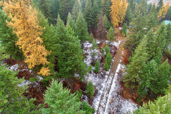
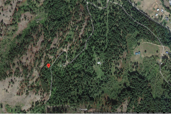
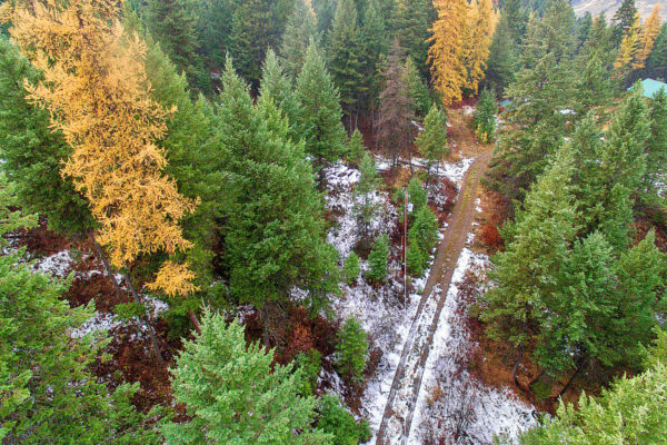
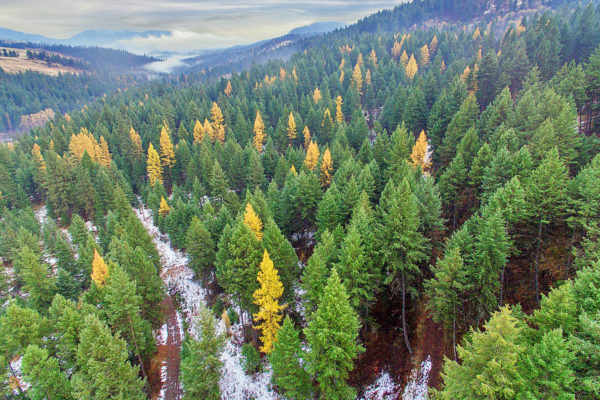
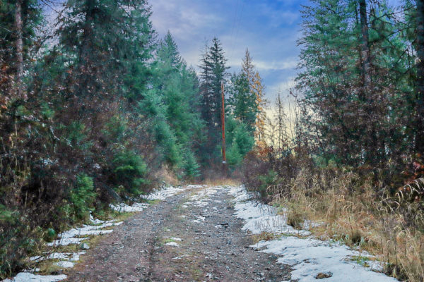
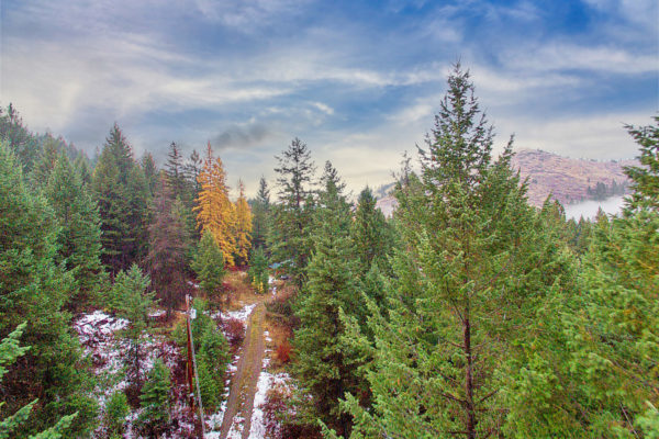
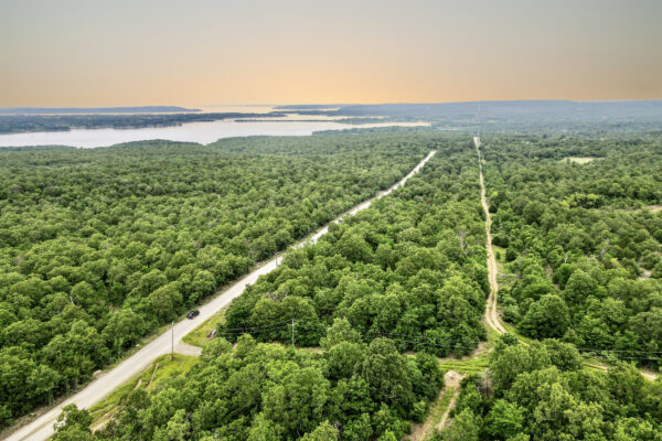
Don’t miss this incredible 10 acre lot in Republic WA! Come camp or build among the trees. The many features of this lot include
- Buildable areas on property
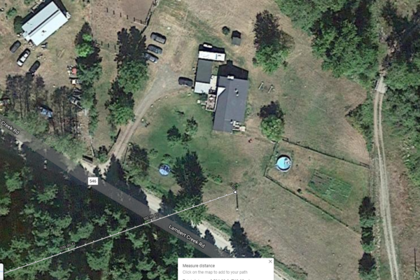
- Several homes nearby
- Beautiful trees
- No zoning
- RVs allowed
- Mobile homes allowed
- Camping allowed
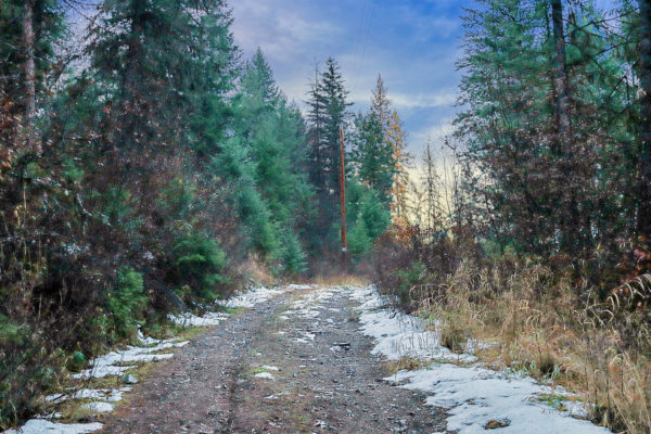
- Power poles are at the lot.
- No HOA!
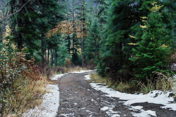
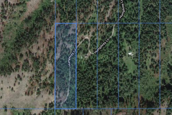
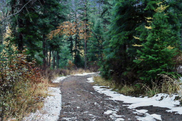
Good gravel road access and property spans across the road with flat parts on the eastern side.
No liens, taxes paid.
| Prop ID |
33835500051000 |
| Size of Lot (or LOT AREA) |
435,600 |
| Acreage Size |
10 |
| Tax Assessment Year |
2019 |
| Yearly Taxes |
$173.40 |
| Tax Status |
Paid |
| Zone Type |
No Zoning in Ferry County, No Restrictions. Planning Department 509-775-5225
|
| Mobile Homes |
Allowed! $100.00 permitting per unit. https://www.ferry-county.com/Planning/Building%20Department/04-2020%20Mobile%20Home%20Permit%20Packet.pdf |
| Camping |
Allowed!
|
| RV |
Allowed! Must be hooked up to septic or take to another location and dispose properly. |
| Sewer -SEPTIC |
Must do soil analysis and complete application to start process https://www.netchd.org/environmental-health/onsite-sewage-treatment-disposal/ |
| Water – WELL |
Water would be by well. No special restrictions. Standard processes. https://www.foglepump.com/domestic-drilling |
| Electricity |
Power Poles at property. Served by PUD 509-775-3325 |
| Terrain |
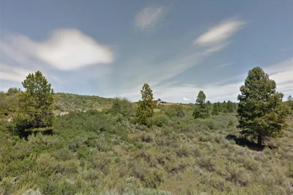
Rolling hills/slopes in surrounding area |
| Road Access |
Humphrey Lane, gravel road |
| Flood Zone |
No |
| HOA / POA |
No HOA / POA |
| Complete Legal Desc: |
Lot 51 Division 1 Curlew Rim Ranches, as per plat Volume 2, Page 3 records of Ferry County, W 1/2 of the W 1/2 of the SE 1/4 of the NW 1/2 of Section 35, T38N, R33E, W.M. Situated in the County of Ferry, State of Washington. SUBJECT TO any existing easements and rights-of-way of record |
| GPS Coordinates: | |
| Center: | 48.7500, -118.6092 |
| NW: | 48.7516, -118.6099 |
| NE: | 48.7516, -118.6085 |
| SW: | 48.7480, -118.6099 |
| SE: | 48.7480, -118.6085 |
Property Location
| Prop ID | 33835500051000′ |
| Size of Lot (or LOT AREA) | 435,600 |
| Acreage Size | 10 |
| Tax Assessment Year | 2019 |
| Yearly Taxes | $173.40 |
| Tax Status | Paid |
| Zone Type | No Zoning in Ferry County, No Restrictions. Planning Department 509-775-5225 |
| Mobile Homes | Allowed!. $100.00 permitting per unit. https://www.ferry-county.com/Planning/Building%20Department/04-2020%20Mobile%20Home%20Permit%20Packet.pdf |
| Camping | Allowed! |
| RV | Allowed! Must be hooked up to septic or take to another location and dispose properly. |
| Sewer -SEPTIC | Must do soil analysis and complete application to start process https://www.netchd.org/environmental-health/onsite-sewage-treatment-disposal/ |
| Water – WELL | Water would be by well. No special restrictions. Standard processes. https://www.foglepump.com/domestic-drilling |
| Electricity | Power Poles at proprety. Served by PUD 509-775-3325 |
| Terrain | Rolling hills/slopes in surrounding area |
| Road Access | Humphrey Lane, gravel road |
| Flood Zone | No |
| HOA / POA | No HOA / POA |
| Complete Legal Desc: | Lot 51 Division 1 Curlew Rim Ranches, as per plat Volume 2, Page 3 records of Ferry County, W 1/2 of the W 1/2 of the SE 1/4 of the NW 1/2 of Section 35, T38N, R33E, W.M. Situated in the County of Ferry, State of Washingto. SUBJECT TO any existing easements and rights-of-way of record |
| GPS Coordinates: | |
| Center: | 48.7500, -118.6092 |
| NW: | 48.7516, -118.6099 |
| NE: | 48.7516, -118.6085 |
| SW: | 48.7480, -118.6099 |
| SE: | 48.7480, -118.6085 |
Property Location
Discounted Cash Pricing
Cash Price: $23,999
Doc & Reservation Fee: $199
Total: $24,198
Deposit Amount: $999
Terms Pricing
Terms Price: $29,998
Down Payment: $6,801
Interest Rate: 10%
Monthly Payment: $493
Montly Loan Fee : $20
Total Term months : 60
Property Location
Property Details
Size (Acres)
5.54
Best Attribute
Wide Open Space
APN or Other ID
70235760
Legal Description
LOT 1704, BLOCK 113, SANGRE DE CRISTO RANCHES, UNIT J, COSTILLA COUNTY, COLORADO
Approximate GPS Coordinates
37.364998, -105.342107
Property Size
Rural Land
Zoning
Estate – Residential
General Elevation (in feet)
8554
Power
Would be alternative power source.
HOA/POA
SDCR – Membership is optional for $25/year
Water
Well Can Be Drilled
Sewer
Septic can be installed
Roads
Dirt Road
Terrain
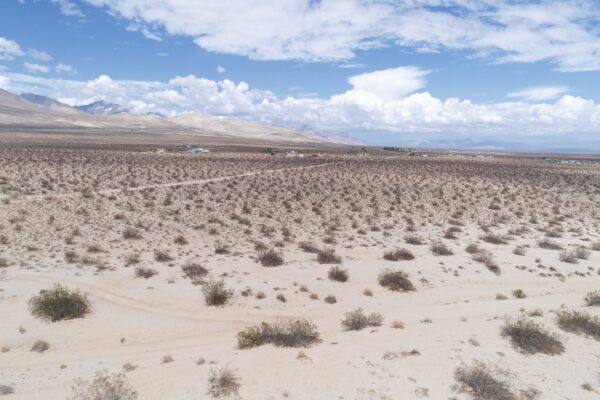
Property on rolling hills
Title Info
Clear Title
Annual Property Taxes (Approx)
$115.64
Related Properties
Contact Seller
Don’t miss this incredible 10 acre lot in Republic WA! Come camp or build among the trees. The many features of this lot include
- Buildable areas on property
- Several homes nearby
- Beautiful trees
- No zoning
- RVs allowed
- Mobile homes allowed
- Camping allowed
- Power poles are at the lot.
- No HOA!
Good gravel road access and property spans across the road with flat parts on the eastern side.
No liens, taxes paid.
| Prop ID |
33835500051000 |
| Size of Lot (or LOT AREA) |
435,600 |
| Acreage Size |
10 |
| Tax Assessment Year |
2019 |
| Yearly Taxes |
$173.40 |
| Tax Status |
Paid |
| Zone Type |
No Zoning in Ferry County, No Restrictions. Planning Department 509-775-5225
|
| Mobile Homes |
Allowed! $100.00 permitting per unit. https://www.ferry-county.com/Planning/Building%20Department/04-2020%20Mobile%20Home%20Permit%20Packet.pdf |
| Camping |
Allowed!
|
| RV |
Allowed! Must be hooked up to septic or take to another location and dispose properly. |
| Sewer -SEPTIC |
Must do soil analysis and complete application to start process https://www.netchd.org/environmental-health/onsite-sewage-treatment-disposal/ |
| Water – WELL |
Water would be by well. No special restrictions. Standard processes. https://www.foglepump.com/domestic-drilling |
| Electricity |
Power Poles at property. Served by PUD 509-775-3325 |
| Terrain |
Rolling hills/slopes in surrounding area |
| Road Access |
Humphrey Lane, gravel road |
| Flood Zone |
No |
| HOA / POA |
No HOA / POA |
| Complete Legal Desc: |
Lot 51 Division 1 Curlew Rim Ranches, as per plat Volume 2, Page 3 records of Ferry County, W 1/2 of the W 1/2 of the SE 1/4 of the NW 1/2 of Section 35, T38N, R33E, W.M. Situated in the County of Ferry, State of Washington. SUBJECT TO any existing easements and rights-of-way of record |
| GPS Coordinates: | |
| Center: | 48.7500, -118.6092 |
| NW: | 48.7516, -118.6099 |
| NE: | 48.7516, -118.6085 |
| SW: | 48.7480, -118.6099 |
| SE: | 48.7480, -118.6085 |
Property Location
| Prop ID | 33835500051000′ |
| Size of Lot (or LOT AREA) | 435,600 |
| Acreage Size | 10 |
| Tax Assessment Year | 2019 |
| Yearly Taxes | $173.40 |
| Tax Status | Paid |
| Zone Type | No Zoning in Ferry County, No Restrictions. Planning Department 509-775-5225 |
| Mobile Homes | Allowed!. $100.00 permitting per unit. https://www.ferry-county.com/Planning/Building%20Department/04-2020%20Mobile%20Home%20Permit%20Packet.pdf |
| Camping | Allowed! |
| RV | Allowed! Must be hooked up to septic or take to another location and dispose properly. |
| Sewer -SEPTIC | Must do soil analysis and complete application to start process https://www.netchd.org/environmental-health/onsite-sewage-treatment-disposal/ |
| Water – WELL | Water would be by well. No special restrictions. Standard processes. https://www.foglepump.com/domestic-drilling |
| Electricity | Power Poles at proprety. Served by PUD 509-775-3325 |
| Terrain | Rolling hills/slopes in surrounding area |
| Road Access | Humphrey Lane, gravel road |
| Flood Zone | No |
| HOA / POA | No HOA / POA |
| Complete Legal Desc: | Lot 51 Division 1 Curlew Rim Ranches, as per plat Volume 2, Page 3 records of Ferry County, W 1/2 of the W 1/2 of the SE 1/4 of the NW 1/2 of Section 35, T38N, R33E, W.M. Situated in the County of Ferry, State of Washingto. SUBJECT TO any existing easements and rights-of-way of record |
| GPS Coordinates: | |
| Center: | 48.7500, -118.6092 |
| NW: | 48.7516, -118.6099 |
| NE: | 48.7516, -118.6085 |
| SW: | 48.7480, -118.6099 |
| SE: | 48.7480, -118.6085 |
Property Location
Discounted Cash Pricing
Cash Price: $23,999
Doc & Reservation Fee: $199
Total: $24,198
Deposit Amount: $999
Terms Pricing
Terms Price: $29,998
Down Payment: $6,801
Interest Rate: 10%
Monthly Payment: $493
Montly Loan Fee : $20
Total Term months : 60

