Contact Seller
Price Drop! Motivated Seller!
Description
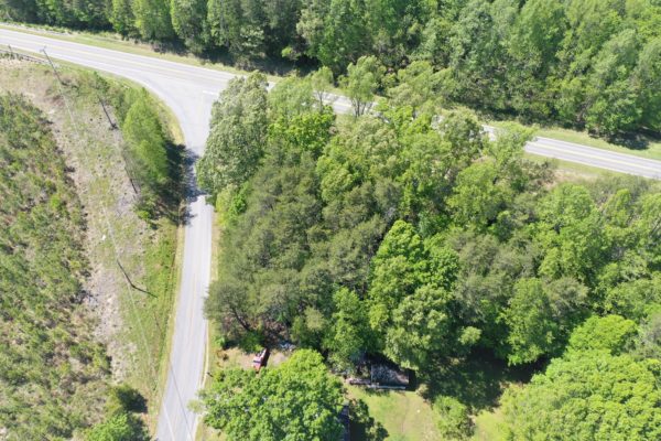
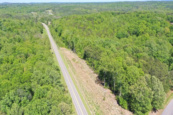
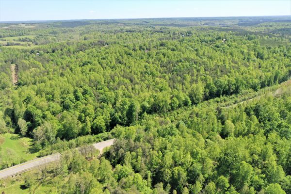
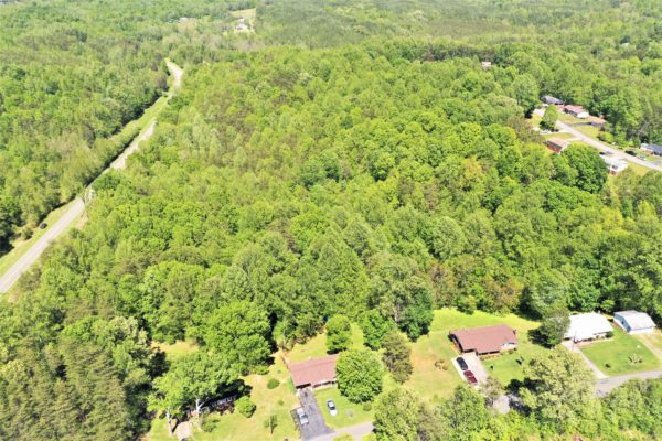
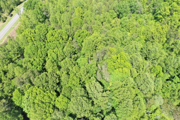
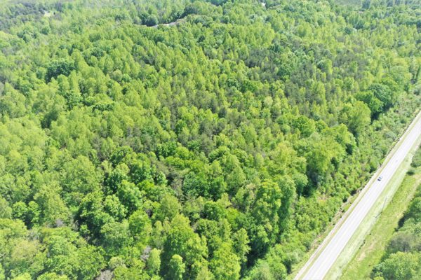
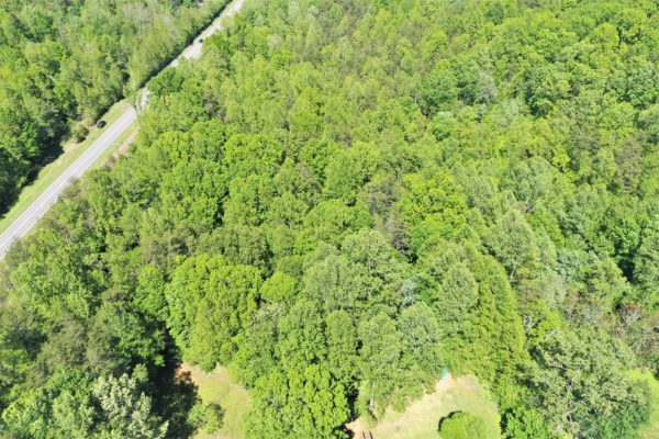
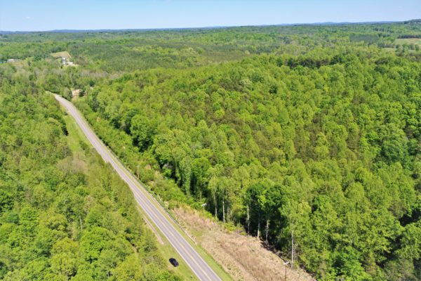
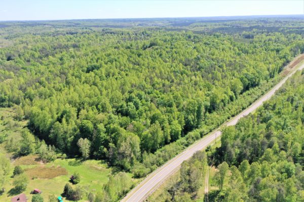
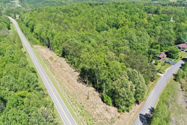
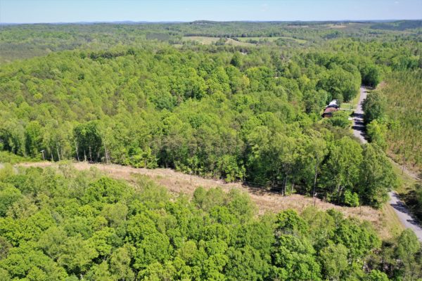
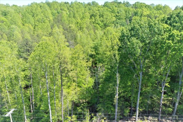
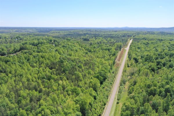
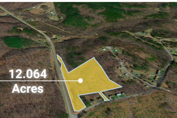
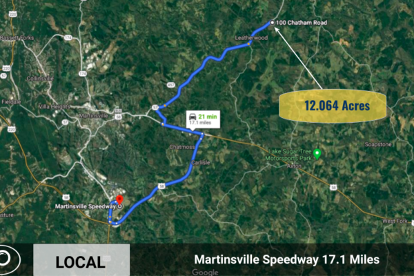
This amazing 12.064 acre of land is located in Henry County, VA in the City of Martinsville. Located in the foothills of the Blue Ridge Mountains in Southern Virginia, this area has plenty of activities available to guarantee that you and your family have a fun time you won’t soon forget! The land is zoned for agricultural use – which means you can grow on it or live on it!
“A fisher’s delight, Philpott Lake, is a 3,000 acre reservoir and home to Philpott Marina, is just 45 minutes away from the property. Here you will find, walleye, smallmouth bass, carp and largemouth bass, among many more. There are boat landings, campgrounds, picnic areas, beaches, and hiking trails.
Philpott Lake offers pleasure boaters and paddlers a variety of places to explore including hidden waterfalls, scenic rock outcrops and three islands. Deer Island, the largest of the three, offers nightly camp site rentals that are only accessible via boat.
Bowen’s Creek Park and Goose Point Park are some of the other recreational areas offered on Philpott.
NEW! Download the Philpott Lake Blueway guide here.”
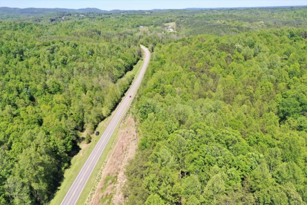
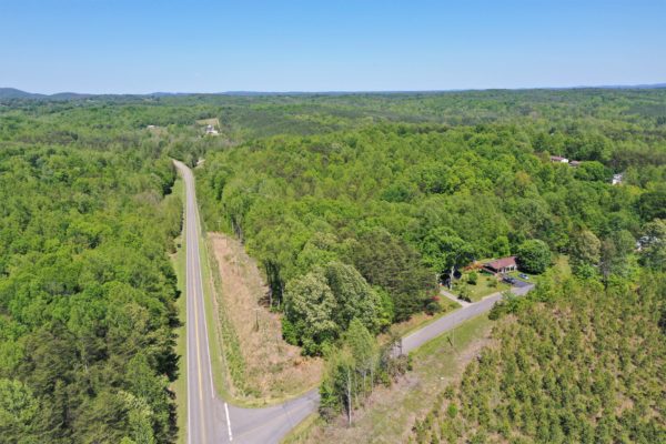
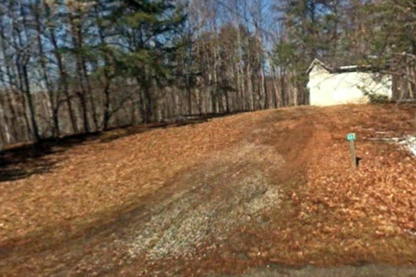
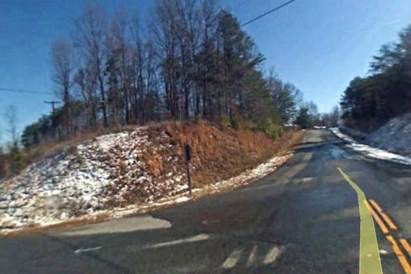
Super cheap land being sold UNDER ASSESSED VALUE! This property is conveniently located in the corner of HWY 57 and Lawrence Drive. The land features gently sloping. It is currently zoned for residential and there is nearby electrical power.
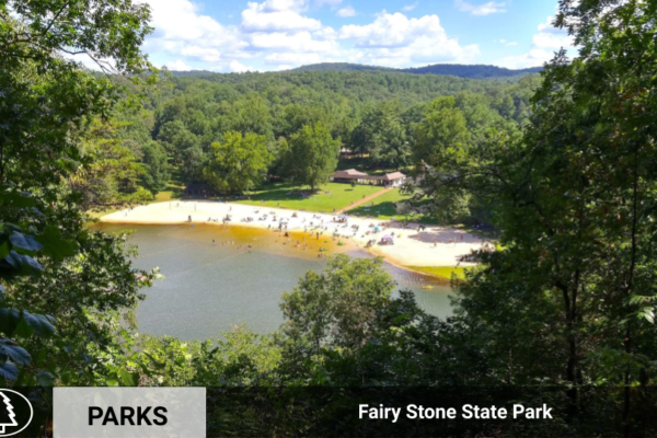
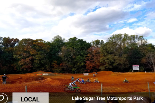
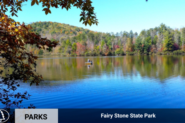
Take advantage of the incredible nearby state parks, local entertainment and more!
What’s Nearby:
Turkeycock Wildlife Management 6.4 Miles
Lake Sugar Tree Motorsports Park 11 Miles
Walmart @ Martinsville 11.7 Miles
Martinsville Speedway – 17.1 Miles
Fairy Stone State Park TN 26.6 Miles
Address & Coordinates
Please plug into Google Map for Land Coordinates for parcel – 36.750606, -79.729566
The actual address as it appears on tax record is: 100 Chatham Rd, Martinsville, VA 24112
Property Information:
APN: 130360028
Deeded Acreage: 12.064
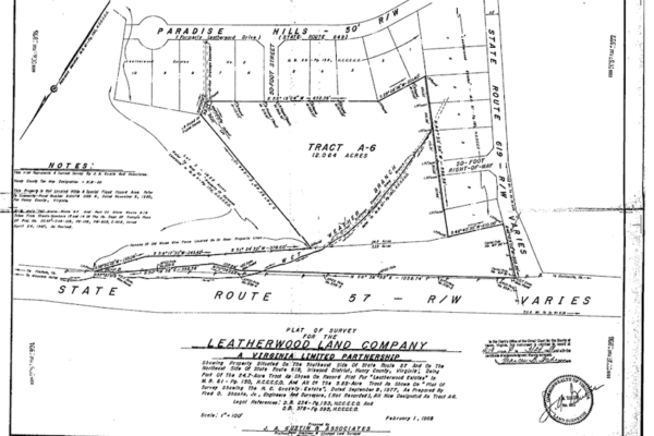
Link to Survey: http://www.co.henry.va.us/plats/BOOK%2082/00821904.tif
Link to County Zoning Provisions for Agricultural Land: https://library.municode.com/va/henry_county/codes/code_of_ordinances?nodeId=COOR_CH21ZO_ARTIIIAGDIA-
| Title | Free and Clear |
| Tax Status | Current |
| Yearly Taxes | $134.87 |
| Assessed Value | $24,300.00 |
| Zone Type | A1-or Agricultural |
| Mobile Homes |
A single wide mobile home up to a stick built, modulars and double-wides are both allowed. While multi-family units would require a Special Use Permit.
|
| RV |
You may live in an RV on the property while a home is being built. You would need to apply for the building permit for the new residence in order to get the power connected to the RV. A building permit expires 6 months from the last inspection. If you are continuing to build, you can stay in the RV as long as your permit does not expire. Then once a Certificate of Occupancy is issued for the house, the RV must be disconnected from utilities.
|
| Sewer | Would be by septic. Neighbors use septic. |
| Water | Public water. |
| Electricity |
Power is available in the area, either by American Electric Power / AEP or Appalachian Power Company.
|
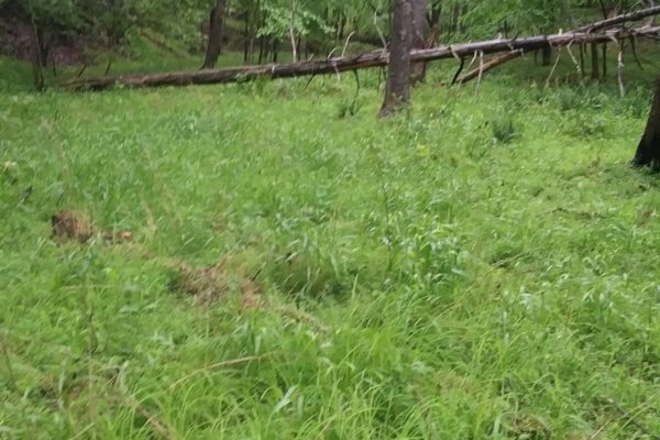
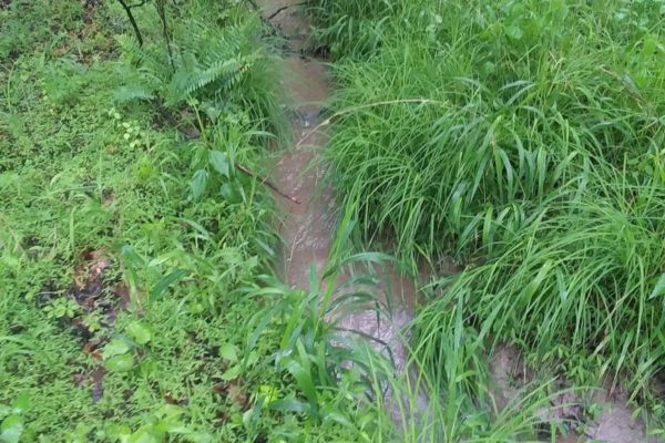
| Terrain | Property is rolling. |
| Road Access | Property can be accessed via Chatham Road and Lawrence Drive. |
| Flood Zone | The property is not located in the FEMA floodplain, and/or any designated wetlands. |
| HOA | No HOA/POA |
| Abbreviated Legal Description | LEATHERWOOD ST RT 619 TRACT A |
| Complete Legal Desc: | All that certain tract or parcel of land, with improvements thereon located and appurtenances thereunto appertaining, situated on the Southeast side of the State Highway 57 and on the Northeast side of State Route 619, in the Iriswood Magisterial District of Henry County, Virginia, and being known and designated as Tract A-6, containing 12.064 acres, more or less, as shown on an unrecorded plat of survey for the Leatherwood Land Company, dated February 1, 1988, prepared by J.A. Gustin & Associates, CR & LLS, and being a part of the 24.7 acre tract as shown on a recorded plat for the Leatherwood Estate, of record in the aforesaid Clerk’s Office in Map Book 61, page 150, and all of the 3.23 acre tract as shown on a unrecorded plat of survey shown the H.C. Gravely Estate, dated September 9, 1977, prepared by Fred O. Shanks, Jr., Engineers and Surveyors. |
| GPS Coordinates: | |
| Center: | 36.750551, -79.729593 |
| NW: | 36.752882, -79.727776 |
| NE: | 36.750950, -79.727395 |
| SW: | 36.750174, -79.731891 |
| SE: | 36.749232, -79.729420 |
Discounted Cash Pricing
Cash Price: $20,999
Doc & Reservation Fee: $199
Total: $21,198
Deposit Amount: $300
Terms Pricing
Terms Price: $25,999
Down Payment: $5,999
Interest Rate: 10%
Monthly Payment: $552
Montly Loan Fee : $20
Total Term months : 60
Property Details
Size (Acres)
5.54
Best Attribute
Wide Open Space
APN or Other ID
70235760
Legal Description
LOT 1704, BLOCK 113, SANGRE DE CRISTO RANCHES, UNIT J, COSTILLA COUNTY, COLORADO
Approximate GPS Coordinates
37.364998, -105.342107
Property Size
Rural Land
Zoning
Estate – Residential
General Elevation (in feet)
8554
Power
Would be alternative power source.
HOA/POA
SDCR – Membership is optional for $25/year
Water
Well Can Be Drilled
Sewer
Septic can be installed
Roads
Dirt Road
Terrain
Property on rolling hills
Title Info
Clear Title
Annual Property Taxes (Approx)
$115.64
ALL THE INFORMATION WE HAVE ON THIS PROPERTY IS DISCLOSED WITHIN THE CONTENT OF THIS LISTING PAGE. IN MOST CASES WE HAVE NOT SEEN THE PROPERTY. ANY AND ALL OTHER QUESTIONS REGARDING THIS PROPERTY SHOULD BE DIRECTED TOWARD THE CITY OR COUNTY OF WHICH THE PROPERTY IS LOCATED IN. YOUR DUE DILIGENCE SHOULD BE PERFORMED PRIOR TO BUYING, TO ENSURE THE PROPERTY MEETS YOUR NEEDS AND CRITERIA.
Thank you for considering Liberty Land Sales
Related Properties
Contact Seller
Price Drop! Motivated Seller!
Description
This amazing 12.064 acre of land is located in Henry County, VA in the City of Martinsville. Located in the foothills of the Blue Ridge Mountains in Southern Virginia, this area has plenty of activities available to guarantee that you and your family have a fun time you won’t soon forget! The land is zoned for agricultural use – which means you can grow on it or live on it!
“A fisher’s delight, Philpott Lake, is a 3,000 acre reservoir and home to Philpott Marina, is just 45 minutes away from the property. Here you will find, walleye, smallmouth bass, carp and largemouth bass, among many more. There are boat landings, campgrounds, picnic areas, beaches, and hiking trails.
Philpott Lake offers pleasure boaters and paddlers a variety of places to explore including hidden waterfalls, scenic rock outcrops and three islands. Deer Island, the largest of the three, offers nightly camp site rentals that are only accessible via boat.
Bowen’s Creek Park and Goose Point Park are some of the other recreational areas offered on Philpott.
NEW! Download the Philpott Lake Blueway guide here.”
Super cheap land being sold UNDER ASSESSED VALUE! This property is conveniently located in the corner of HWY 57 and Lawrence Drive. The land features gently sloping. It is currently zoned for residential and there is nearby electrical power.
Take advantage of the incredible nearby state parks, local entertainment and more!
What’s Nearby:
Turkeycock Wildlife Management 6.4 Miles
Lake Sugar Tree Motorsports Park 11 Miles
Walmart @ Martinsville 11.7 Miles
Martinsville Speedway – 17.1 Miles
Fairy Stone State Park TN 26.6 Miles
Address & Coordinates
Please plug into Google Map for Land Coordinates for parcel – 36.750606, -79.729566
The actual address as it appears on tax record is: 100 Chatham Rd, Martinsville, VA 24112
Property Information:
APN: 130360028
Deeded Acreage: 12.064
Link to Survey: http://www.co.henry.va.us/plats/BOOK%2082/00821904.tif
Link to County Zoning Provisions for Agricultural Land: https://library.municode.com/va/henry_county/codes/code_of_ordinances?nodeId=COOR_CH21ZO_ARTIIIAGDIA-
| Title | Free and Clear |
| Tax Status | Current |
| Yearly Taxes | $134.87 |
| Assessed Value | $24,300.00 |
| Zone Type | A1-or Agricultural |
| Mobile Homes |
A single wide mobile home up to a stick built, modulars and double-wides are both allowed. While multi-family units would require a Special Use Permit.
|
| RV |
You may live in an RV on the property while a home is being built. You would need to apply for the building permit for the new residence in order to get the power connected to the RV. A building permit expires 6 months from the last inspection. If you are continuing to build, you can stay in the RV as long as your permit does not expire. Then once a Certificate of Occupancy is issued for the house, the RV must be disconnected from utilities.
|
| Sewer | Would be by septic. Neighbors use septic. |
| Water | Public water. |
| Electricity |
Power is available in the area, either by American Electric Power / AEP or Appalachian Power Company.
|
| Terrain | Property is rolling. |
| Road Access | Property can be accessed via Chatham Road and Lawrence Drive. |
| Flood Zone | The property is not located in the FEMA floodplain, and/or any designated wetlands. |
| HOA | No HOA/POA |
| Abbreviated Legal Description | LEATHERWOOD ST RT 619 TRACT A |
| Complete Legal Desc: | All that certain tract or parcel of land, with improvements thereon located and appurtenances thereunto appertaining, situated on the Southeast side of the State Highway 57 and on the Northeast side of State Route 619, in the Iriswood Magisterial District of Henry County, Virginia, and being known and designated as Tract A-6, containing 12.064 acres, more or less, as shown on an unrecorded plat of survey for the Leatherwood Land Company, dated February 1, 1988, prepared by J.A. Gustin & Associates, CR & LLS, and being a part of the 24.7 acre tract as shown on a recorded plat for the Leatherwood Estate, of record in the aforesaid Clerk’s Office in Map Book 61, page 150, and all of the 3.23 acre tract as shown on a unrecorded plat of survey shown the H.C. Gravely Estate, dated September 9, 1977, prepared by Fred O. Shanks, Jr., Engineers and Surveyors. |
| GPS Coordinates: | |
| Center: | 36.750551, -79.729593 |
| NW: | 36.752882, -79.727776 |
| NE: | 36.750950, -79.727395 |
| SW: | 36.750174, -79.731891 |
| SE: | 36.749232, -79.729420 |
Discounted Cash Pricing
Cash Price: $20,999
Doc & Reservation Fee: $199
Total: $21,198
Deposit Amount: $300
Terms Pricing
Terms Price: $25,999
Down Payment: $5,999
Interest Rate: 10%
Monthly Payment: $552
Montly Loan Fee : $20
Total Term months : 60

