Contact Seller
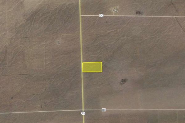
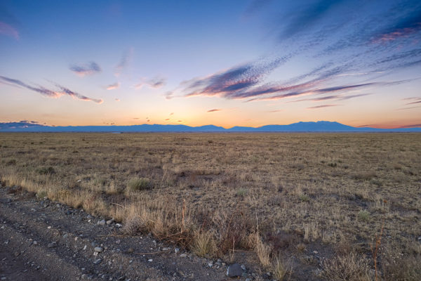
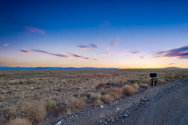
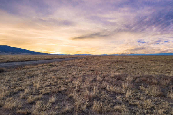
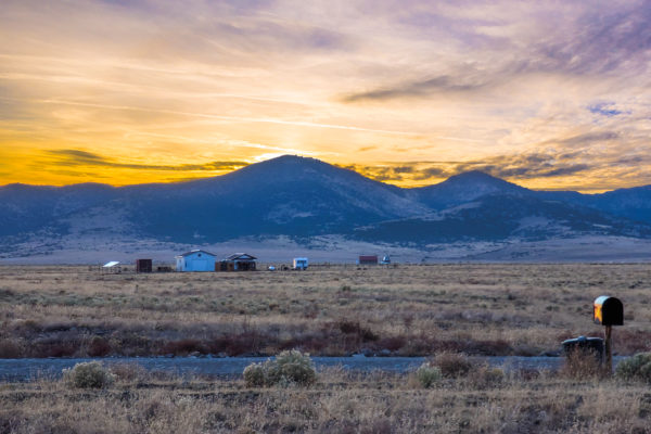
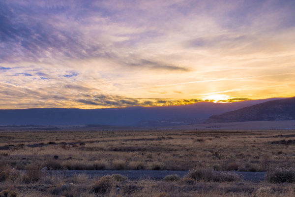
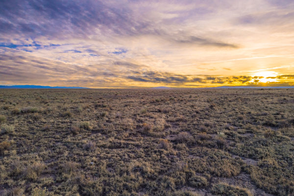
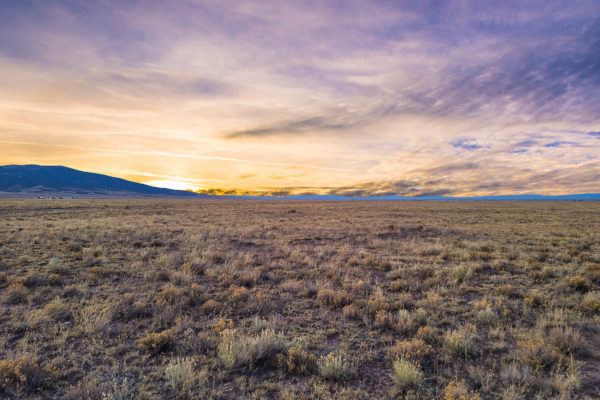
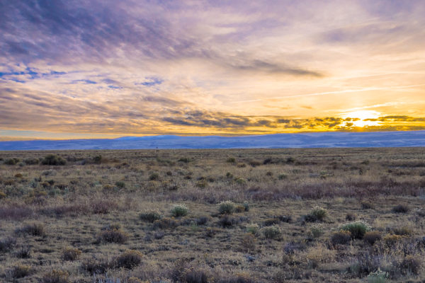
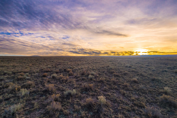
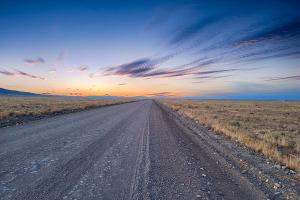
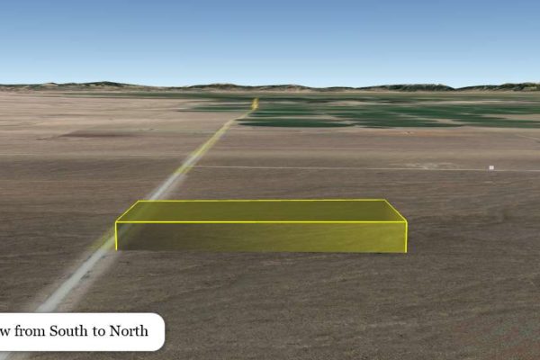
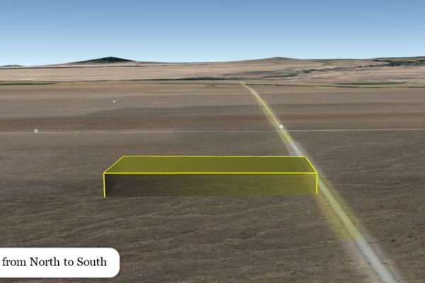
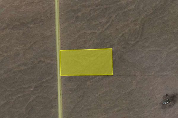
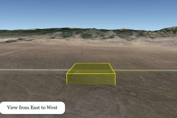
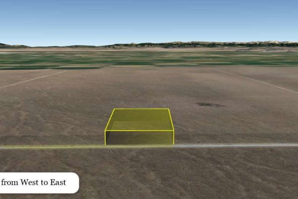
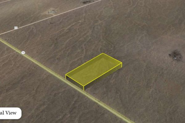
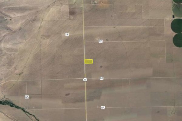
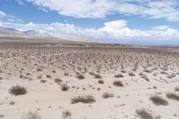
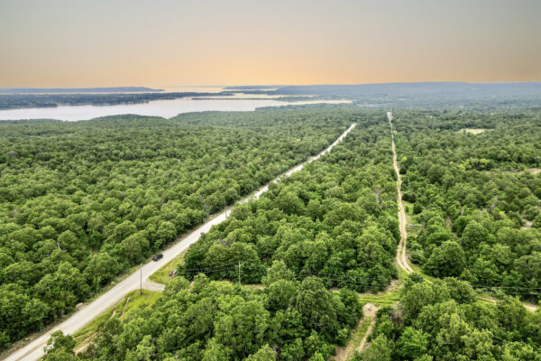
Ready for off-grid living? This would be the perfect spot to start. This 20 acre parcel has direct road access via Gunbarrel Road (County Road 6) and is less than 20 minutes to La Jara to stock up on all necessities before heading back home. Standing in the center of this property, and looking West you are met with the mountains, with the closest peak being Chiquitos Peak, which is a steep hike, but worth the view.
This wide-open space is bursting with opportunity, get ready to live off-grid while still having the city convenience a short drive away.
Prop ID |
556119200009 |
Size of Lot (or LOT AREA): |
871,200 Sq. Ft. |
Acreage Size: |
20 ac |
Tax Assessment Year: |
2020 |
Yearly Taxes: |
$357.16 |
Zone Type: |
Rural Zone District – The character of an area that is primarily low-density residential, unimproved and open. |
Mobile Homes: |
MH’s are allowed, there is a permitting and inspection process. They are the authorized authority by the State of Colorado Mobile Home Installation Program. They must be installed per State Guidelines. The County also requires a permit to place it on the property. Mobile homes would be best for full-time residential use. |
RV: |
Yes, Seasonal RV camping is allowed.The ideal time for camping is Mid April to Mid October. Camping in a tent would be for a shorter period of time – like June – August.RV’s must be licensed and registered with the Department of Motor Vehicle and you can live in an RV while building a home if you have a valid building permit from Conejos County . |
Sewer: |
No public sewer system in that area. You will need to install a County/State approved Onsite Wastewater Treatment System (Septic System.) There is a permitting and inspection process. |
Water: |
There is no water tap in this rural area. You would need to apply for a well permit with the Colorado Division of Water Resources and hire a well driller. |
Electricity: |
Alternative. There is no public electrical service. |
Terrain: |
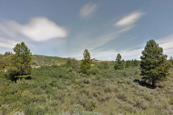
Property is gently rolling. |
Road Access: |
Property can be accessed via Co Rd 6. |
Flood Zone: |
No floodmap data available. |
HOA Information: |
No HOA/POA information found for the property online. |
Abbreviated Legal Description: |
S1/2 SW1/4 NW1/4 19-36-8 TNA 20 M/L |
GPS Coordinates: |
|
Center: |
37.351273, -106.146472 |
NW: |
37.352182, -106.149023 |
NE: |
37.352290, -106.144132 |
SW: |
37.350419, -106.149024 |
SE: |
37.350360, -106.144112 |
Property Location
Discounted Cash Pricing
Cash Price: $14,400
Doc & Reservation Fee: $198
Total: $14,598
Deposit Amount: $1
Terms Pricing
Terms Price: $18,720
Down Payment: $1
Interest Rate: 7%
Monthly Payment: $462
Montly Loan Fee : $20
Total Term months : 36
Property Location
Property Details
Size (Acres)
5.54
Best Attribute
Wide Open Space
APN or Other ID
70235760
Legal Description
LOT 1704, BLOCK 113, SANGRE DE CRISTO RANCHES, UNIT J, COSTILLA COUNTY, COLORADO
Approximate GPS Coordinates
37.364998, -105.342107
Property Size
Rural Land
Zoning
Estate – Residential
General Elevation (in feet)
8554
Power
Would be alternative power source.
HOA/POA
SDCR – Membership is optional for $25/year
Water
Well Can Be Drilled
Sewer
Septic can be installed
Roads
Dirt Road
Terrain
Property on rolling hills
Title Info
Clear Title
Annual Property Taxes (Approx)
$115.64
“We have not visited this property. We have posted all of the information we have available about this property and we encourage our customers to do their own due diligence prior to purchasing.”
Related Properties
Contact Seller
Ready for off-grid living? This would be the perfect spot to start. This 20 acre parcel has direct road access via Gunbarrel Road (County Road 6) and is less than 20 minutes to La Jara to stock up on all necessities before heading back home. Standing in the center of this property, and looking West you are met with the mountains, with the closest peak being Chiquitos Peak, which is a steep hike, but worth the view.
This wide-open space is bursting with opportunity, get ready to live off-grid while still having the city convenience a short drive away.
Prop ID |
556119200009 |
Size of Lot (or LOT AREA): |
871,200 Sq. Ft. |
Acreage Size: |
20 ac |
Tax Assessment Year: |
2020 |
Yearly Taxes: |
$357.16 |
Zone Type: |
Rural Zone District – The character of an area that is primarily low-density residential, unimproved and open. |
Mobile Homes: |
MH’s are allowed, there is a permitting and inspection process. They are the authorized authority by the State of Colorado Mobile Home Installation Program. They must be installed per State Guidelines. The County also requires a permit to place it on the property. Mobile homes would be best for full-time residential use. |
RV: |
Yes, Seasonal RV camping is allowed.The ideal time for camping is Mid April to Mid October. Camping in a tent would be for a shorter period of time – like June – August.RV’s must be licensed and registered with the Department of Motor Vehicle and you can live in an RV while building a home if you have a valid building permit from Conejos County . |
Sewer: |
No public sewer system in that area. You will need to install a County/State approved Onsite Wastewater Treatment System (Septic System.) There is a permitting and inspection process. |
Water: |
There is no water tap in this rural area. You would need to apply for a well permit with the Colorado Division of Water Resources and hire a well driller. |
Electricity: |
Alternative. There is no public electrical service. |
Terrain: |
Property is gently rolling. |
Road Access: |
Property can be accessed via Co Rd 6. |
Flood Zone: |
No floodmap data available. |
HOA Information: |
No HOA/POA information found for the property online. |
Abbreviated Legal Description: |
S1/2 SW1/4 NW1/4 19-36-8 TNA 20 M/L |
GPS Coordinates: |
|
Center: |
37.351273, -106.146472 |
NW: |
37.352182, -106.149023 |
NE: |
37.352290, -106.144132 |
SW: |
37.350419, -106.149024 |
SE: |
37.350360, -106.144112 |
Property Location
Prop ID |
556119200009 |
Size of Lot (or LOT AREA): |
871,200 Sq. Ft. |
Acreage Size: |
20 ac |
Tax Assessment Year: |
2020 |
Yearly Taxes: |
$357.16 |
Zone Type: |
Rural Zone District – The character of an area that is primarily low-density residential, unimproved and open. |
Mobile Homes: |
MH’s are allowed, there is a permitting and inspection process. They are the authorized authority by the State of Colorado Mobile Home Installation Program. They must be installed per State Guidelines. The County also requires a permit to place it on the property. Mobile homes would be best for full-time residential use. |
RV: |
Yes, Seasonal RV camping is allowed.The ideal time for camping is Mid April to Mid October. Camping in a tent would be for a shorter period of time – like June – August.RV’s must be licensed and registered with the Department of Motor Vehicle and you can live in an RV while building a home if you have a valid building permit from Conejos County . |
Sewer: |
No public sewer system in that area. You will need to install a County/State approved Onsite Wastewater Treatment System (Septic System.) There is a permitting and inspection process. |
Water: |
There is no water tap in this rural area. You would need to apply for a well permit with the Colorado Division of Water Resources and hire a well driller. |
Electricity: |
Alternative. There is no public electrical service. |
Terrain: |
Property is gently rolling. |
Road Access: |
Property can be accessed via Co Rd 6. |
Flood Zone: |
No floodmap data available. |
HOA Information: |
No HOA/POA information found for the property online. |
Abbreviated Legal Description: |
S1/2 SW1/4 NW1/4 19-36-8 TNA 20 M/L |
GPS Coordinates: |
|
Center: |
37.351273, -106.146472 |
NW: |
37.352182, -106.149023 |
NE: |
37.352290, -106.144132 |
SW: |
37.350419, -106.149024 |
SE: |
37.350360, -106.144112 |
Property Location
Discounted Cash Pricing
Cash Price: $14,400
Doc & Reservation Fee: $198
Total: $14,598
Deposit Amount: $1
Terms Pricing
Terms Price: $18,720
Down Payment: $1
Interest Rate: 7%
Monthly Payment: $462
Montly Loan Fee : $20
Total Term months : 36

