Contact Seller
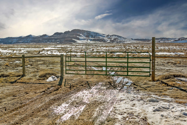
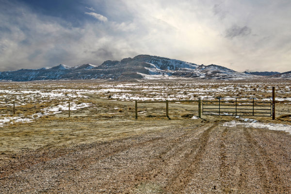
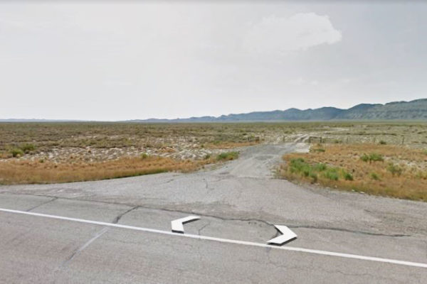
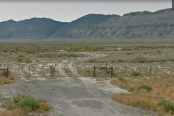
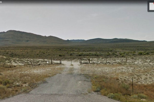
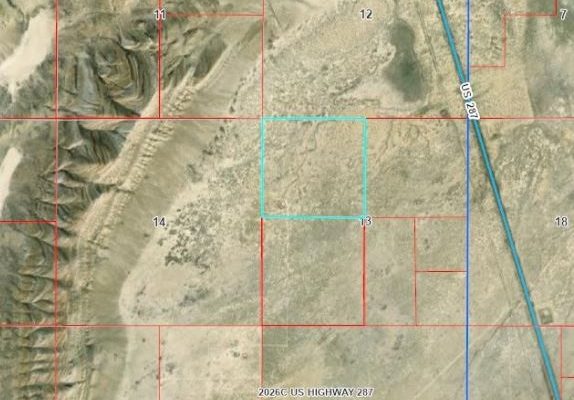
Looking for your dream hunting property adjacent to BLM land? This lot is for you! This lot has deeded access on the dirt road through the adjoining property to Highway 287.
This 160 Acre lot is zoned RAM (Ranching, Agriculture, and Mining) by Carbon County, possessing principally permitted uses such as commercial or general agriculture, including ranching and farming, mining and quarrying, mineral extraction, and highway construction activities, just to name a few. Some conditionally permitted uses are public and civil uses, commercial storage yards, commercial recreation areas, and recreation vehicle parks. Full list of RAM permitted uses below.
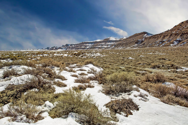
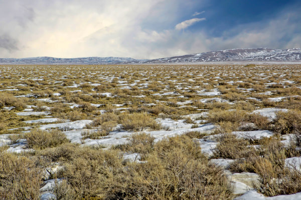
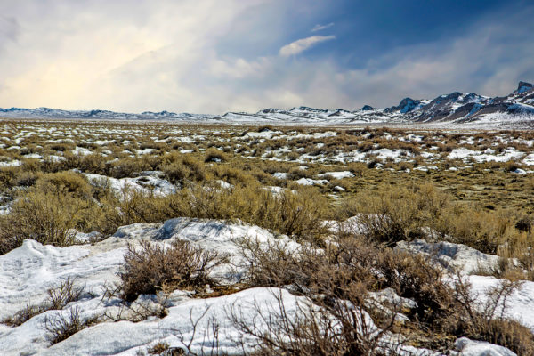
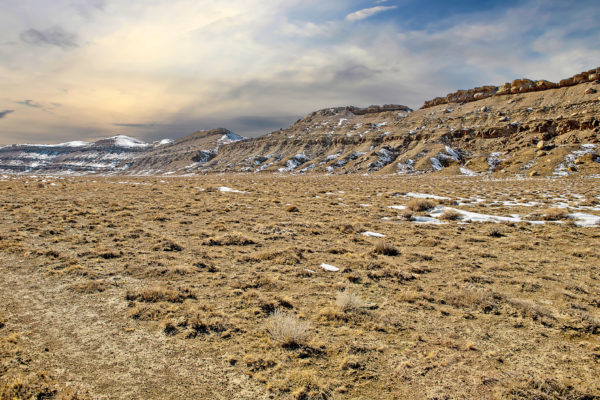
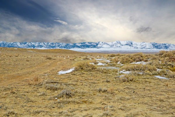
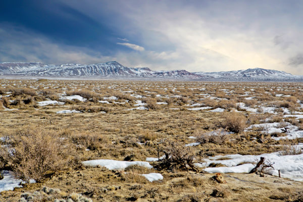
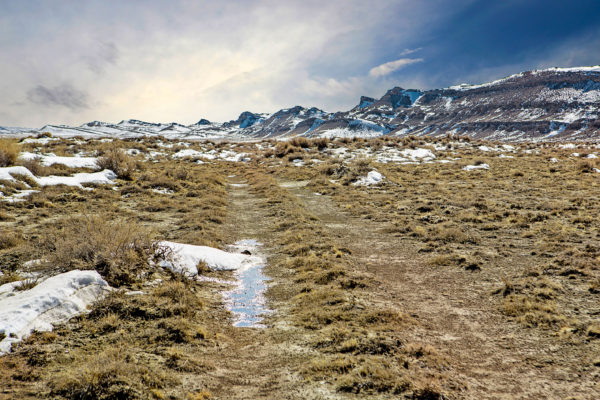
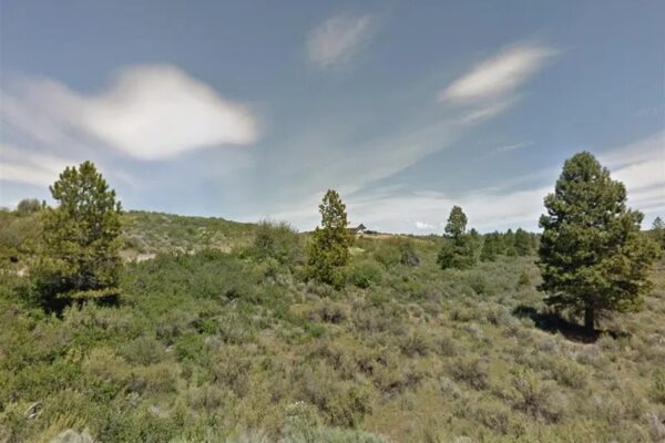
Just 36 minutes from Bairoil, Wy and 5 minutes off I-287, this 160 acre property is waiting for someone to claim it as their own piece of American freedom. Located east of Separation point, this property boasts impressive rock outcroppings giving the property extra character. Looking for extra areas to explore? There is no electric in the area, so you’ll need to be versed in working with solar or other means for power.
The placement of this land next to BLM land perfectly complements Southern Wyoming’s rich wildlife. This property falls in the regions designated for the hunting of Antelope, Elk, Bighorn Sheep, Deer, Mountain Lion, Pheasant, Sage Grouse and Wild Turkey. The property is close to world-class fishing, water sports and outdoor recreation activities at the nearby Pathfinder Reservoir, Seminoe State Park, Seminoe Reservoir, North Platte River, Miracle Mile and Alcova Reservoir.
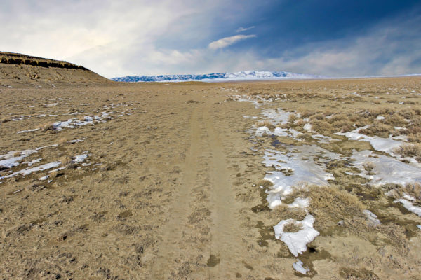
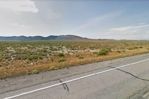
There is a dirt road and an easement granting access from Highway 287 through the neighbor’s lot to this property.
What are you waiting for? Your Wyoming adventure starts here!
Prop ID: R0016721
Acreage Size: 160 AC
Property Address: Rawlins, WY 82301
Tax Assessment: Year 2021
Yearly Taxes $243.38
Tax Status: Current
Section 4.4 RANCHING, AGRICULTURE AND MINING ZONE (RAM)
The purpose of this District is to preserve historic uses and open space areas of the County while at the same time permit ranching, agriculture, animal husbandry, forestry, and mining in a manner that attains this purpose. All of the unincorporated area of the County not otherwise zoned is designated as the Ranching, Agriculture and Mining Zone.
Residential uses accessory to a preexisting Commercial or General Agricultural operation are permitted in this zone. If residential uses not covered above are desired, a conditional use permit or a zone change should be sought. The Carbon County Land Use Plan contains land use policies which encourage the development of new residential development and commercial sites in close proximity to municipalities and developed areas. The purpose of this policy is to ensure that future land development is fiscally responsible, to strengthen existing communities and to make maximum use of the services already established for police and fire protection, trash collection, snow removal and other public services. A criterion used in deciding whether or not to grant a zone change or a conditional use permit for residential uses will be considerations as to whether the establishment of a new zoning district is unavoidable because of the remote location of new employment.
A. PrincipallyPermittedUses:
- Commercial or General Agriculture including ranching and farming, their related uses and facilities and animal husbandry relative to above activities.
- Residential uses that are accessory to a preexisting Commercial or General Agricultural operation, as defined in Chapter III including accessory dwelling unit, bed & breakfast facility, home occupation, and cottage industries.
- Public parks and playgrounds, including public rest rooms.
- Cemeteries.
- Ore beneficiation, milling and quarrying with proof of state permit. Said operations ifabove ground are not permitted within 1,000 feet of a residential district. Ore processing is principally permitted only if directly associated with an adjacent extraction operation.
- Extraction or production of mineral resources.
- Timberland and Timber Production, but not including wood pulp mills or paperprocessing.
- Timber Products, Non-Commercial.
- Highway Construction Facilities.
- Gravel mines and accessory facilities.
- Habitat management.
12. Kennels on parcels 35 acres or greater.
13.Animal Crematorium-when located on-site and accessory to an agricultural operation.
14. Meteorological (MET) Tower with tower height being less than 300 feet. 15. Non-commercial nurseries and greenhouses.
B. ConditionallyPermittedUses:
The following uses are permitted subject to the review and approval pursuant to Chapter 5 – General Regulations Applying to all Districts and Uses:
- Residential uses if accessory to a commercial or general agricultural operation if theoperation is not preexisting.
- Public Uses and Civic Use(s).
- Public facilities and utilities limited to above ground structures including sewagetreatment and water supply facilities, municipal solid waste landfill, all conforming to Wyoming Department of Environmental Quality requirements.
- Compressor, regulator, distribution stations and gas processing plants.
- Oilfield Wastewater Disposal Facilities (OWDF).
- Commercial Storage Yards.
- Industrial Uses, processing plants and related uses.
- Agriculture Industrial Uses.
- Guest Ranch or Resort.
- Commercial recreation areas and facilities, including campgrounds.
- Boarding house and recreation lodge.
- Recreational Vehicle Park and Trailer Camp.
- Churches and Sunday schools.
- Labor camps including agricultural or farm labor camps.
- Temporary Living Facilities.
- Recycling Center and Recycling Plant.
- Kennels on parcels less than 35 acres.
- Roadside Stand.
- Commercial Nurseries and Greenhouses.
- Pulp and paper processing, related facilities and accessory uses.
- Timber Products Processing Plants.
- Radio transmitting stations.
- Crematorium. See Chapter 5.
- Animal Crematorium-when not located on-site of an agricultural operation andnot accessory to an agricultural operation. See Chapter 5.
- Telecommunication Towers and Facilities. See Chapter 5.
- Electrical Substations and Transmission Lines. See Chapter 5.
- Non-Commercial Wind Energy Collection Systems. See Chapter 5.
- Commercial Scale Energy Facilities. See Chapter 6.
- Low Hazard-Low Volume Treatment, Processing, Storage and Transfer Facility. SeeChapter 5.
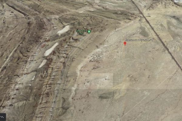
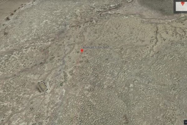
Property Location
Prop ID: R0016721
Acreage Size: 160 AC
Property Address: Rawlins, WY 82301
Tax Assessment: Year 2021
Yearly Taxes $243.38
Tax Status: Current
Zone Type: RAM-Ranching, Agricultural, Mining
Mobile Homes: No
RV: No
Sewer: Would need septic. No permits on file per state. This goes through state of WY due to the county does not have their own permitting. To find out if a previous soil/perc test done must submit formal request and payment to http://deq.wyoming.gov/wqd/water-wastewater/
Water: Note from initial info: Main line water is located in HWY 287 according to the county or you’d have to dig a well. Somewhat private reservoir on property according to sellers for stocking fish
Electricity: Alternative Power per initial info. Overhead lines are S of lot, 7 miles away
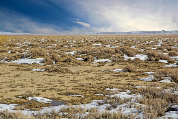
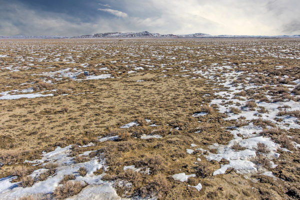
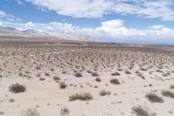
Terrain: flat/desert
Road Access: There is a dirt road and an easement granting access from Highway 287 through the neighbor’s lot to this property.
Flood Zone: Not in a floodzone area.
HOA: None per deed, owner or online
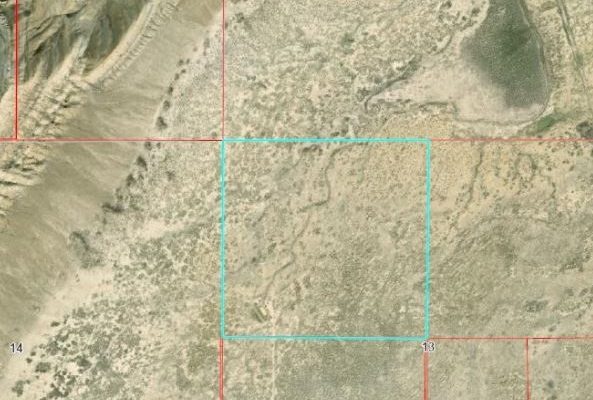
Abbreviated Legal Description: NW1/4: SEC 13 T 24 R 89 NET 160 A MORL. (BK 1208/80) TAX CODE 0100
GPS Coordinates:
Center: 42.0556, -107.4032
NW: 42.0589, -107.4080
NE: 42.0589, -107.3983
SW: 42.0520, -107.4080
SE: 42.0520, -107.3984
Property Location
Discounted Cash Pricing
Cash Price: $40,000
Doc & Reservation Fee: $0
Total: $40,000
Deposit Amount: $400
Terms Pricing
Terms Price: $58,999
Down Payment: $9,000
Interest Rate: 10%
Monthly Payment: $1,243
Montly Loan Fee : $20
Total Term months : 48
Property Location
Property Details
Size (Acres)
5.54
Best Attribute
Wide Open Space
APN or Other ID
70235760
Legal Description
LOT 1704, BLOCK 113, SANGRE DE CRISTO RANCHES, UNIT J, COSTILLA COUNTY, COLORADO
Approximate GPS Coordinates
37.364998, -105.342107
Property Size
Rural Land
Zoning
Estate – Residential
General Elevation (in feet)
8554
Power
Would be alternative power source.
HOA/POA
SDCR – Membership is optional for $25/year
Water
Well Can Be Drilled
Sewer
Septic can be installed
Roads
Dirt Road
Terrain
Property on rolling hills
Title Info
Clear Title
Annual Property Taxes (Approx)
$115.64
Related Properties
Contact Seller
Looking for your dream hunting property adjacent to BLM land? This lot is for you! This lot has deeded access on the dirt road through the adjoining property to Highway 287.
This 160 Acre lot is zoned RAM (Ranching, Agriculture, and Mining) by Carbon County, possessing principally permitted uses such as commercial or general agriculture, including ranching and farming, mining and quarrying, mineral extraction, and highway construction activities, just to name a few. Some conditionally permitted uses are public and civil uses, commercial storage yards, commercial recreation areas, and recreation vehicle parks. Full list of RAM permitted uses below.
Just 36 minutes from Bairoil, Wy and 5 minutes off I-287, this 160 acre property is waiting for someone to claim it as their own piece of American freedom. Located east of Separation point, this property boasts impressive rock outcroppings giving the property extra character. Looking for extra areas to explore? There is no electric in the area, so you’ll need to be versed in working with solar or other means for power.
The placement of this land next to BLM land perfectly complements Southern Wyoming’s rich wildlife. This property falls in the regions designated for the hunting of Antelope, Elk, Bighorn Sheep, Deer, Mountain Lion, Pheasant, Sage Grouse and Wild Turkey. The property is close to world-class fishing, water sports and outdoor recreation activities at the nearby Pathfinder Reservoir, Seminoe State Park, Seminoe Reservoir, North Platte River, Miracle Mile and Alcova Reservoir.
There is a dirt road and an easement granting access from Highway 287 through the neighbor’s lot to this property.
What are you waiting for? Your Wyoming adventure starts here!
Prop ID: R0016721
Acreage Size: 160 AC
Property Address: Rawlins, WY 82301
Tax Assessment: Year 2021
Yearly Taxes $243.38
Tax Status: Current
Section 4.4 RANCHING, AGRICULTURE AND MINING ZONE (RAM)
The purpose of this District is to preserve historic uses and open space areas of the County while at the same time permit ranching, agriculture, animal husbandry, forestry, and mining in a manner that attains this purpose. All of the unincorporated area of the County not otherwise zoned is designated as the Ranching, Agriculture and Mining Zone.
Residential uses accessory to a preexisting Commercial or General Agricultural operation are permitted in this zone. If residential uses not covered above are desired, a conditional use permit or a zone change should be sought. The Carbon County Land Use Plan contains land use policies which encourage the development of new residential development and commercial sites in close proximity to municipalities and developed areas. The purpose of this policy is to ensure that future land development is fiscally responsible, to strengthen existing communities and to make maximum use of the services already established for police and fire protection, trash collection, snow removal and other public services. A criterion used in deciding whether or not to grant a zone change or a conditional use permit for residential uses will be considerations as to whether the establishment of a new zoning district is unavoidable because of the remote location of new employment.
A. PrincipallyPermittedUses:
- Commercial or General Agriculture including ranching and farming, their related uses and facilities and animal husbandry relative to above activities.
- Residential uses that are accessory to a preexisting Commercial or General Agricultural operation, as defined in Chapter III including accessory dwelling unit, bed & breakfast facility, home occupation, and cottage industries.
- Public parks and playgrounds, including public rest rooms.
- Cemeteries.
- Ore beneficiation, milling and quarrying with proof of state permit. Said operations ifabove ground are not permitted within 1,000 feet of a residential district. Ore processing is principally permitted only if directly associated with an adjacent extraction operation.
- Extraction or production of mineral resources.
- Timberland and Timber Production, but not including wood pulp mills or paperprocessing.
- Timber Products, Non-Commercial.
- Highway Construction Facilities.
- Gravel mines and accessory facilities.
- Habitat management.
12. Kennels on parcels 35 acres or greater.
13.Animal Crematorium-when located on-site and accessory to an agricultural operation.
14. Meteorological (MET) Tower with tower height being less than 300 feet. 15. Non-commercial nurseries and greenhouses.
B. ConditionallyPermittedUses:
The following uses are permitted subject to the review and approval pursuant to Chapter 5 – General Regulations Applying to all Districts and Uses:
- Residential uses if accessory to a commercial or general agricultural operation if theoperation is not preexisting.
- Public Uses and Civic Use(s).
- Public facilities and utilities limited to above ground structures including sewagetreatment and water supply facilities, municipal solid waste landfill, all conforming to Wyoming Department of Environmental Quality requirements.
- Compressor, regulator, distribution stations and gas processing plants.
- Oilfield Wastewater Disposal Facilities (OWDF).
- Commercial Storage Yards.
- Industrial Uses, processing plants and related uses.
- Agriculture Industrial Uses.
- Guest Ranch or Resort.
- Commercial recreation areas and facilities, including campgrounds.
- Boarding house and recreation lodge.
- Recreational Vehicle Park and Trailer Camp.
- Churches and Sunday schools.
- Labor camps including agricultural or farm labor camps.
- Temporary Living Facilities.
- Recycling Center and Recycling Plant.
- Kennels on parcels less than 35 acres.
- Roadside Stand.
- Commercial Nurseries and Greenhouses.
- Pulp and paper processing, related facilities and accessory uses.
- Timber Products Processing Plants.
- Radio transmitting stations.
- Crematorium. See Chapter 5.
- Animal Crematorium-when not located on-site of an agricultural operation andnot accessory to an agricultural operation. See Chapter 5.
- Telecommunication Towers and Facilities. See Chapter 5.
- Electrical Substations and Transmission Lines. See Chapter 5.
- Non-Commercial Wind Energy Collection Systems. See Chapter 5.
- Commercial Scale Energy Facilities. See Chapter 6.
- Low Hazard-Low Volume Treatment, Processing, Storage and Transfer Facility. SeeChapter 5.
Property Location
Prop ID: R0016721
Acreage Size: 160 AC
Property Address: Rawlins, WY 82301
Tax Assessment: Year 2021
Yearly Taxes $243.38
Tax Status: Current
Zone Type: RAM-Ranching, Agricultural, Mining
Mobile Homes: No
RV: No
Sewer: Would need septic. No permits on file per state. This goes through state of WY due to the county does not have their own permitting. To find out if a previous soil/perc test done must submit formal request and payment to http://deq.wyoming.gov/wqd/water-wastewater/
Water: Note from initial info: Main line water is located in HWY 287 according to the county or you’d have to dig a well. Somewhat private reservoir on property according to sellers for stocking fish
Electricity: Alternative Power per initial info. Overhead lines are S of lot, 7 miles away
Terrain: flat/desert
Road Access: There is a dirt road and an easement granting access from Highway 287 through the neighbor’s lot to this property.
Flood Zone: Not in a floodzone area.
HOA: None per deed, owner or online
Abbreviated Legal Description: NW1/4: SEC 13 T 24 R 89 NET 160 A MORL. (BK 1208/80) TAX CODE 0100
GPS Coordinates:
Center: 42.0556, -107.4032
NW: 42.0589, -107.4080
NE: 42.0589, -107.3983
SW: 42.0520, -107.4080
SE: 42.0520, -107.3984
Property Location
Discounted Cash Pricing
Cash Price: $40,000
Doc & Reservation Fee: $0
Total: $40,000
Deposit Amount: $400
Terms Pricing
Terms Price: $58,999
Down Payment: $9,000
Interest Rate: 10%
Monthly Payment: $1,243
Montly Loan Fee : $20
Total Term months : 48

