Contact Seller
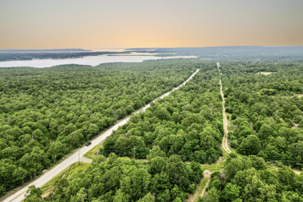
Build Your Farm on This 20 Acre Lot
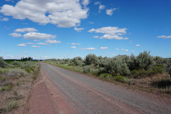
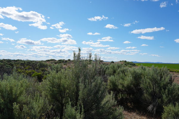
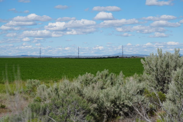
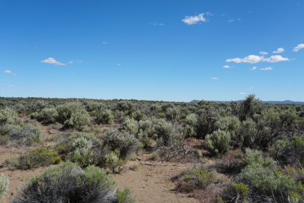
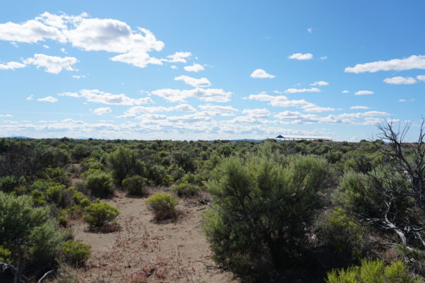
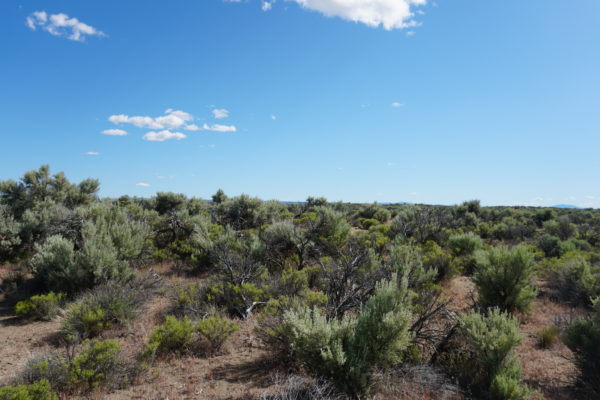
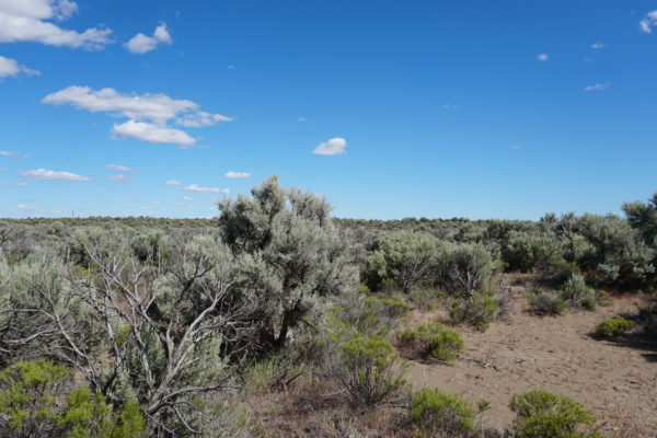
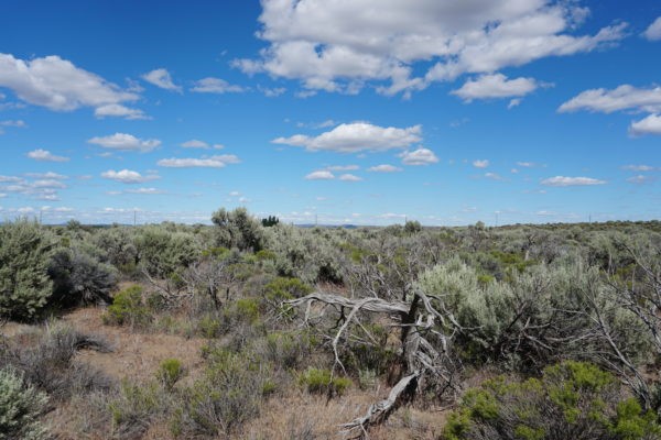
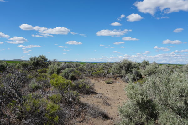
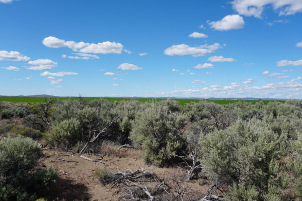
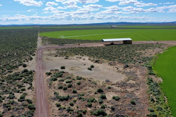
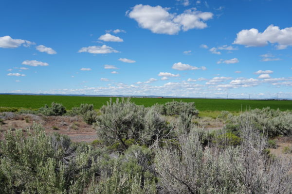
Mobile Homes Allowed! Do you want to escape the city life and live in a simple, quiet and peaceful surrounding? This 20 acre property is perfect for farming and building your barn, home or second home!
Off Main Road, Near Power
This lot is located just off of Fossil Lake Road in Christmas Valley, Oregon. There is power on Fossil Lake Road, just 528 feet away!
Zoning
This property is zoned for agricultural use but may be built on with a Type II Conditional Use Permit. The application may be found here: https://www.lakecountyor.org/government/docs/TYPE_II_CUP_APP.pdf
Christmas Valley Shops
There are several shops, stores and a gas station within 15 miles of the property in Christmas Valley that you can visit to get your necessities:
- Robbins Equipment (Farm equipment supplier) – 13.8 miles
- Handde Pump & Electric (garden center) – 13.6 miles
- Gifts-n-More (restaurant) – 13.4 miles
- Sagewood Grocery – 13.1 miles
- Chevron (gas station) – 12.9 miles
- Fuel Commander Cardlock (gas station) – 13.0 miles
- Cardtronics ATM – 9.0 miles
- The Trail Café – 12.8 miles
Area Amenities
Are you a fan of golf? Nearby is Christmas Valley’s Golf Course, it has 3 sets of tees and challenging play for golfers for different skill levels with fantastic views and well groomed fairways.
Swimming and fishing? No problem! Baert Lake in Christmas Valley is open from Spring through Fall for fishing, swimming and boating. Ice Skating is available in the winter season!
Few miles away from Silver Lake, OR is the Summer Lake Wildlife Area, a refuge and breeding area of waterfowl, geese and swans and other water birds. Outdoor activities such as camping, picnicking, wildlife viewing and hunting are available. While you are on a road trip for your spring break, stop by and relax at Summer Lake Hot Springs.
There are BLM lands in Christmas Valley one of them is the Christmas Valley Dunes. The popular sand dunes are a few miles away and you can ATV, camp, sightsee and hike.
This is one of the largest inland shifting sand dunes. Dunes guidelines may be found here:
http://www.duneguide.com/sand_dune_guide_christmas_valley.htm
https://www.riderplanet-usa.com/atv/trails/info/oregon_07797/ride_734a.htm
https://www.blm.gov/policies/oregon-washington
Property ID / APN: 1804
Size: 20 Acres
Yearly Taxes: $87.65
Zoning: The property is zoned A-2 Agriculture Use. A Type II CUP would be required for the property to become buildable.
Mobile Home: Allowed with Land Use approval.
RV: Camping and RV’s are allowed for short periods of time, but not more than 7 out of 30 days for a guest of the owners. You cannot live on the property in an RV, and camping is only supposed to be for short periods like a weekend here or there.
Minimum Home Size: At least 120 square feet and would need to meet single-family dwelling standards with building codes.
Sewer: Septic may be installed.
Power: Poles are 528 feet away.
Water: A well may be drilled.
Terrain: Property is gently rolling.
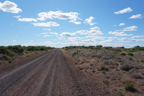
Road Access: Property can be accessed via an unnamed property on the North that connects to County Hwy 5-14D.
Flood Zone: No
HOA: None
Complete Legal Description: The East half of the Northwest quarter of the Northeast quarter of Section 24, Township 26 South, Range 18 East, W.M.Reserving therefrom an easement of 30 feet along all boundaries for public highway for use in common with others, with power to dedicate and EXCEPTING THEREFROM all petroleum, oil, minerals and products derived therefrom, within or underlying said land or that may be produced therefrom and all rights thereto.
GPS Coordinates:
- Center: 43.308165, -120.527808
- NW:43.310033, -120.529080
- NE:43.310042, -120.526606
- SW:43.306375, -120.529092
- SE:43.306376, -120.526613
Property Location
Discounted Cash Pricing
Cash Price: $12,499
Doc & Reservation Fee: $299
Total: $12,798
Deposit Amount: $2,500
Terms Pricing
Terms Price: $16,249
Down Payment: $3,250
Interest Rate: 12%
Monthly Payment: $432
Montly Loan Fee : $20
Total Term months : 36
Property Location
Property Details
Size (Acres)
5.54
Best Attribute
Wide Open Space
APN or Other ID
70235760
Legal Description
LOT 1704, BLOCK 113, SANGRE DE CRISTO RANCHES, UNIT J, COSTILLA COUNTY, COLORADO
Approximate GPS Coordinates
37.364998, -105.342107
Property Size
Rural Land
Zoning
Estate – Residential
General Elevation (in feet)
8554
Power
Would be alternative power source.
HOA/POA
SDCR – Membership is optional for $25/year
Water
Well Can Be Drilled
Sewer
Septic can be installed
Roads
Dirt Road
Terrain
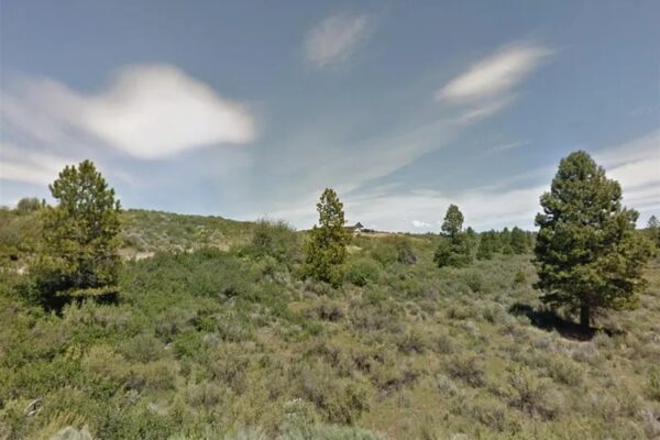
Property on rolling hills
Title Info
Clear Title
Annual Property Taxes (Approx)
$115.64
ALL THE INFORMATION WE HAVE ON THIS PROPERTY IS DISCLOSED WITHIN THE CONTENT OF THIS LISTING PAGE. IN MOST CASES WE HAVE NOT SEEN THE PROPERTY. ANY AND ALL OTHER QUESTIONS REGARDING THIS PROPERTY SHOULD BE DIRECTED TOWARD THE CITY OR COUNTY OF WHICH THE PROPERTY IS LOCATED IN. YOUR DUE DILIGENCE SHOULD BE PERFORMED PRIOR TO BUYING, TO ENSURE THE PROPERTY MEETS YOUR NEEDS AND CRITERIA.
Thank you for considering Liberty Land Sales
Related Properties
Contact Seller
Build Your Farm on This 20 Acre Lot
Mobile Homes Allowed! Do you want to escape the city life and live in a simple, quiet and peaceful surrounding? This 20 acre property is perfect for farming and building your barn, home or second home!
Off Main Road, Near Power
This lot is located just off of Fossil Lake Road in Christmas Valley, Oregon. There is power on Fossil Lake Road, just 528 feet away!
Zoning
This property is zoned for agricultural use but may be built on with a Type II Conditional Use Permit. The application may be found here: https://www.lakecountyor.org/government/docs/TYPE_II_CUP_APP.pdf
Christmas Valley Shops
There are several shops, stores and a gas station within 15 miles of the property in Christmas Valley that you can visit to get your necessities:
- Robbins Equipment (Farm equipment supplier) – 13.8 miles
- Handde Pump & Electric (garden center) – 13.6 miles
- Gifts-n-More (restaurant) – 13.4 miles
- Sagewood Grocery – 13.1 miles
- Chevron (gas station) – 12.9 miles
- Fuel Commander Cardlock (gas station) – 13.0 miles
- Cardtronics ATM – 9.0 miles
- The Trail Café – 12.8 miles
Area Amenities
Are you a fan of golf? Nearby is Christmas Valley’s Golf Course, it has 3 sets of tees and challenging play for golfers for different skill levels with fantastic views and well groomed fairways.
Swimming and fishing? No problem! Baert Lake in Christmas Valley is open from Spring through Fall for fishing, swimming and boating. Ice Skating is available in the winter season!
Few miles away from Silver Lake, OR is the Summer Lake Wildlife Area, a refuge and breeding area of waterfowl, geese and swans and other water birds. Outdoor activities such as camping, picnicking, wildlife viewing and hunting are available. While you are on a road trip for your spring break, stop by and relax at Summer Lake Hot Springs.
There are BLM lands in Christmas Valley one of them is the Christmas Valley Dunes. The popular sand dunes are a few miles away and you can ATV, camp, sightsee and hike.
This is one of the largest inland shifting sand dunes. Dunes guidelines may be found here:
http://www.duneguide.com/sand_dune_guide_christmas_valley.htm
https://www.riderplanet-usa.com/atv/trails/info/oregon_07797/ride_734a.htm
https://www.blm.gov/policies/oregon-washington
Property ID / APN: 1804
Size: 20 Acres
Yearly Taxes: $87.65
Zoning: The property is zoned A-2 Agriculture Use. A Type II CUP would be required for the property to become buildable.
Mobile Home: Allowed with Land Use approval.
RV: Camping and RV’s are allowed for short periods of time, but not more than 7 out of 30 days for a guest of the owners. You cannot live on the property in an RV, and camping is only supposed to be for short periods like a weekend here or there.
Minimum Home Size: At least 120 square feet and would need to meet single-family dwelling standards with building codes.
Sewer: Septic may be installed.
Power: Poles are 528 feet away.
Water: A well may be drilled.
Terrain: Property is gently rolling.
Road Access: Property can be accessed via an unnamed property on the North that connects to County Hwy 5-14D.
Flood Zone: No
HOA: None
Complete Legal Description: The East half of the Northwest quarter of the Northeast quarter of Section 24, Township 26 South, Range 18 East, W.M.Reserving therefrom an easement of 30 feet along all boundaries for public highway for use in common with others, with power to dedicate and EXCEPTING THEREFROM all petroleum, oil, minerals and products derived therefrom, within or underlying said land or that may be produced therefrom and all rights thereto.
GPS Coordinates:
- Center: 43.308165, -120.527808
- NW:43.310033, -120.529080
- NE:43.310042, -120.526606
- SW:43.306375, -120.529092
- SE:43.306376, -120.526613
Property Location
Property ID / APN: 1804
Size: 20 Acres
Yearly Taxes: $87.65
Zoning: The property is zoned A-2 Agriculture Use. A Type II CUP would be required for the property to become buildable.
Mobile Home: Allowed with Land Use approval.
RV: Camping and RV’s are allowed for short periods of time, but not more than 7 out of 30 days for a guest of the owners. You cannot live on the property in an RV, and camping is only supposed to be for short periods like a weekend here or there.
Minimum Home Size: At least 120 square feet and would need to meet single-family dwelling standards with building codes.
Sewer: Septic may be installed.
Power: Poles are 528 feet away.
Water: A well may be drilled.
Terrain: Property is gently rolling.
Road Access: Property can be accessed via an unnamed property on the North that connects to County Hwy 5-14D.
Flood Zone: No
HOA: None
Complete Legal Description: The East half of the Northwest quarter of the Northeast quarter of Section 24, Township 26 South, Range 18 East, W.M.Reserving therefrom an easement of 30 feet along all boundaries for public highway for use in common with others, with power to dedicate and EXCEPTING THEREFROM all petroleum, oil, minerals and products derived therefrom, within or underlying said land or that may be produced therefrom and all rights thereto.
GPS Coordinates:
- Center: 43.308165, -120.527808
- NW:43.310033, -120.529080
- NE:43.310042, -120.526606
- SW:43.306375, -120.529092
- SE:43.306376, -120.526613
Property Location
Discounted Cash Pricing
Cash Price: $12,499
Doc & Reservation Fee: $299
Total: $12,798
Deposit Amount: $2,500
Terms Pricing
Terms Price: $16,249
Down Payment: $3,250
Interest Rate: 12%
Monthly Payment: $432
Montly Loan Fee : $20
Total Term months : 36

